MyTopo
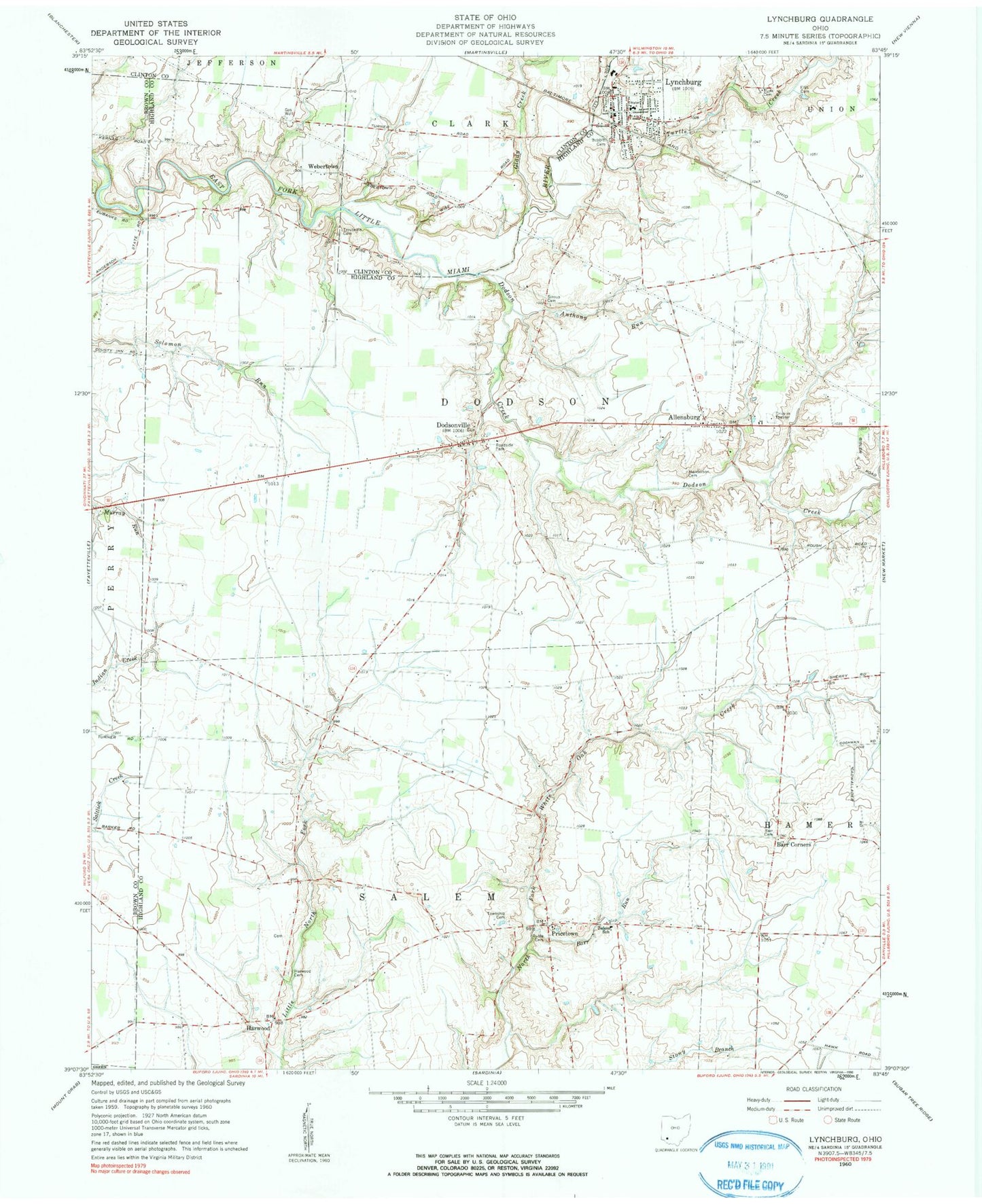
Classic USGS Lynchburg Ohio 7.5'x7.5' Topo Map
Couldn't load pickup availability
Historical USGS topographic quad map of Lynchburg in the state of Ohio. Map scale may vary for some years, but is generally around 1:24,000. Print size is approximately 24" x 27"
This quadrangle is in the following counties: Brown, Clinton, Highland.
The map contains contour lines, roads, rivers, towns, and lakes. Printed on high-quality waterproof paper with UV fade-resistant inks, and shipped rolled.
Contains the following named places: Adams Farm, Allensburg, Allensburgh Post Office, Anderson Pike, Anthony Run, Barr Cemetery, Barr Corners, Barr Run, Bobbitt Cemetery, Brown School, Chaney School, Dodson Creek, Dodsonville, Dodsonville Cemetery, Dodsonville Post Office, Ellis Cemetery, Fawley Farms, Glady Creek, Harwood, Harwood Cemetery, Harwood Methodist Chapel, Henderson Cemetery, Honolulu, Honolulu Post Office, Honolulu School, Independent Order of Oddfellows Cemetery, Laymon School, Littleton School, Luttleton, Lynchburg, Lynchburg Bridge, Lynchburg Fire Department and Ambulance District, Lynchburg Post Office, Lynchburg Village Police Department, Lynchburg-Clay Elementary School, Lynchburg-Clay High School, Maple Grove School, Masonic Cemetery, Mullen Hill School, Ohio Valley Flower Farm, Pricetown, Pricetown Church of Christ, Pricetown Post Office, Robb School, Roosterville School, Ruble Cemetery, Runk Cemetery, Salem School, Salem Township Cemetery, Stahl Farm, Stroud Farms, Stroup Cemetery, Stroup School, Thompson School, Township of Dodson, Township of Salem, Troutwine Cemetery, Turtle Creek, Twin Brook Farm, Village of Lynchburg, Walnut School, Webertown, Webertown Post Office, ZIP Code: 45142