MyTopo
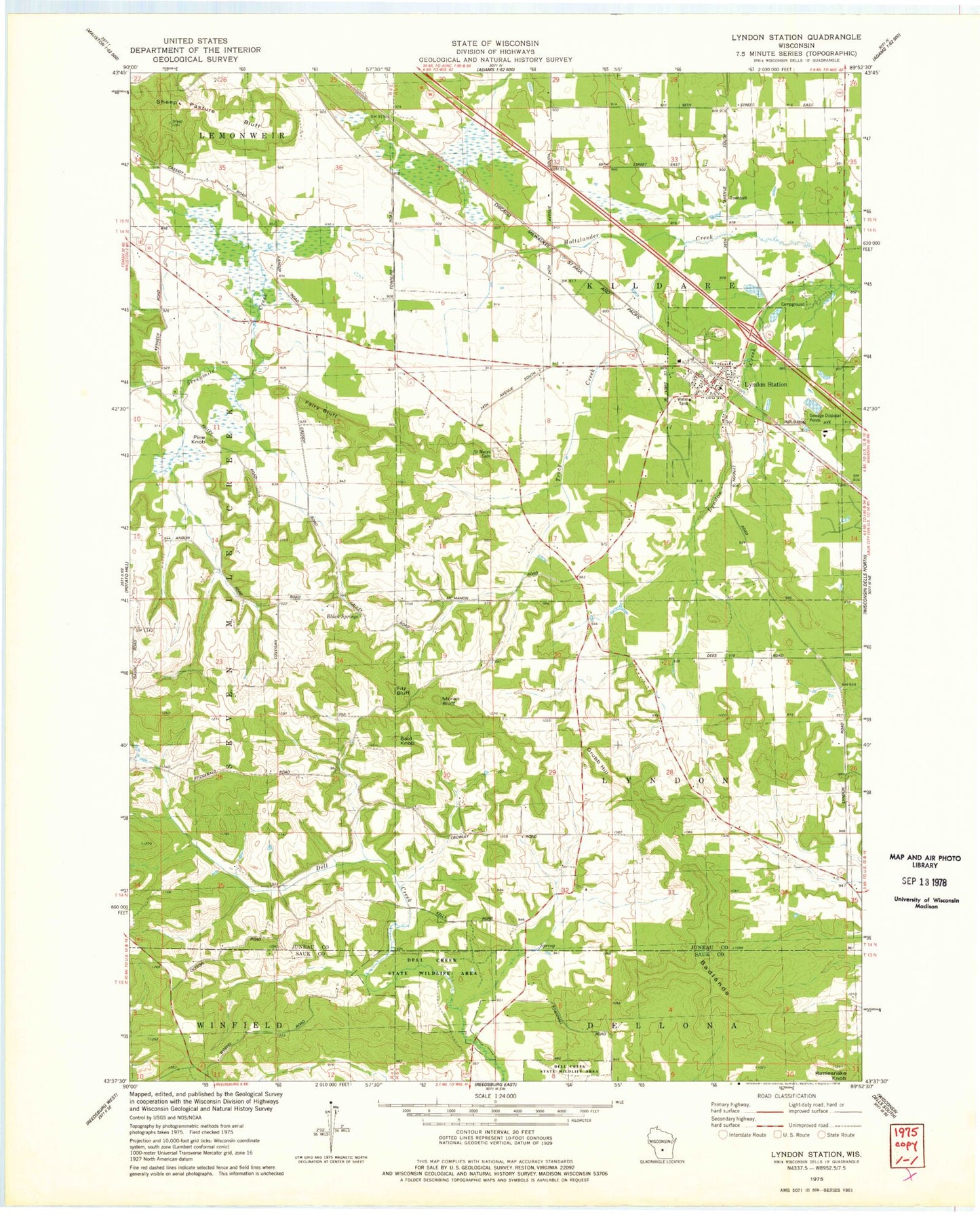
Classic USGS Lyndon Station Wisconsin 7.5'x7.5' Topo Map
Couldn't load pickup availability
Historical USGS topographic quad map of Lyndon Station in the state of Wisconsin. Map scale may vary for some years, but is generally around 1:24,000. Print size is approximately 24" x 27"
This quadrangle is in the following counties: Juneau, Sauk.
The map contains contour lines, roads, rivers, towns, and lakes. Printed on high-quality waterproof paper with UV fade-resistant inks, and shipped rolled.
Contains the following named places: Bald Knob, Black Springs, Fairy Bluff, Fritz Bluff, Grubb Hill, Holtzlander Creek, Lyndon Station, Lyndon Station Elementary School, Lyndon Station Fire and Rescue, Lyndon Station Police Department, Lyndon Station Post Office, Moran Bluff, Pine Knob, Round Bluff Station, Saint Marys Cemetery, Sheep Pasture Bluff, Town of Kildare, Tracy Creek, Village of Lyndon Station, ZIP Code: 53944