MyTopo
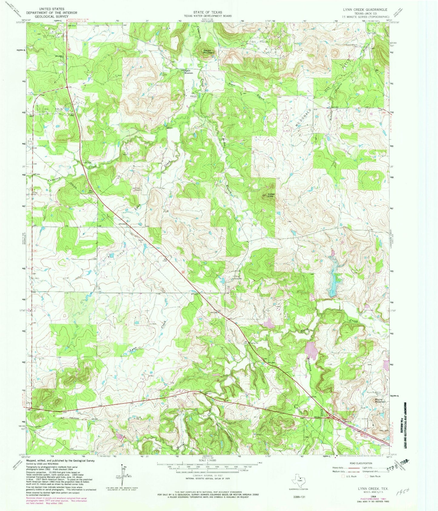
Classic USGS Lynn Creek Texas 7.5'x7.5' Topo Map
Couldn't load pickup availability
Historical USGS topographic quad map of Lynn Creek in the state of Texas. Map scale may vary for some years, but is generally around 1:24,000. Print size is approximately 24" x 27"
This quadrangle is in the following counties: Jack.
The map contains contour lines, roads, rivers, towns, and lakes. Printed on high-quality waterproof paper with UV fade-resistant inks, and shipped rolled.
Contains the following named places: Ellis Oil Field, Henderson Creek, Indian Hills, Lynn Creek, Lynn Creek Chapel, Martin Lake, Martin Lake Dam, McBee Branch, McDonald Oil Field, Roberts Branch Cemetery, Roper Branch, Round Mountain, Round Mountain Cemetery, Soil Conservation Service Site 13 Dam, Soil Conservation Service Site 13 Reservoir, Soil Conservation Service Site 14 Dam, Soil Conservation Service Site 14 Reservoir, Soil Conservation Service Site 15 Dam, Soil Conservation Service Site 15 Reservoir, Soil Conservation Service Site 16 Dam, Soil Conservation Service Site 16 Reservoir, Soil Conservation Service Site 17 Dam, Soil Conservation Service Site 17 Reservoir, Soil Conservation Service Site 26 Dam, Soil Conservation Service Site 26 Reservoir, Soil Conservation Service Site 30 Dam, Soil Conservation Service Site 30 Reservoir, Soil Conservation Service Site 31 Dam, Soil Conservation Service Site 31 Reservoir, Squaw Mountain