MyTopo
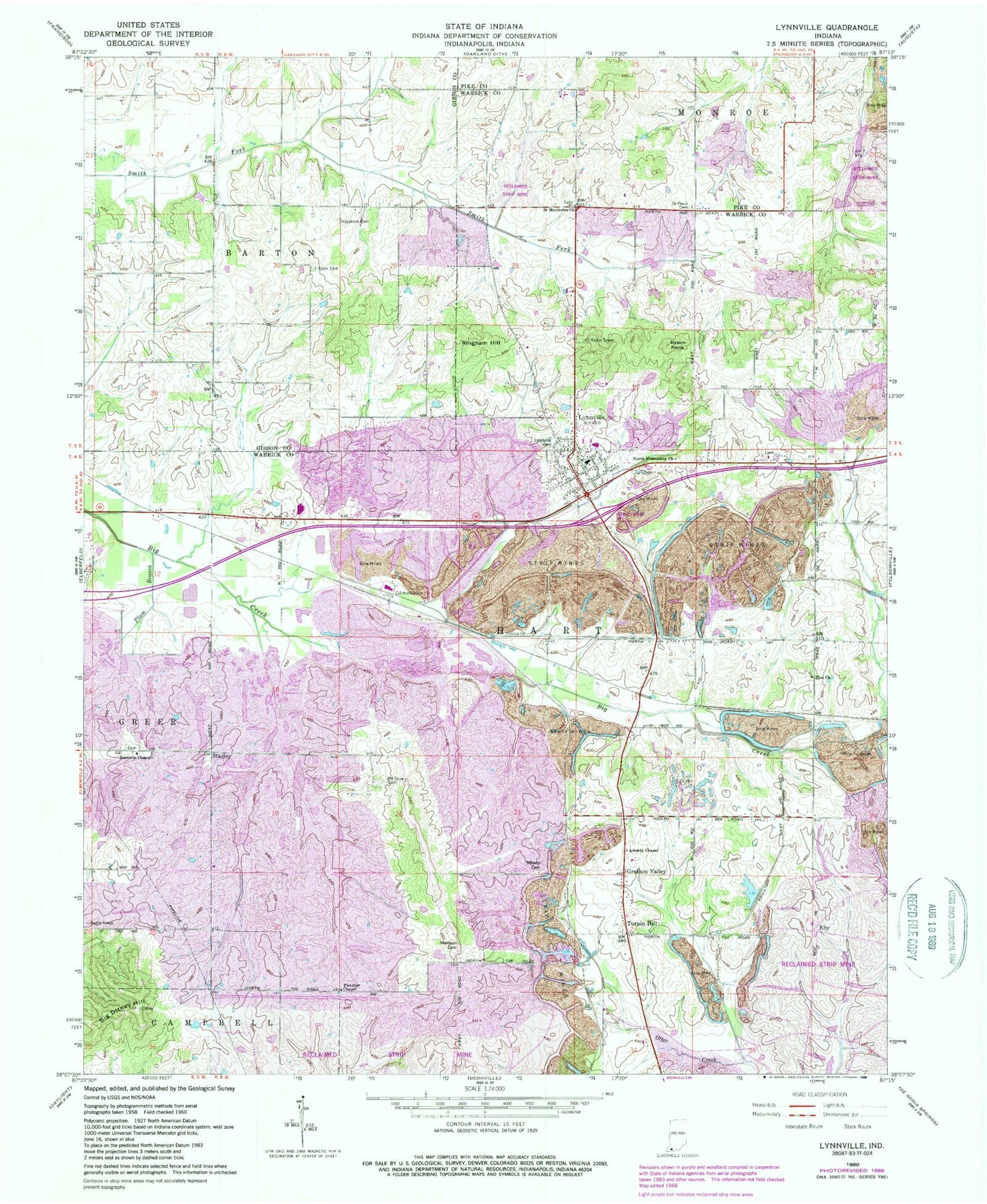
Classic USGS Lynnville Indiana 7.5'x7.5' Topo Map
Couldn't load pickup availability
Historical USGS topographic quad map of Lynnville in the state of Indiana. Map scale may vary for some years, but is generally around 1:24,000. Print size is approximately 24" x 27"
This quadrangle is in the following counties: Gibson, Pike, Warrick.
The map contains contour lines, roads, rivers, towns, and lakes. Printed on high-quality waterproof paper with UV fade-resistant inks, and shipped rolled.
Contains the following named places: Barnetts Chapel, Big Ditney Hill, Dyson Knob, Eby, Eby Post Office, Eden Cemetery, Fletcher Chapel, Graham Valley, Kilpatrick Cemetery, Liberty Chapel, Little Creek, Lynnville, Lynnville Cemetery, Lynnville Elementary School, Lynnville Mine, Lynnville Post Office, Lynnville Town Marshal, Lynnville Volunteer Fire Department, Massey Cemetery, Morrison Cemetery, Mount Olive Cemetery, North Friendship Church, Plum Branch, Ringham Hill, Saint Matthews Church, Saint Pauls Cemetery, Stanley, Tecumseh Junior - Senior High School, Town of Lynnville, Township of Hart, Turpin Hill, Zion Church, ZIP Code: 47619