MyTopo
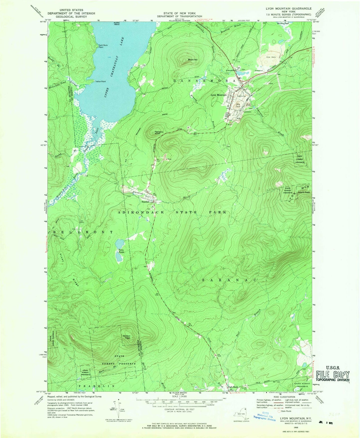
Classic USGS Lyon Mountain New York 7.5'x7.5' Topo Map
Couldn't load pickup availability
Historical USGS topographic quad map of Lyon Mountain in the state of New York. Typical map scale is 1:24,000, but may vary for certain years, if available. Print size: 24" x 27"
This quadrangle is in the following counties: Clinton, Franklin.
The map contains contour lines, roads, rivers, towns, and lakes. Printed on high-quality waterproof paper with UV fade-resistant inks, and shipped rolled.
Contains the following named places: Averill Peak, Birch Hill, Bradley Brook, Brandy Brook, East Branch Cold Brook, Indian Point, Lyon Mountain, Middle Kiln Brook, Mountain Pond Stream, Norton Peak, Parsons Knob, Piney Ridge, Rocky Brook, Rocky Brook, Saint Bernards Church, South Inlet, Split Rock Point, Standish, Standish Brook, Twin Ponds, Upper Chateaugay Lake, High Bank, WCFE-FM (Plattsburgh), WSTY-FM (Plattsburgh), WCFE-TV (Plattsburgh), Lyon Mountain Census Designated Place, Lyon Mountain Sewer District Wastewater Treatment Plant, Lyon Mountain Post Office