MyTopo
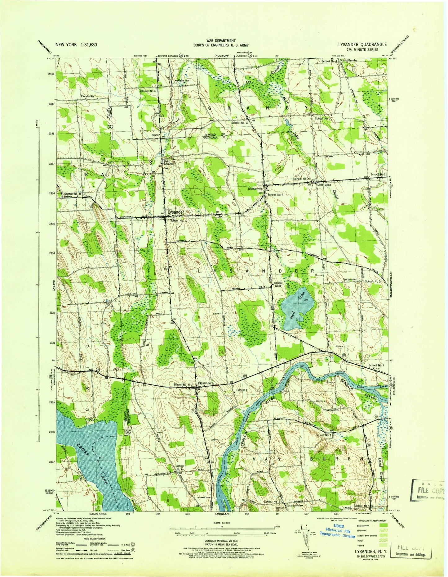
Classic USGS Lysander New York 7.5'x7.5' Topo Map
Couldn't load pickup availability
Historical USGS topographic quad map of Lysander in the state of New York. Map scale may vary for some years, but is generally around 1:24,000. Print size is approximately 24" x 27"
This quadrangle is in the following counties: Cayuga, Onondaga, Oswego.
The map contains contour lines, roads, rivers, towns, and lakes. Printed on high-quality waterproof paper with UV fade-resistant inks, and shipped rolled.
Contains the following named places: Adams Cemetery, Baird Corners, Brook, Cody Fire Department Station 1, Dead Creek, Destiny Farms, Floridaville, Hahn Family Farm, Hortontown, Hortontown Cemetery, Jacksonville, Jacksonville Cemetery, Kingdom Road Cemetery, Little Utica, Little Utica Methodist Church, Lysander, Lysander Cemetery, Lysander Fire Department, Maloney Island, Merritt Cemetery, Mud Lake, Mud Lake Inlet, Mud Lake Outlet, Old Presbyterian Cemetery, Plainville, Plainville Fire District Station 1, Plainville Post Office, Plainville Rural Cemetery, Potters Tree Farm, School Number 1, School Number 10, School Number 11, School Number 17, School Number 2, School Number 3, School Number 4, School Number 5, School Number 6, School Number 7, School Number 8, School Number 9, WKFM-FM (Fulton)