MyTopo
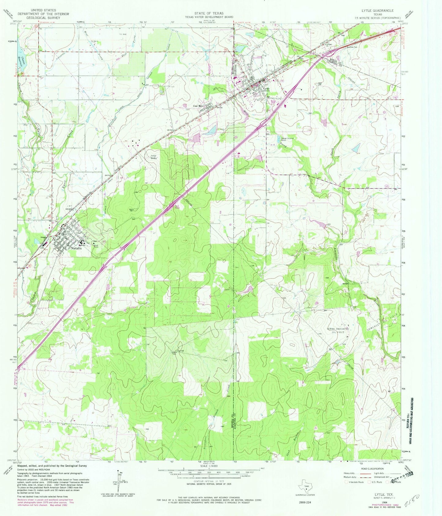
Classic USGS Lytle Texas 7.5'x7.5' Topo Map
Couldn't load pickup availability
Historical USGS topographic quad map of Lytle in the state of Texas. Map scale may vary for some years, but is generally around 1:24,000. Print size is approximately 24" x 27"
This quadrangle is in the following counties: Atascosa, Bexar, Medina.
The map contains contour lines, roads, rivers, towns, and lakes. Printed on high-quality waterproof paper with UV fade-resistant inks, and shipped rolled.
Contains the following named places: Assembly of God Gospel Temple Church, Calvary Church, City of Lytle, City of Natalia, Coal Mine, East Prong Fort Ewell Creek, Fort Ewell Creek, Lytle, Lytle City Hall, Lytle High School, Lytle Police Department, Lytle Post Office, Lytle Volunteer Fire Department, Natalia, Natalia Canal, Natalia City Hall, Natalia Police Department, Natalia Post Office, Natalia Volunteer Fire Department, North Prong Atascosa River, Pilgrim Dam, Pilgrim Lake, Twin Lake Estates-East Lake Dam, Twin Lake Estates-West Lake Dam, Verna-Anacacho Oil Field, West Prong Atascosa River, West Prong Fort Ewell Creek, ZIP Codes: 78052, 78059