
MyTopo
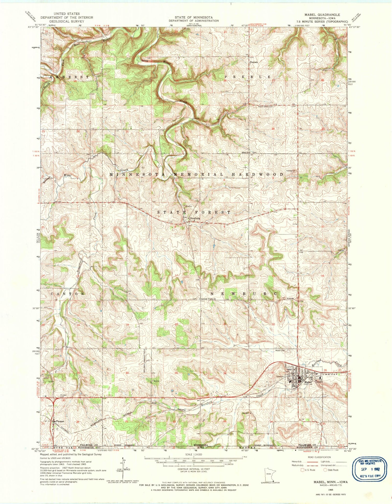
Classic USGS Mabel Minnesota 7.5'x7.5' Topo Map
Couldn't load pickup availability
Historical USGS topographic quad map of Mabel in the state of Minnesota. Map scale may vary for some years, but is generally around 1:24,000. Print size is approximately 24" x 27"
This quadrangle is in the following counties: Fillmore, Winneshiek.
The map contains contour lines, roads, rivers, towns, and lakes. Printed on high-quality waterproof paper with UV fade-resistant inks, and shipped rolled.
Contains the following named places: City of Mabel, Donaldson Creek, Garness Cemetery, Garness Trinity Church, Green Lea Manor, Green Lea Mobile Home Park, Mabel, Mabel Ambulance Service, Mabel Canton Public Schools, Mabel City Hall, Mabel Clinic, Mabel Fire Department, Mabel First Lutheran Church, Mabel Lutheran Cemetery, Mabel Police Department, Mabel Post Office, Mabel Public Library, Meadowbrook Country Club, Newburg, Newburg Cemetery, Newburg Post Office, North Sheie Cemetery, Prosper, Prosper Cemetery, Prosper Post Office, Rediske-Vatland Group Dam, Saint Olaf Catholic Church, Sellman Field, Sheie Church, Sorenson Creek, Steam Engine Museum, Tawney, Tawney Post Office, Tawney Wayside Park, Township of Newburg, United Methodist Church, ZIP Code: 55954


