MyTopo
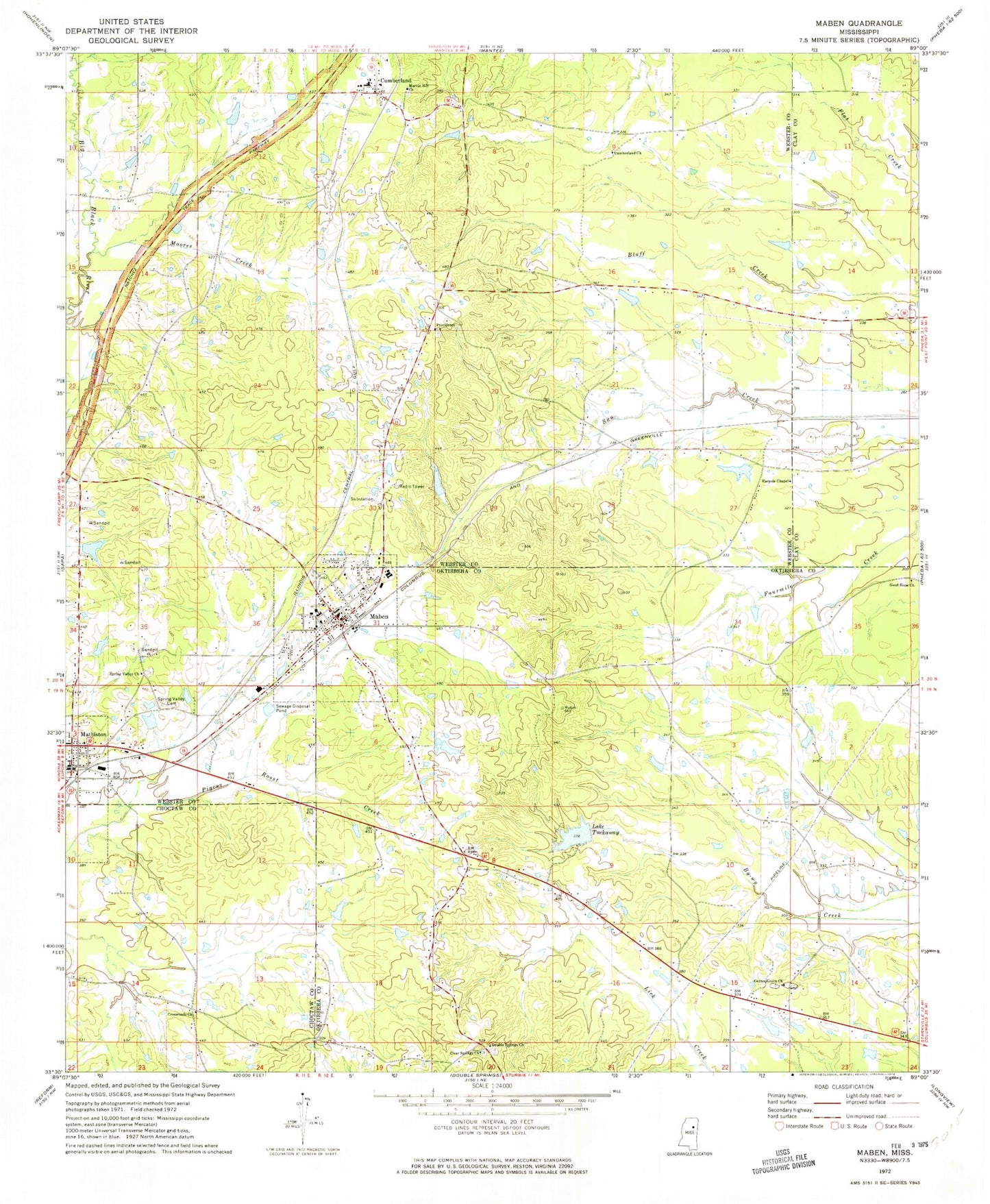
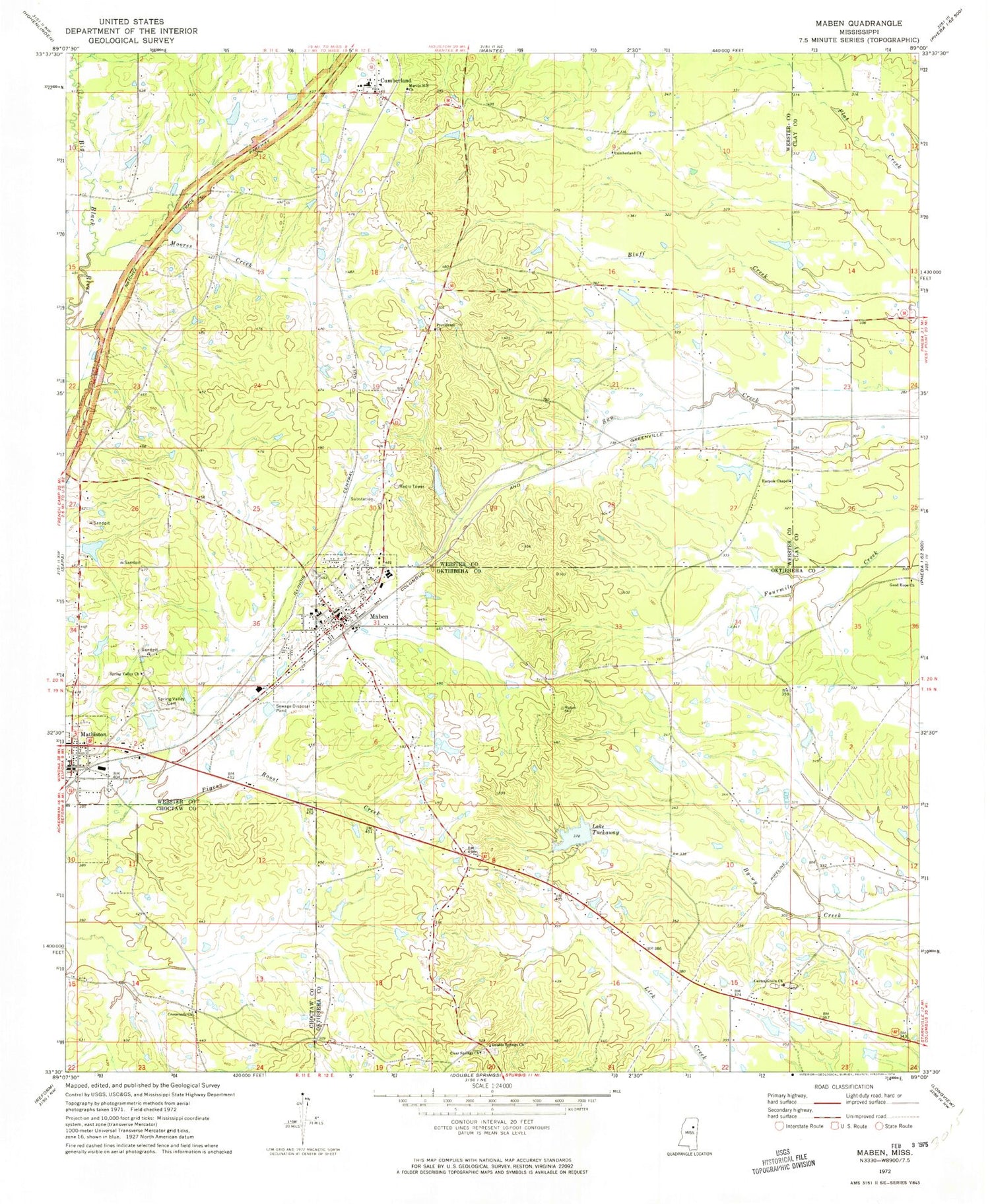
Classic USGS Maben Mississippi 7.5'x7.5' Topo Map
Couldn't load pickup availability
Historical USGS topographic quad map of Maben in the state of Mississippi. Map scale may vary for some years, but is generally around 1:24,000. Print size is approximately 24" x 27"
This quadrangle is in the following counties: Choctaw, Clay, Oktibbeha, Webster.
The map contains contour lines, roads, rivers, towns, and lakes. Printed on high-quality waterproof paper with UV fade-resistant inks, and shipped rolled.
Contains the following named places: Bethel Baptist Church, Cane Lake Dam, Center Grove, Center Grove Baptist Church, Center Grove Cemetery, Church of God of Prophecy, Clear Spring, Clear Springs Cemetery, Clear Springs Primitive Baptist Church, Cleggs Mill, Crossroads Church, Crowly Lake Dam, Cumberland, Cumberland Cemetery, Cumberland Church, Cumberland Volunteer Fire Department, Double Springs Cemetery, Double Springs Methodist Church, Ebenezer Methodist Church, Ebenezer School, Good Hope Baptist Church, Grove Baptist Church, Harpole Chapel, Hatcher, J Crowley Pond Dam, Johnson Lake Dam, Lake Tuckaway, Lewis Chapel School, Line Creek, Maben, Maben Cemetery, Maben Church of Christ, Maben Elementary School, Maben First Baptist Church, Maben High School, Maben Junior High School, Maben Police Department, Maben Post Office, Maben United Methodist Church, Maben Volunteer Fire Department, Marvin Hill Cemetery, Marvin Hill Church, Mathison Baptist Church, Mathison United Methodist Church, Mathiston, Mathiston Post Office, Mathiston Volunteer Fire Department, McMullen Lake Dam, Midway Church of Christ, Moores Creek, Page Lake Dam, Providence Cemetery, Providence Church, Sanders Lake Dam, Shurls Pond Dam, Spring Valley, Spring Valley Cemetery, Spring Valley Church, Town of Maben, Tuckaway Lake Dam, Turner Lake Dam, ZIP Code: 39750