MyTopo
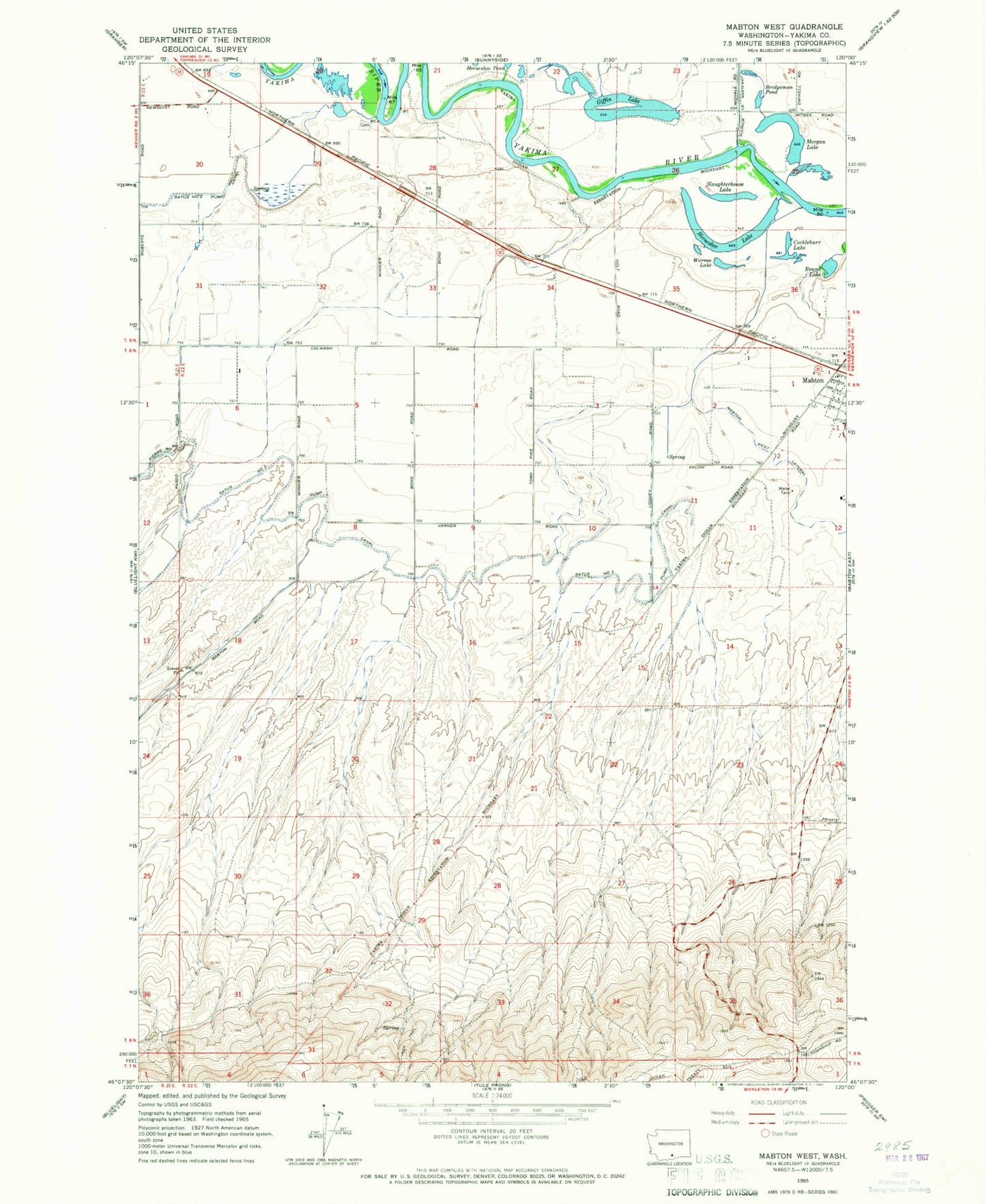
Classic USGS Mabton West Washington 7.5'x7.5' Topo Map
Regular price
$16.95
Regular price
Sale price
$16.95
Unit price
per
Couldn't load pickup availability
Historical USGS topographic quad map of Mabton West in the state of Washington. Map scale may vary for some years, but is generally around 1:24,000. Print size is approximately 24" x 27"
This quadrangle is in the following counties: Yakima.
The map contains contour lines, roads, rivers, towns, and lakes. Printed on high-quality waterproof paper with UV fade-resistant inks, and shipped rolled.
Contains the following named places: Bridgeman Pond, Cockleburr Lake, Empire, Giffin Lake, Horseshoe Lake, Morgan Lake, Round Lake, Satus Census Designated Place, Satus Number 3 Pump Canal, Slaughterhouse Lake, Sunnyside State Wildlife Recreation Area, Warren Lake, ZIP Code: 98935