MyTopo
Classic USGS Macclenny NE Georgia 7.5'x7.5' Topo Map
Couldn't load pickup availability
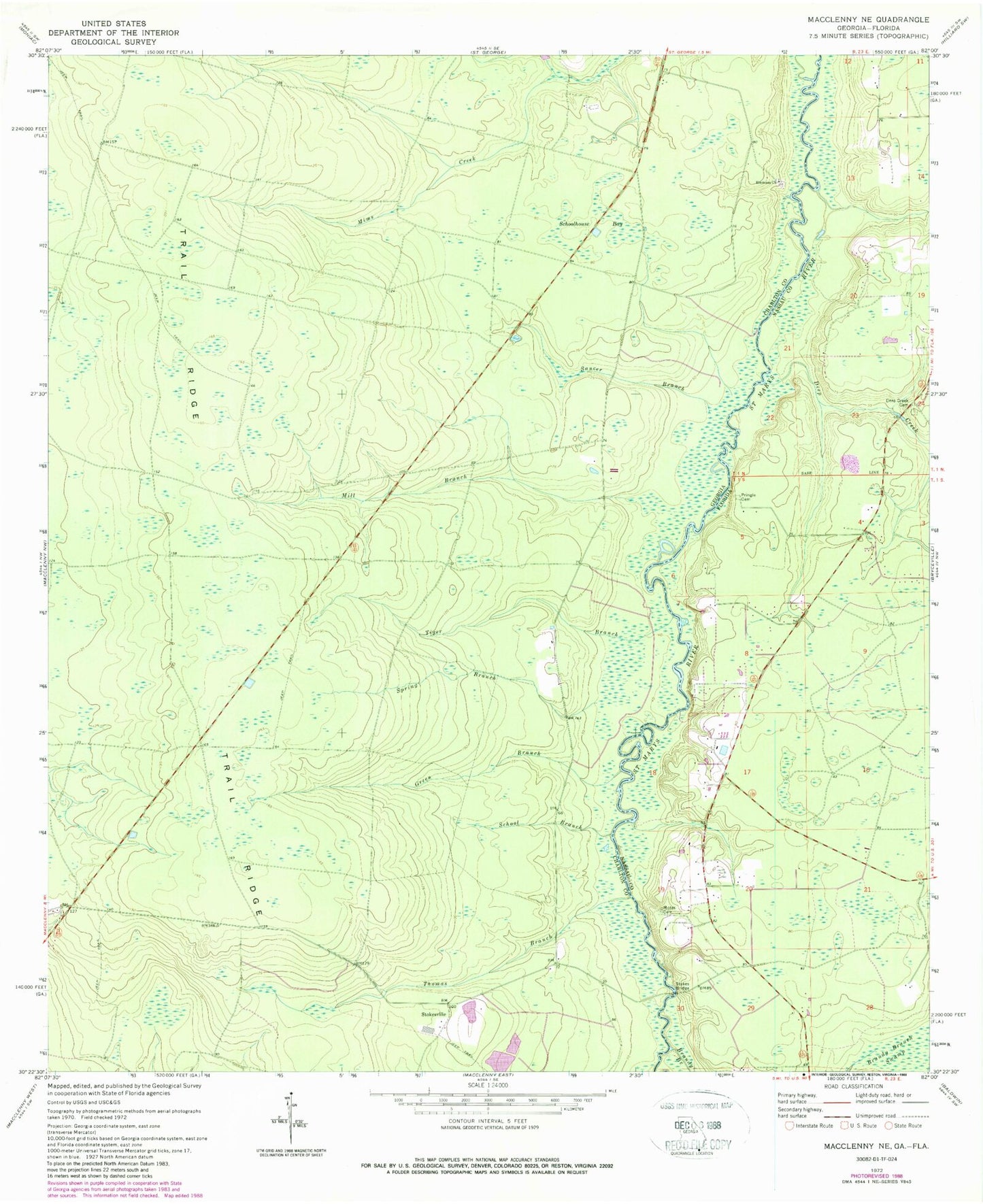
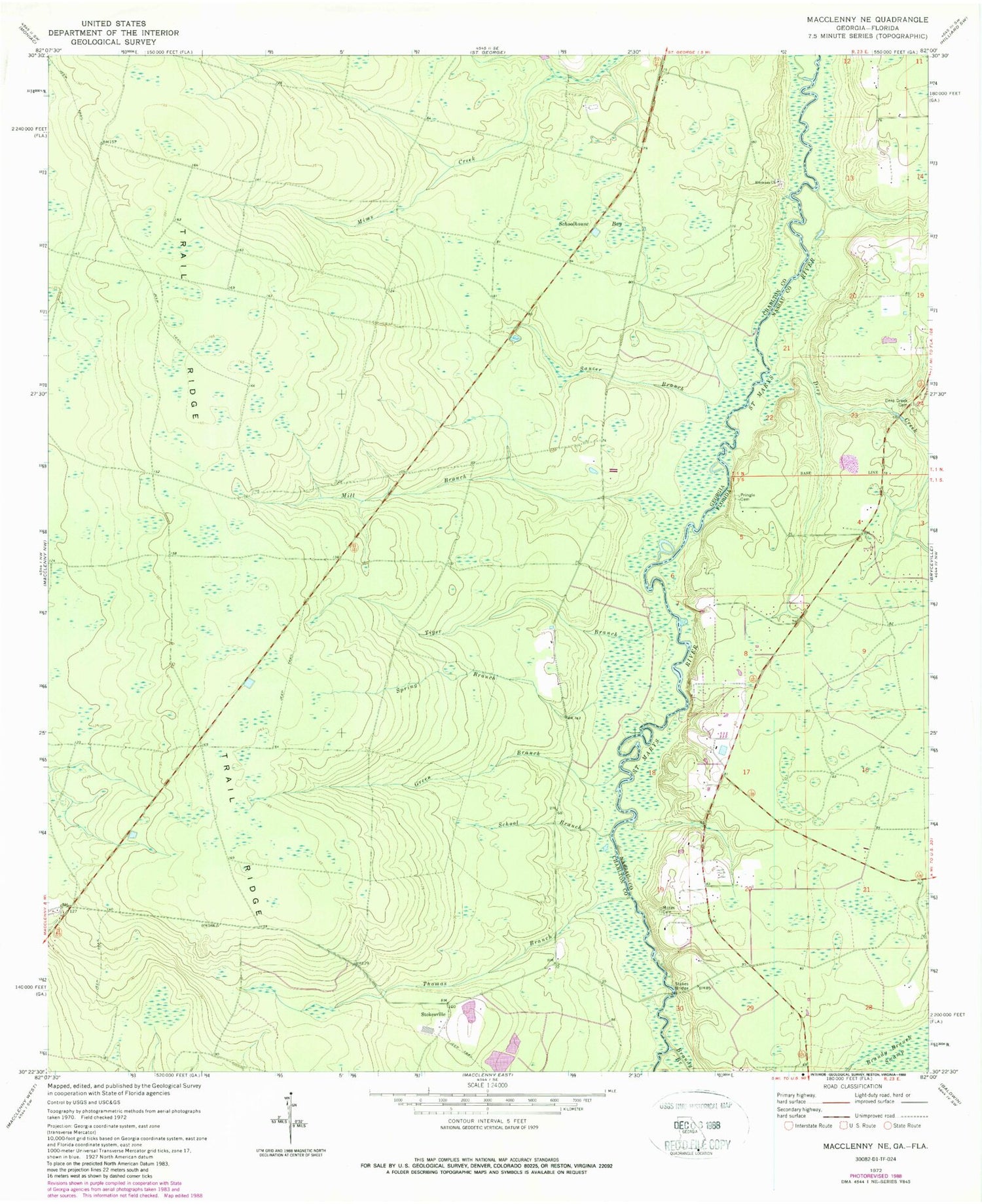
Historical USGS topographic quad map of Macclenny NE in the states of Georgia, Florida. Map scale may vary for some years, but is generally around 1:24,000. Print size is approximately 24" x 27"
This quadrangle is in the following counties: Charlton, Nassau.
The map contains contour lines, roads, rivers, towns, and lakes. Printed on high-quality waterproof paper with UV fade-resistant inks, and shipped rolled.
Contains the following named places: Brandy Branch, Charlton County Fire Department Station 4, Chism School, Deep Creek, Deep Creek Cemetery, Emmaus Cemetery, Emmaus Church, Green Branch, Mill Branch, Motes Cemetery, Nassau County Fire and Rescue Station 6, Pringle Cemetery, Saucer Branch, School Branch, Schoolhouse Bay, Spring Branch, Stokes Bridge, Stokes School, Stokesville, Suggs Still, Thomas Branch, Tiger Branch