
MyTopo
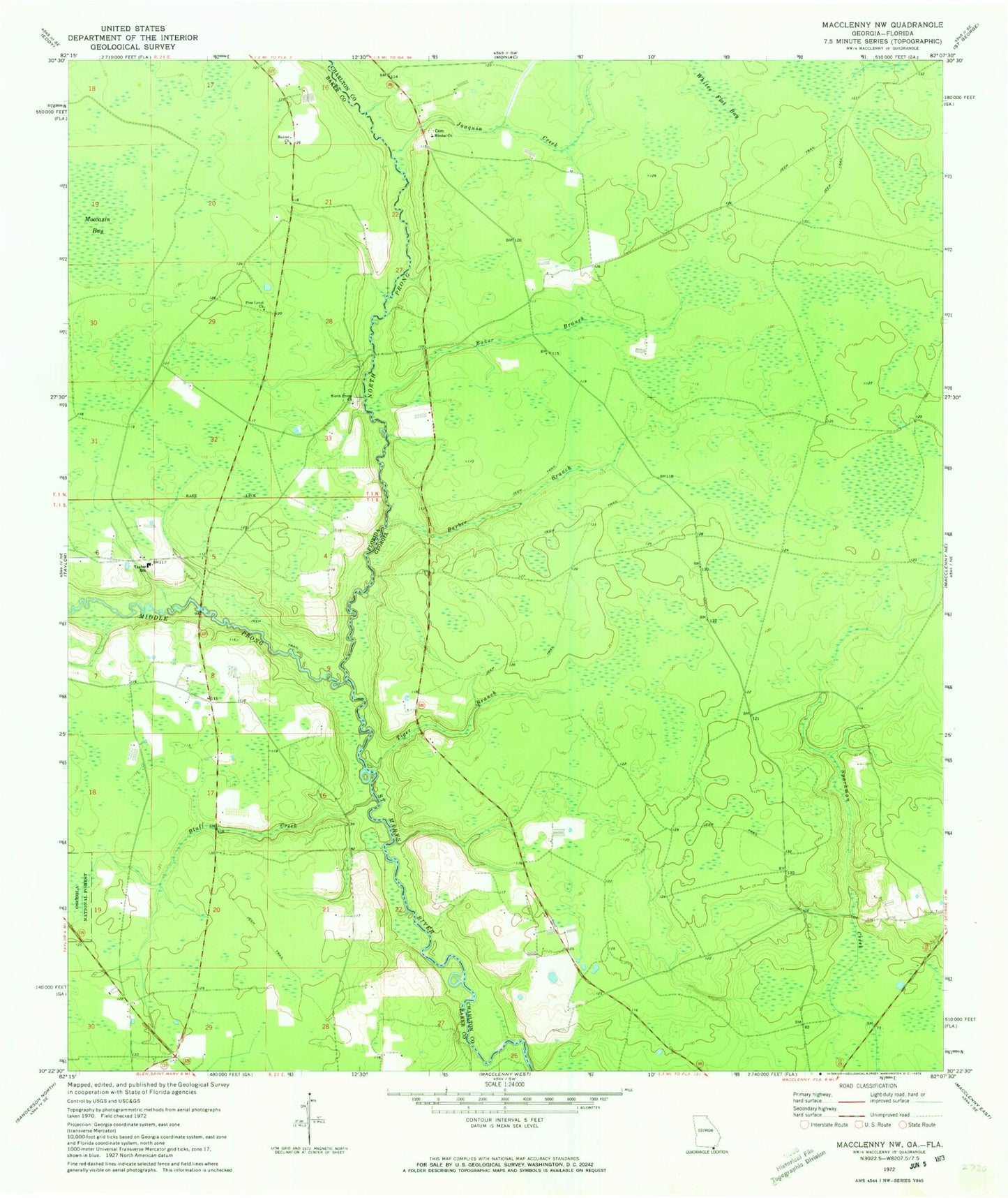
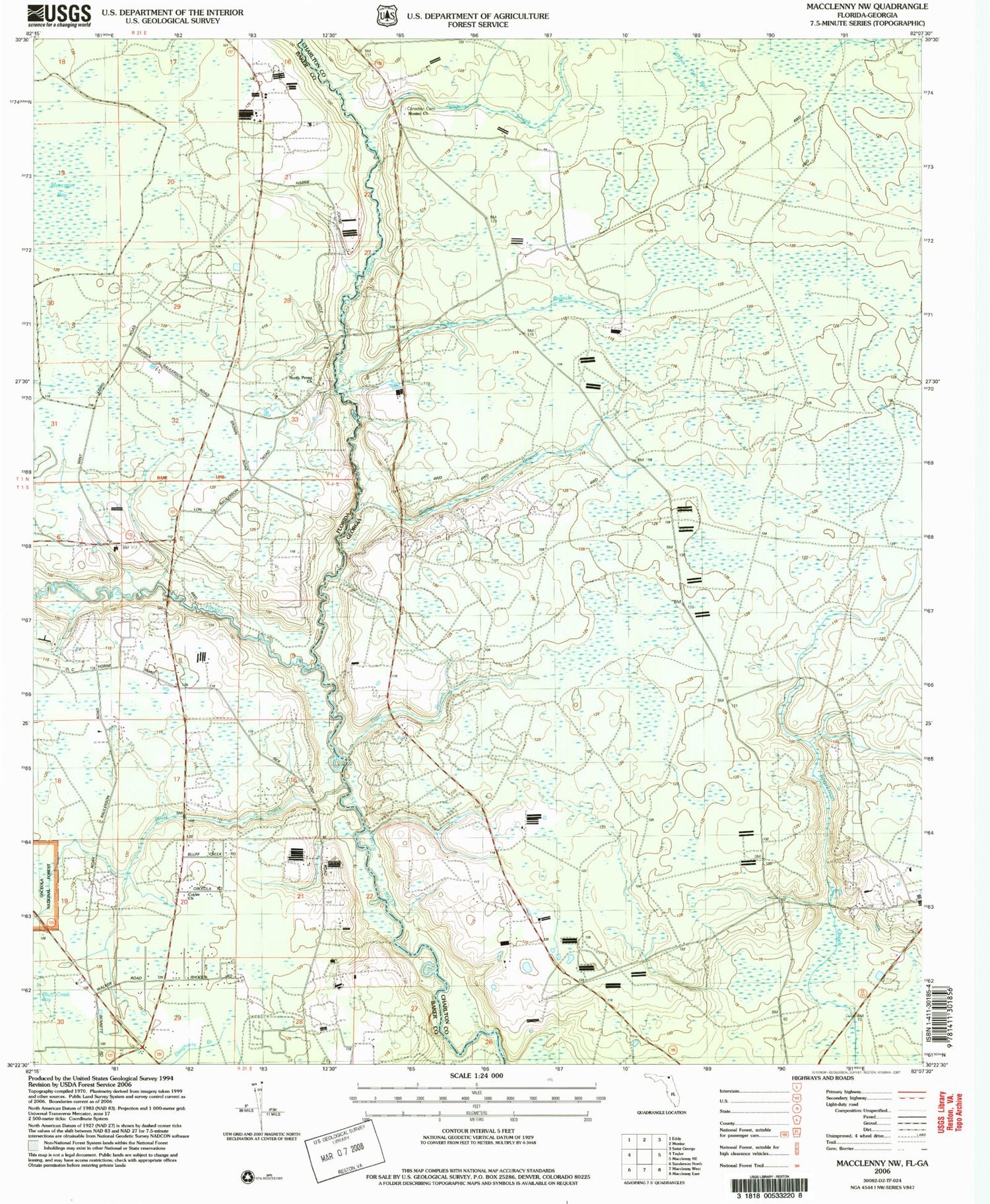
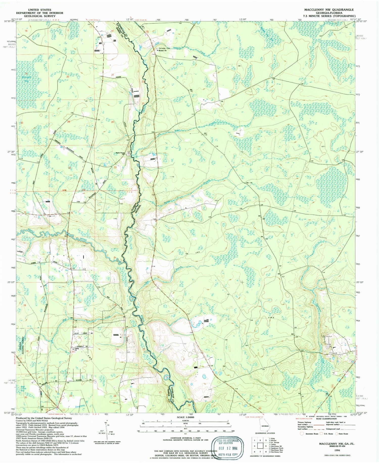
Classic USGS Macclenny NW Georgia 7.5'x7.5' Topo Map
Couldn't load pickup availability
Historical USGS topographic quad map of Macclenny NW in the states of Georgia, Florida. Map scale may vary for some years, but is generally around 1:24,000. Print size is approximately 24" x 27"
This quadrangle is in the following counties: Baker, Charlton.
The map contains contour lines, roads, rivers, towns, and lakes. Printed on high-quality waterproof paper with UV fade-resistant inks, and shipped rolled.
Contains the following named places: Baker Branch, Baker County Fire Department Station 30 Cuyler, Barber Branch, Baxter Church, Bluff Creek, Canaday School, Joaquin Creek, Middle Prong Saint Marys River, Moccasin Bay, Moniac Church, North Prong Church, North Prong Saint Marys River, Pine Level Church, Sandusky School, Taylor School, Tiger Branch, ZIP Code: 31562