MyTopo
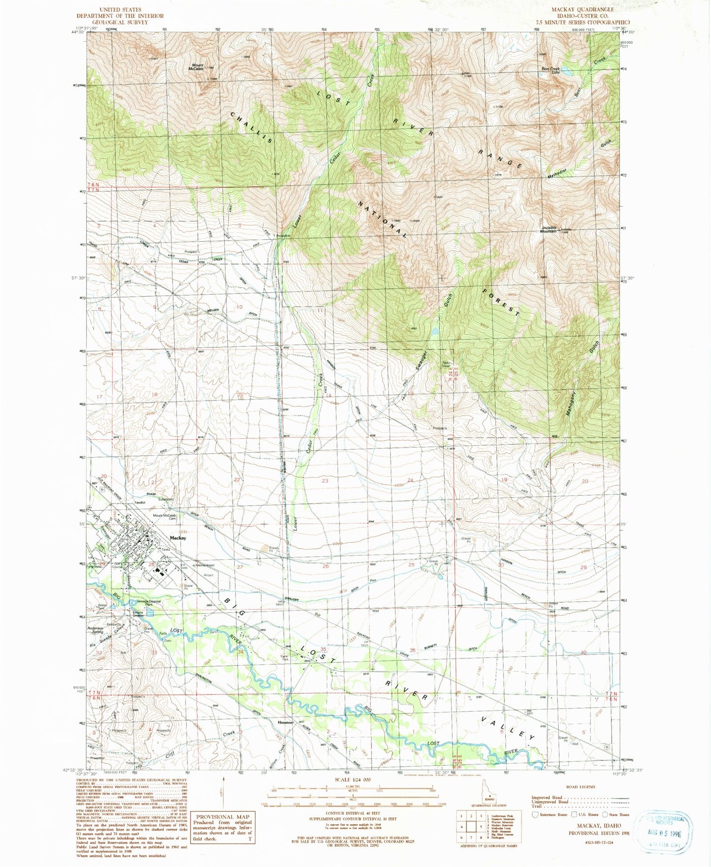
Classic USGS Mackay Idaho 7.5'x7.5' Topo Map
Couldn't load pickup availability
Historical USGS topographic quad map of Mackay in the state of Idaho. Map scale may vary for some years, but is generally around 1:24,000. Print size is approximately 24" x 27"
This quadrangle is in the following counties: Custer.
The map contains contour lines, roads, rivers, towns, and lakes. Printed on high-quality waterproof paper with UV fade-resistant inks, and shipped rolled.
Contains the following named places: Anderson Spring, Bear Creek Lake, City of Mackay, Cliff Creek, Empire Smelter, Hanson Ditch, Houston, Invisible Mountain, Lower Cedar Creek, Lower Cedar Creek Ditch, Mackay, Mackay Airport, Mackay District Ranger Office, Mackay Elementary School, Mackay Fire Department, Mackay Junior - Senior High School, Mackay Post Office, Mahogany Gulch, Mount McCaleb, Mount McCaleb Cemetery, Nielsen Ditch, Rio Grande Canyon, Rothas, Sharp Ditch, South Custer Ambulance, South Custer Rural Fire District, Swauger Ditch, Swauger Gulch, Swauger Slough, Willow Creek