MyTopo
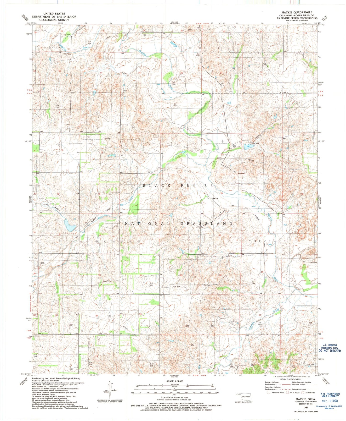
Classic USGS Mackie Oklahoma 7.5'x7.5' Topo Map
Couldn't load pickup availability
Historical USGS topographic quad map of Mackie in the state of Oklahoma. Map scale may vary for some years, but is generally around 1:24,000. Print size is approximately 24" x 27"
This quadrangle is in the following counties: Roger Mills.
The map contains contour lines, roads, rivers, towns, and lakes. Printed on high-quality waterproof paper with UV fade-resistant inks, and shipped rolled.
Contains the following named places: Black Kettle National Grassland, Camp Hollow, Cheyenne Division, Croton Creek, Mackie, Rush Creek, Shaller Number 1 Dam, Shaller Number 1 Reservoir, Shaller Number 2 Dam, Shaller Number 2 Reservoir, Shaller Number 3 Dam, Shaller Number 3 Reservoir, Upper Washita Site 44 Dam, Upper Washita Site 44 Reservoir, Upper Washita Site 54 Dam, Upper Washita Site 54 Reservoir, Upper Washita Site 55 Dam, Upper Washita Site 55 Reservoir, Upper Washita Site 61 Dam, Upper Washita Site 61 Reservoir, Upper Washita Site 62 Dam, Upper Washita Site 62 Reservoir, Upper Washita Site 63 Dam, Upper Washita Site 63 Reservoir, Upper Washita Site 64 Dam, Upper Washita Site 64 Reservoir, Upper Washita Site 65 Dam, Upper Washita Site 65 Reservoir