MyTopo
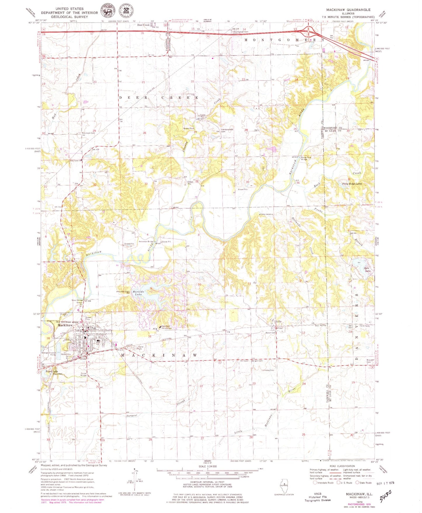
Classic USGS Mackinaw Illinois 7.5'x7.5' Topo Map
Couldn't load pickup availability
Historical USGS topographic quad map of Mackinaw in the state of Illinois. Map scale may vary for some years, but is generally around 1:24,000. Print size is approximately 24" x 27"
This quadrangle is in the following counties: McLean, Tazewell, Woodford.
The map contains contour lines, roads, rivers, towns, and lakes. Printed on high-quality waterproof paper with UV fade-resistant inks, and shipped rolled.
Contains the following named places: Alloway Creek, Amerman Bridge, Amerman School, Bergen Cemetery, Brock Lake, Brock Park, Camp Jeremia, Chaffer School, Dee-Mack High School, Dee-Mack Primary-Junior High School, Funks Branch, Hardscrabble Cemetery, Heritage Lake, Heritage Lake Census Designated Place, Heritage Lake Dam, Hill Cemetery, Hollands Creek, Le Baube Lake, Le Baube Lake Dam, Lee School, Lilly, Lilly Cemetery, Lindsey Cemetery, Lindstrom Heliport, Lone Star School, Mackinaw, Mackinaw Cemetery, Mackinaw Fire Department, Mackinaw Fire Protection District, Mackinaw Post Office, Maraldo Lake, Mitchell Lake, Mitchell Lake Dam, Mount Pleasant School, New Castle, New Castle Church, Newcastle School, Oak Knoll Sanatorium, Oak Ridge School, ParkLands Nature Preserve, Porter Bridge, Posey Ridge Lakes, Roberson Cemetery, Rock Creek, Rocky Ford Bridge, Science Hill School, Spin Lake, Spin Lake Dam, Stout Bridge, Stumbaugh Cemetery, Township of Deer Creek, Township of Mackinaw, Union School, Village of Mackinaw, Weishaupt Airport, West Union Cemetery, ZIP Codes: 61733, 61755