MyTopo
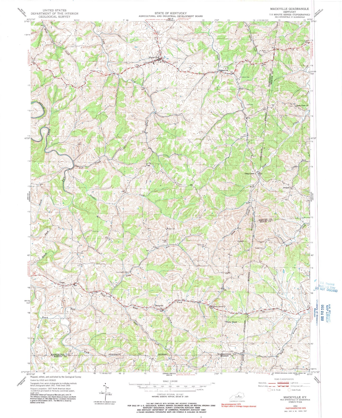
Classic USGS Mackville Kentucky 7.5'x7.5' Topo Map
Couldn't load pickup availability
Historical USGS topographic quad map of Mackville in the state of Kentucky. Map scale may vary for some years, but is generally around 1:24,000. Print size is approximately 24" x 27"
This quadrangle is in the following counties: Boyle, Marion, Mercer, Washington.
The map contains contour lines, roads, rivers, towns, and lakes. Printed on high-quality waterproof paper with UV fade-resistant inks, and shipped rolled.
Contains the following named places: Antioch United Methodist Church, Beech Grove Church, Bottom Cemetery, City of Mackville, Cocanougher Cemetery, Crain Cemetery, Crane School, Cull Cemetery, Deep Creek, Deep Creek Baptist Church, Deep Creek Cemetery, East Fork Beech Fork, Enido Post Office, Hilltop, Holderman Cemetery, Isham Branch, Jenkinsville, Jenkinsville Post Office, Jensonton Post Office, Lick Run, Logan, Long Run, Lower Logan, Mackville, Mackville Fire Department, Mackville High School, Mackville Post Office, Mc Mullin Cemetery, Popes Chapel, Pottsville, Prather Creek, Russell Cemetery, Stewart, Stewart Post Office, Stone Lick, Texas, Texas Post Office, Texas School, Tick Creek, Turkey Creek, Wesley Chapel, Young Cemetery