MyTopo
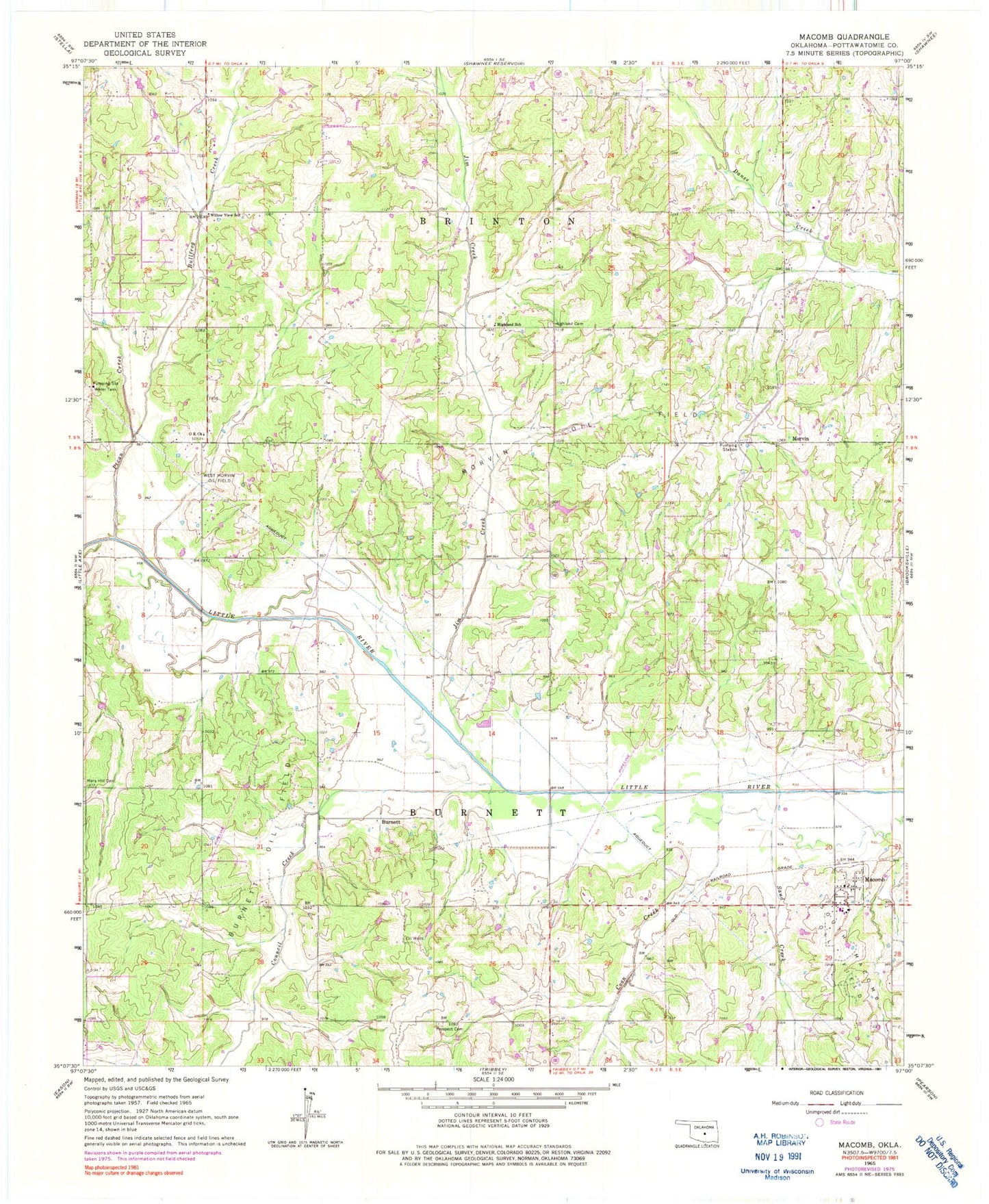
Classic USGS Macomb Oklahoma 7.5'x7.5' Topo Map
Couldn't load pickup availability
Historical USGS topographic quad map of Macomb in the state of Oklahoma. Map scale may vary for some years, but is generally around 1:24,000. Print size is approximately 24" x 27"
This quadrangle is in the following counties: Pottawatomie.
The map contains contour lines, roads, rivers, towns, and lakes. Printed on high-quality waterproof paper with UV fade-resistant inks, and shipped rolled.
Contains the following named places: Bullfrog Creek, Burnett, Burnett Oil Field, Citizen Potawatomi Nation-Absentee Shawnee Oklahoma Tribal Statistical Area, Coon Creek, Council Creek, Highland Cemetery, Highland School, Jim Creek, Macomb, Macomb Elementary School, Macomb Fire Department Station 1, Macomb High School, Macomb Post Office, Morvin, Morvin Oil Field, O K Church, Oknoname 087006 Dam, Oknoname 087006 Reservoir, Oknoname 12509 Dam, Oknoname 12509 Reservoir, Oknoname 12510 Dam, Oknoname 12510 Reservoir, Pecan Creek, Pink Fire Department, Prospect Cemetery, Rocky Dam, Rocky Reservoir, Sand Creek, South Macomb Oil Field, Town of Macomb, Town of Pink, Township of Burnett, West Morvin Oil Field, Willow View School