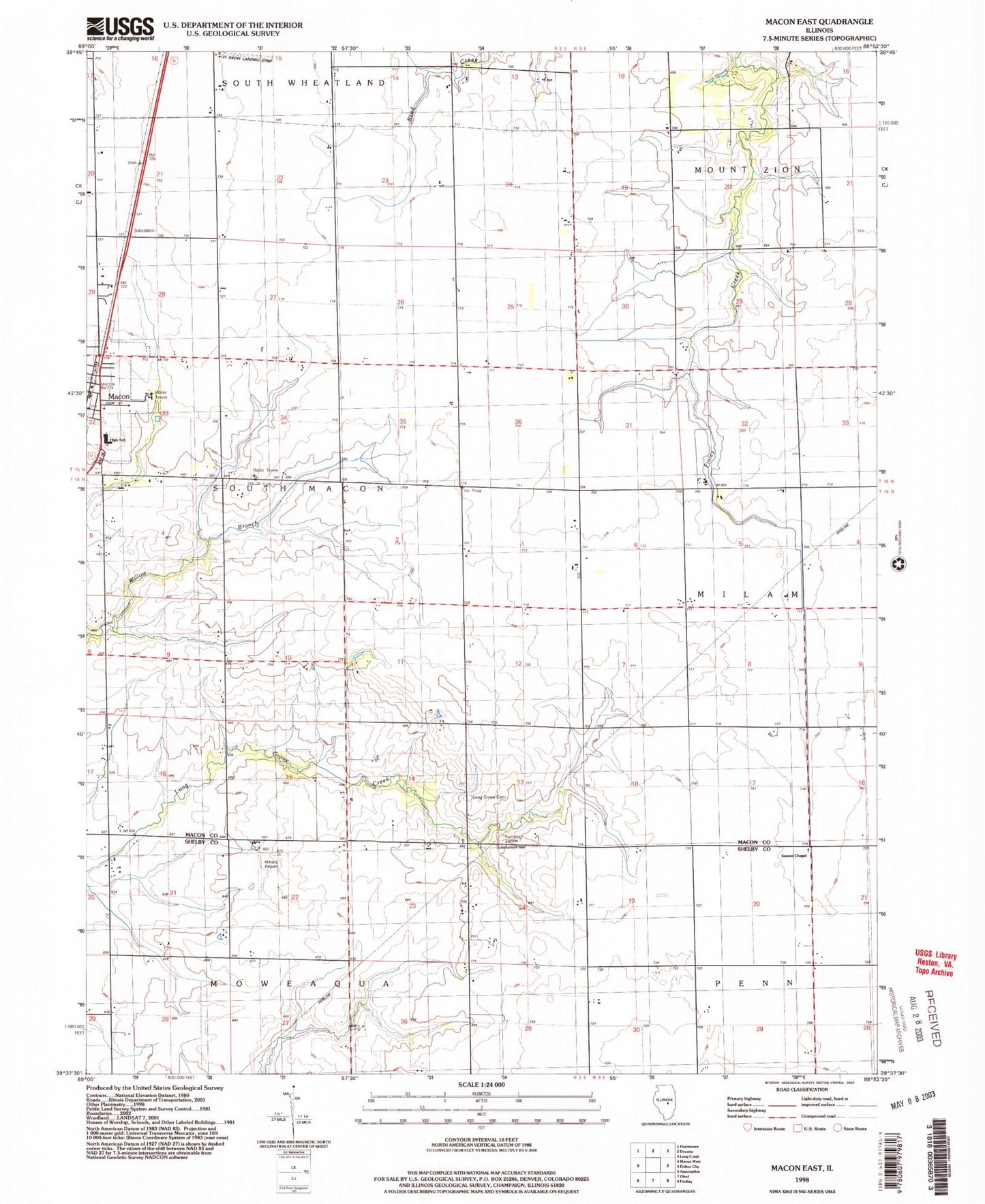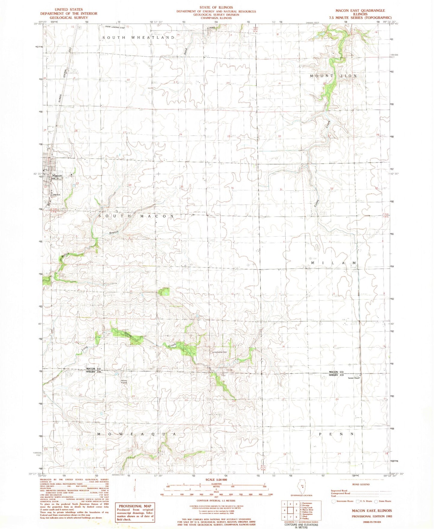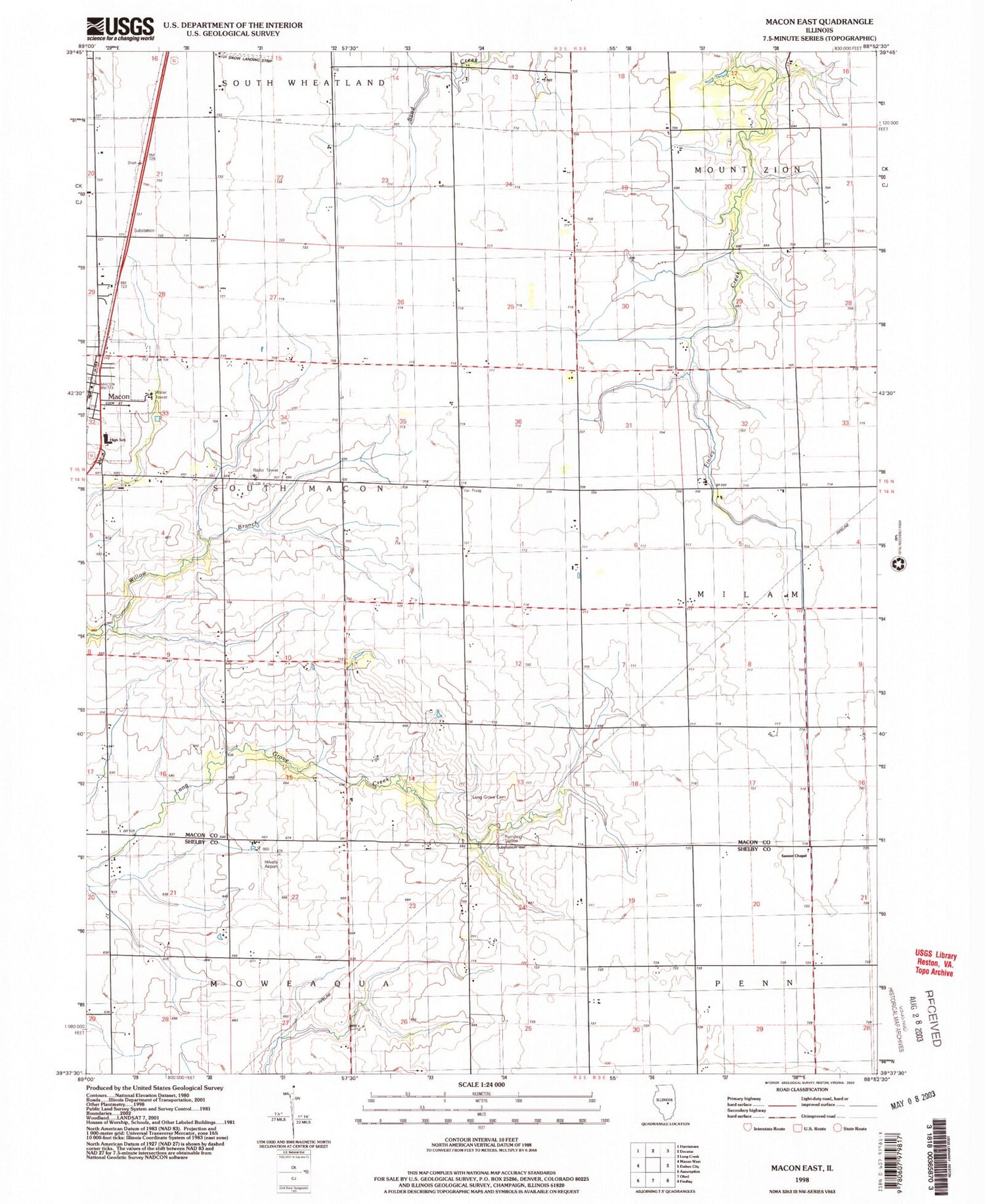
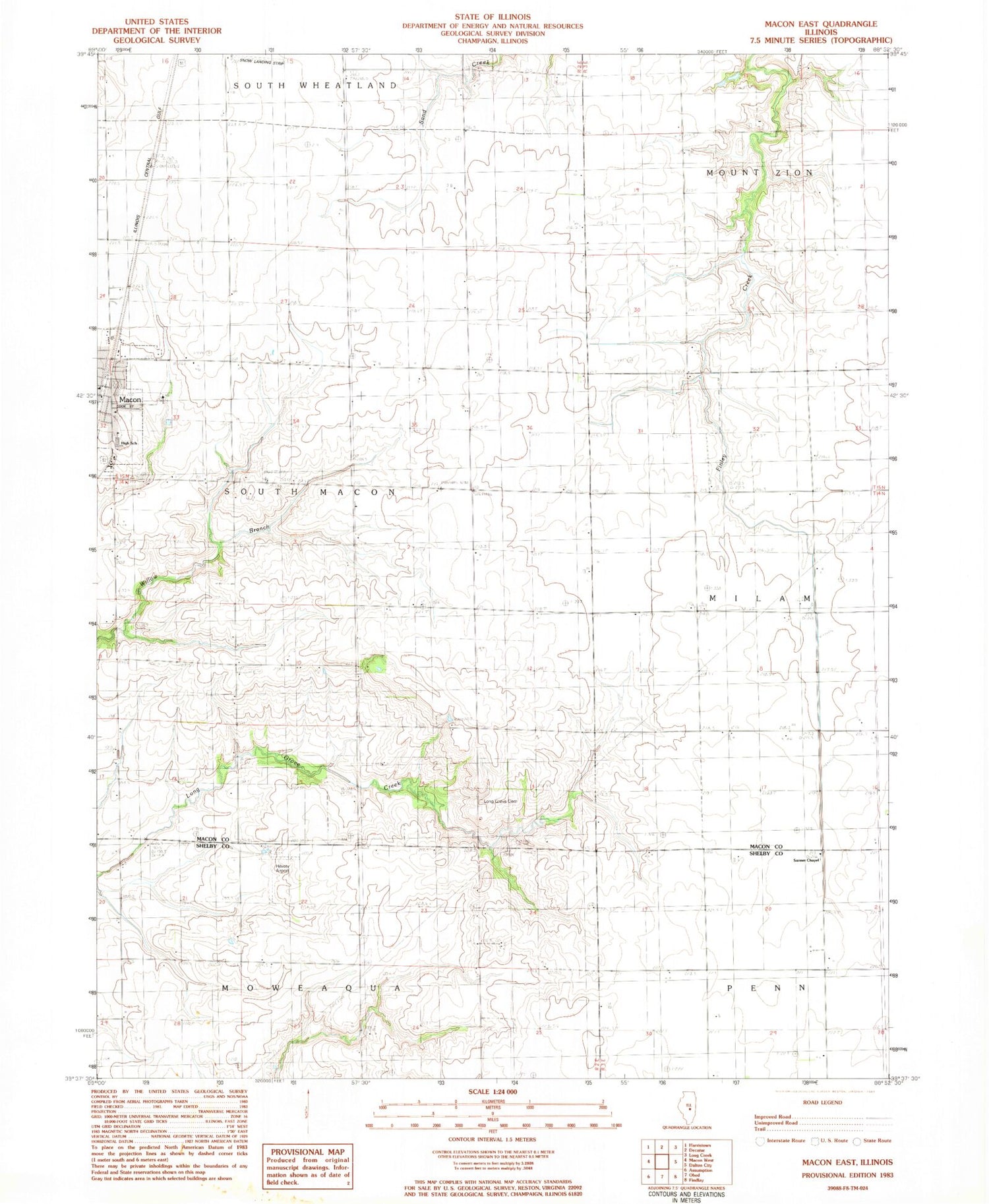
MyTopo
Classic USGS Macon East Illinois 7.5'x7.5' Topo Map
Couldn't load pickup availability
Historical USGS topographic quad map of Macon East in the state of Illinois. Map scale may vary for some years, but is generally around 1:24,000. Print size is approximately 24" x 27"
This quadrangle is in the following counties: Macon, Shelby.
The map contains contour lines, roads, rivers, towns, and lakes. Printed on high-quality waterproof paper with UV fade-resistant inks, and shipped rolled.
Contains the following named places: Center School, City of Macon, Eastern Star Sanitarium, Goodwill School, Hilvety Airport, Long Grove Cemetery, Long Grove School, Macon, Macon Post Office, Meridian Senior High School, Ocean Wave School, Sanner Chapel United Methodist Church, Snow Airport, South Macon Fire Protection District, Township of Moweaqua, Township of South Macon, ZIP Code: 62544