MyTopo
Classic USGS Macon NE Georgia 7.5'x7.5' Topo Map
Couldn't load pickup availability
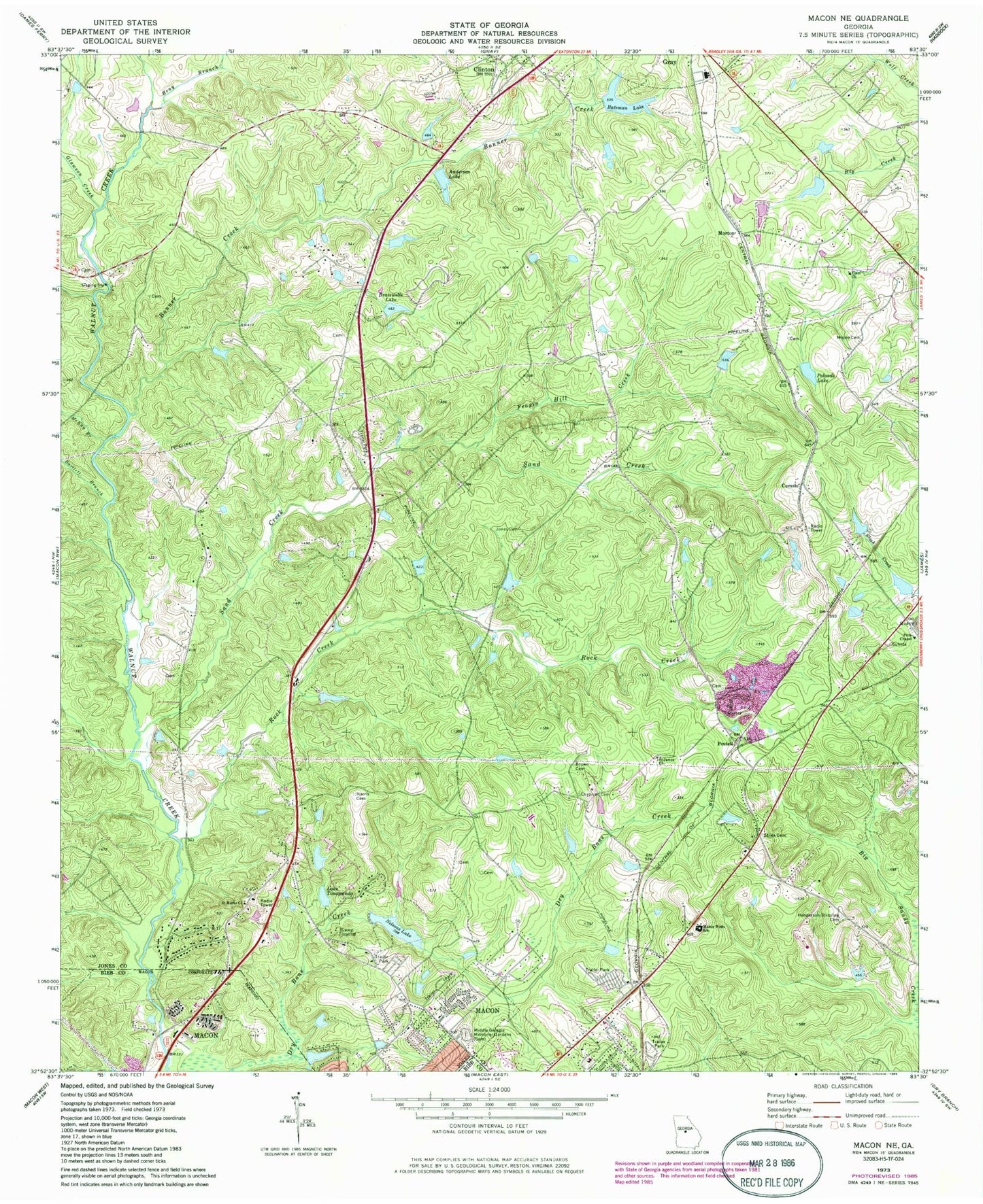
Historical USGS topographic quad map of Macon NE in the state of Georgia. Map scale may vary for some years, but is generally around 1:24,000. Print size is approximately 24" x 27"
This quadrangle is in the following counties: Bibb, Jones.
The map contains contour lines, roads, rivers, towns, and lakes. Printed on high-quality waterproof paper with UV fade-resistant inks, and shipped rolled.
Contains the following named places: Anderson Lake, Anderson Lake Dam, Bartlett Branch, Bateman Lake, Bateman Lake Dam, Bonner Creek, Bowden Hills, Brasswells Lake, Brasswells Lake Dam, Bray Branch, Camp Joycliff, Chapman Cemetery, Clifton Ridge Middle School, Clinton, Cumslo, Dames Ferry Elementary School, Elam Church, Elam Memorial Gardens Cemetery, Ethridge Dam, Ethridge Lake, Feagin Hill Creek, Glawson Creek, Gray Elementary School, Gray Station Middle School, Gray-Macon East Division, Harris Cemetery, Henderson Stripling Cemetery, Jones Acres, Jones Cemetery, Jones County Fire - Rescue Department Station 1, Jones County Fire Department Station 8, Jones County High School, Joycliff Estates, Kings View, Lake Tonowanda, Lake Tonowanda Dam, Litentie School, Martin-Marietta Dam, Martin-Marietta Lake, Mattie Wells Elementary School, McKay Branch, Middle Georgia Memorial Gardens, Moore Cemetery, Morton, Nelsons Lake, Nelsons Lake Dam, Newberry Dam, Newberry Lake, Old Clinton Historic District, Pitts, Pitts Chapel, Polands Lake, Polands Lake Dam, Postell, Rock Creek, Saint James Church, Saint Luke Church, Saint Marks Church, Saint Pauls Church, Sand Creek, Sand Creek Church, Smith Dam, Smith Lake, Stiles Cemetery, Walker - Pitts Cemetery, Walker Dam, Walker Lake, Washburn Dam, Washburn Lake, WDEN-FM (Macon), Wells Primary School, Wincey Cemetery, ZIP Code: 31211