MyTopo
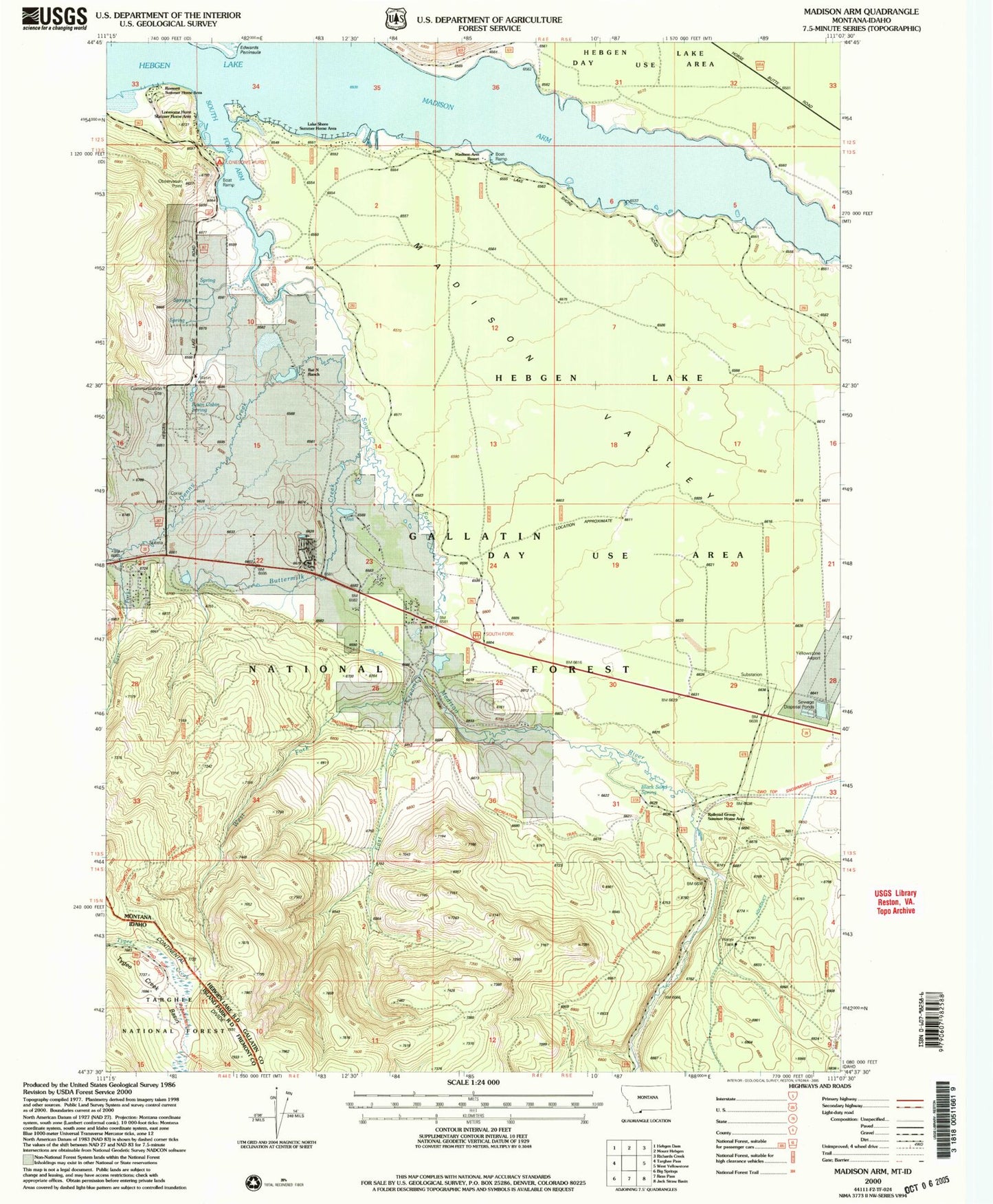
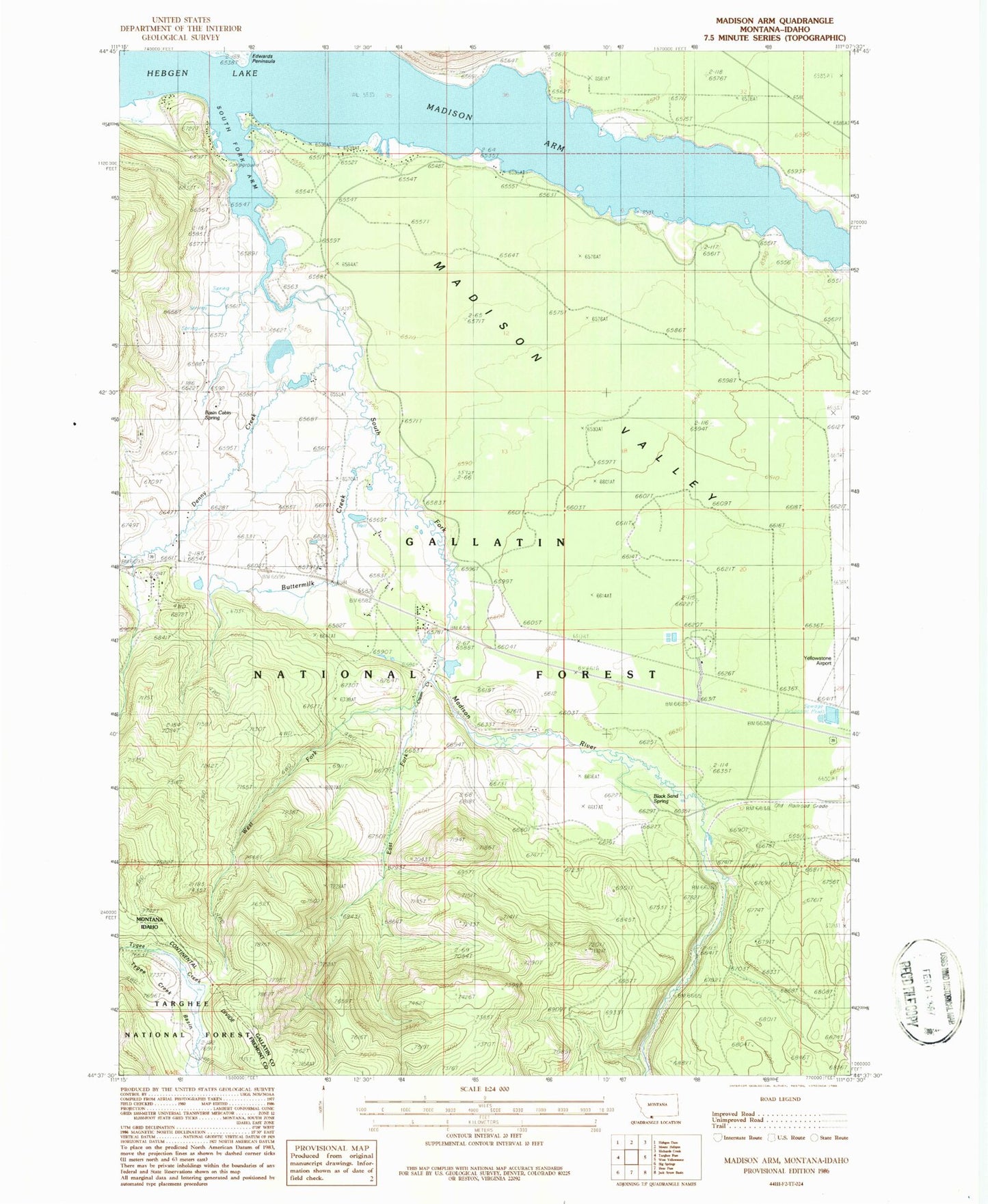
Classic USGS Madison Arm Montana 7.5'x7.5' Topo Map
Couldn't load pickup availability
Historical USGS topographic quad map of Madison Arm in the states of Montana, Idaho. Map scale may vary for some years, but is generally around 1:24,000. Print size is approximately 24" x 27"
This quadrangle is in the following counties: Fremont, Gallatin.
The map contains contour lines, roads, rivers, towns, and lakes. Printed on high-quality waterproof paper with UV fade-resistant inks, and shipped rolled.
Contains the following named places: 12S04E34CACB02 Well, 13S04E01BADD01 Well, 13S04E02AABB01 Well, 13S04E02BBBA01 Well, 13S04E09DDDD01 Spring, 13S04E10DDCA01 Well, 13S04E14CDAD01 Spring, 13S04E21ABDD01 Well, 13S04E21DBBC01 Well, 13S04E22ADCD01 Well, 13S04E23CDCA01 Well, 13S04E23DDDD02 Well, 13S04E26AAAB01 Well, 13S04E26BADB01 Well, 13S04E26BB__01 Well, 13S04E27AACA01 Spring, 13S05E29DA__01 Well, 13S05E31AC__01 Spring, 13S05E31ACDA01 Spring, 13S05E32CBDC01 Spring, 59758, Bar N Ranch, Basin Cabin Spring, Basin Ranger Station, Beaver Ponds, Black Sand Spring, Buttermilk Creek, Corette, Cream Creek, Denny Creek, Dwelles Stage Stop, East Fork Cream Creek, East Fork Denny Creek, Lakeshore Summer Home Area, Lonesome Hurst Summer Home Area, Lonesomehurst Campground, Lonesomehurst Recreation Site, Madison Arm, Madison Arm Resort, Madison Valley, Observation Point, Railroad Summer Home Area, Romsett Summer Home Area, Slushers Point, South Fork Arm, South Fork Camp, South Fork Madison River, Tygee Creek Basin, West Fork Cream Creek, West Fork Denny Creek, Yellowstone Park KOA Campground