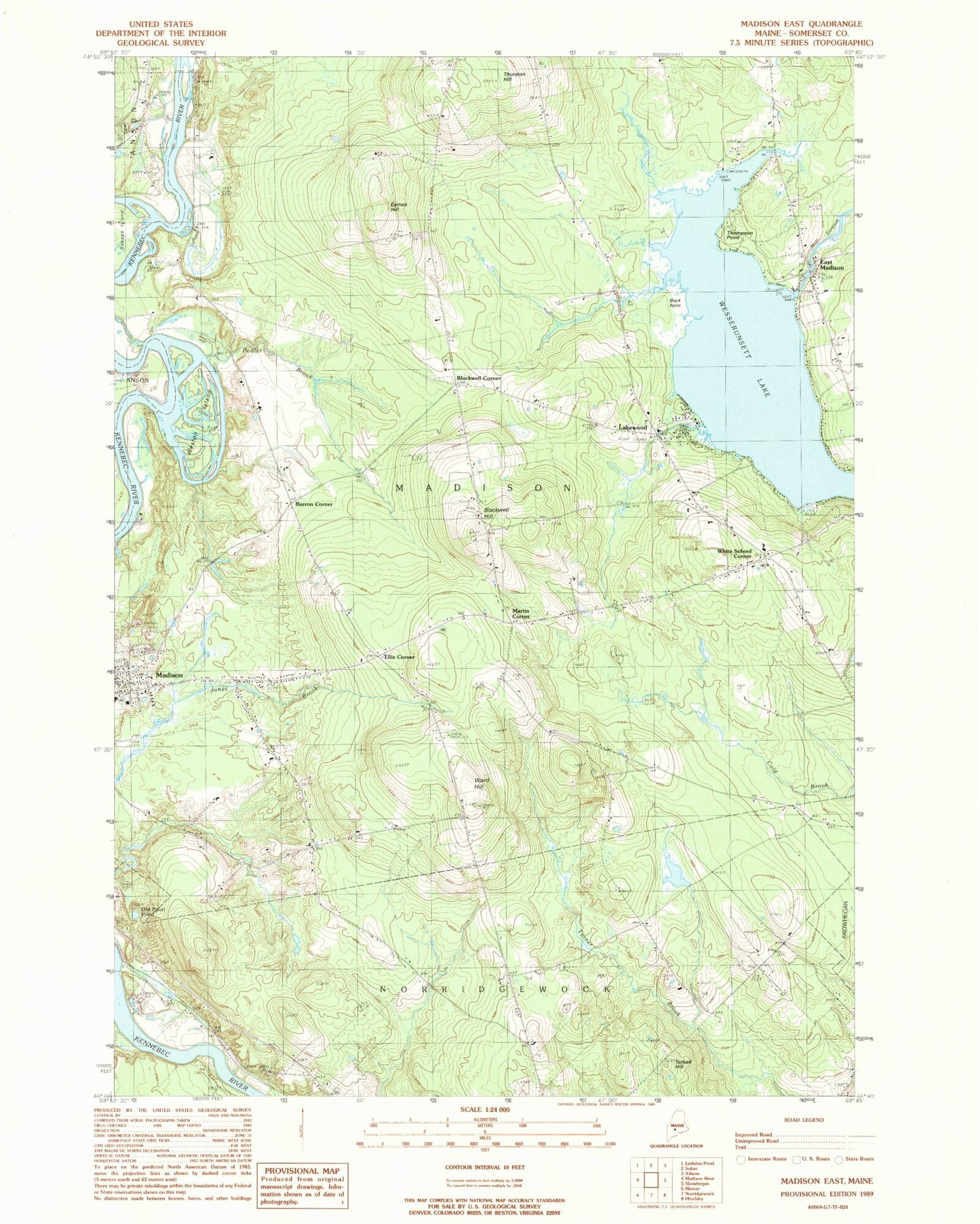
MyTopo
Classic USGS Madison East Maine 7.5'x7.5' Topo Map
Couldn't load pickup availability
Historical USGS topographic quad map of Madison East in the state of Maine. Map scale may vary for some years, but is generally around 1:24,000. Print size is approximately 24" x 27"
This quadrangle is in the following counties: Somerset.
The map contains contour lines, roads, rivers, towns, and lakes. Printed on high-quality waterproof paper with UV fade-resistant inks, and shipped rolled.
Contains the following named places: Abnaki Camping Center, Barron Corner, Black Point, Blackwell Cemetery, Blackwell Corner, Blackwell Hill, Eames Hill, East Madison, East Madison Cemetery, East Madison Dam, Ellis Corner, Forest Hill Cemetery, Jones Cemetery, Lakewood, Lakewood Golf Course, Lakewood Theater, Land of Rest Cemetery, Longley Cemetery, Madison Area Memorial High School, Madison Census Designated Place, Madison Fire Department East Madison Station, Madison Junior High School, Martin Corner, Morse Cemetery, Old Point Pond, Pooler Brook, Sandy Beach Lakeside Campground, Tarbell Hill, Thompson Point, Thurston Hill, Town of Madison, Union Church, Ward Hill, Wesserunsett and Ice Seaplane Base, Wesserunsett Lake, Weston Island, White School Corner, ZIP Code: 04950