MyTopo
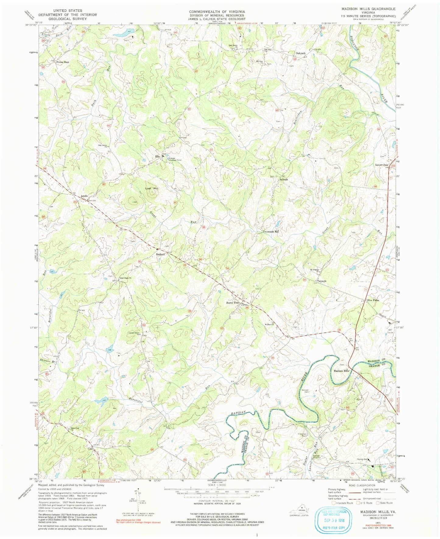
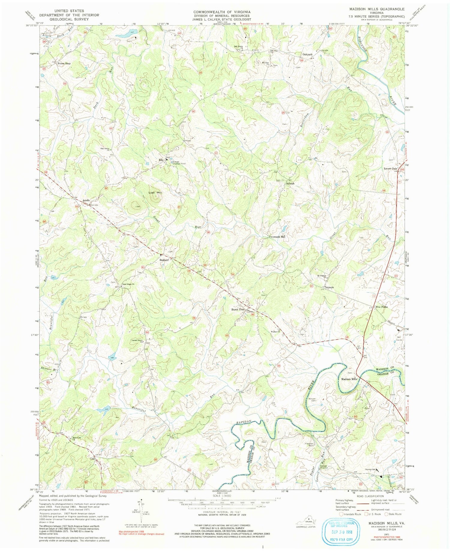
Classic USGS Madison Mills Virginia 7.5'x7.5' Topo Map
Couldn't load pickup availability
Historical USGS topographic quad map of Madison Mills in the state of Virginia. Map scale may vary for some years, but is generally around 1:24,000. Print size is approximately 24" x 27"
This quadrangle is in the following counties: Madison, Orange.
The map contains contour lines, roads, rivers, towns, and lakes. Printed on high-quality waterproof paper with UV fade-resistant inks, and shipped rolled.
Contains the following named places: Achash, Aroda, Beautiful Run, Beautiful Run Number 10 Dam, Beautiful Run Number 11 Dam, Beautiful Run Number Five Dam, Beautiful Run Number Four Dam, Beautiful Run Number Seven Dam, Beautiful Run Number Six Dam, Burnt Tree, Elly, Five Forks, Good Hope Baptist Church, Grymes Memorial School, Kemper Cemetery, Laurel Run, Locust Dale, Locust Dale District, Locust Dale Post Office, Locust Grove Baptist Church, Lost Mountain, Madison Mills, Main Uno Baptist Church, Malvern Dam, Malvern Lake, Mount Pisgah Church, Mount Zion Church, Oak Grove Church, Oak Grove Mennonite Church, Oak Grove Mennonite School, Oakpark, Oakpark Post Office, Poplar Run, Prices Shop, Radiant, Radiant Post Office, Skinner Branch, Tanners, Twymans Mill, Uno, Walker's United Methodist Church, ZIP Codes: 22709, 22730, 22732, 22948, 22989