MyTopo
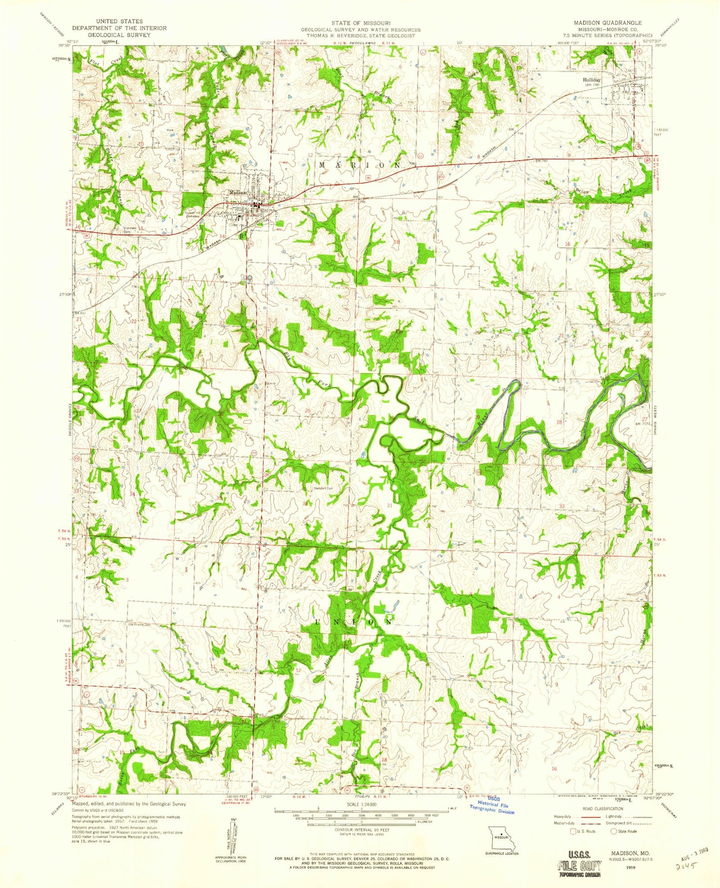
Classic USGS Madison Missouri 7.5'x7.5' Topo Map
Couldn't load pickup availability
Historical USGS topographic quad map of Madison in the state of Missouri. Map scale may vary for some years, but is generally around 1:24,000. Print size is approximately 24" x 27"
This quadrangle is in the following counties: Monroe.
The map contains contour lines, roads, rivers, towns, and lakes. Printed on high-quality waterproof paper with UV fade-resistant inks, and shipped rolled.
Contains the following named places: Allen Creek, Baker Branch, Barnham School, Bee Branch, City of Madison, Dunaway Cemetery, Harley School, Holliday, Holliday Elementary School, Holliday Post Office, Horne Branch, Jacoby School, Madison, Madison and West Monroe Fire Protection District, Madison Elementary School, Madison High School, Madison Post Office, Mason School, New Hope School, O'Bannon Dam, Old Prairie Cemetery, Pedee Branch, Reese Fork, Sunset Hill Cemetery, Swindell Cemetery, Township of Marion, Township of Union, Village of Holliday, Wright School, ZIP Code: 65263