MyTopo
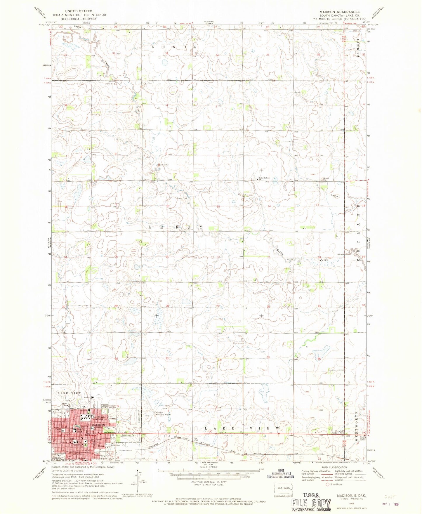
Classic USGS Madison South Dakota 7.5'x7.5' Topo Map
Couldn't load pickup availability
Historical USGS topographic quad map of Madison in the state of South Dakota. Map scale may vary for some years, but is generally around 1:24,000. Print size is approximately 24" x 27"
This quadrangle is in the following counties: Lake.
The map contains contour lines, roads, rivers, towns, and lakes. Printed on high-quality waterproof paper with UV fade-resistant inks, and shipped rolled.
Contains the following named places: Baughman Park, Beadle Hall, Central High School, City of Madison, Dakota State University, East Hall, Emry Hall, Garfield School, Graceland Cemetery, Heston Hall, Higbee Hall, Karl E Mundt Library, Kennedy Center, Lake County Courthouse, Lake County Jail, Lake County Sheriff's Office, Lake Madison Church, Lake Madison Lutheran Cemetery, Lincoln School, Lowry Hall, Madison, Madison City Hall, Madison Community Center, Madison Elementary School, Madison Fire Department, Madison High School, Madison Middle School, Madison Municipal Airport, Madison Police Department, Madison Post Office, Madison Public Library, Richardson Hall, Saint Thomas School, Science Center, Smith Zimmermann Museum, Township of Lake Center, Township of Le Roy, Trojan Center, Trojan Field, Tunheim Classroom Building, Washington School, Wentworth Roadside Park, Zimmermann Hall