MyTopo
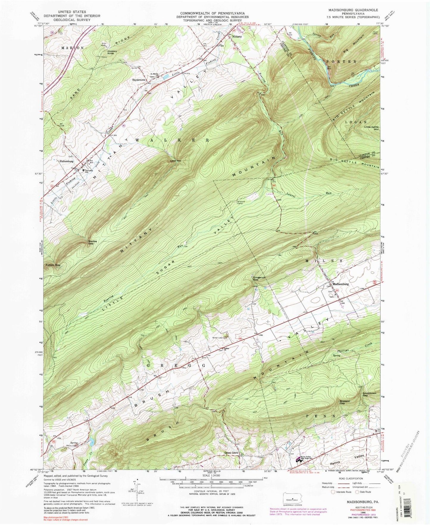
Classic USGS Madisonburg Pennsylvania 7.5'x7.5' Topo Map
Couldn't load pickup availability
Historical USGS topographic quad map of Madisonburg in the state of Pennsylvania. Map scale may vary for some years, but is generally around 1:24,000. Print size is approximately 24" x 27"
This quadrangle is in the following counties: Centre, Clinton.
The map contains contour lines, roads, rivers, towns, and lakes. Printed on high-quality waterproof paper with UV fade-resistant inks, and shipped rolled.
Contains the following named places: Bear Hollow Run, Big Kettle Mountain, Big Mountain, Boy School, Bressler Gap, Brush Valley, Fulton Gap, Gingerich Gap, Green Grove, Green Grove Cemetery, Hickory Knob, Hublersburg, Hublersburg Cemetery, Hublersburg Census Designated Place, Krislund Camp, Laurel Run, Lees Gap, Little Sugar Valley, Madisonburg, Madisonburg Census Designated Place, Madisonburg Lutheran and Reformed Cemetery, Madisonburg Post Office, Madisonburg United Methodist Cemetery, Markle Gap, Murray School, Nittany, Nittany Census Designated Place, Penns Cave Airport, Penns Cave Spring, Penns Valley Area High School, Saint Marks Church, Smithtown Gap, Snydertown, Snydertown Cemetery, Snydertown Census Designated Place, Spring Run, Township of Walker, Trinity Church, United Church of Christ and Lutheran Cemetery, Valley Church, Walker Township Volunteer Fire Company 16 Main Station, Yearick Cemetery, Yearick Cemetery West, ZIP Code: 16852