MyTopo
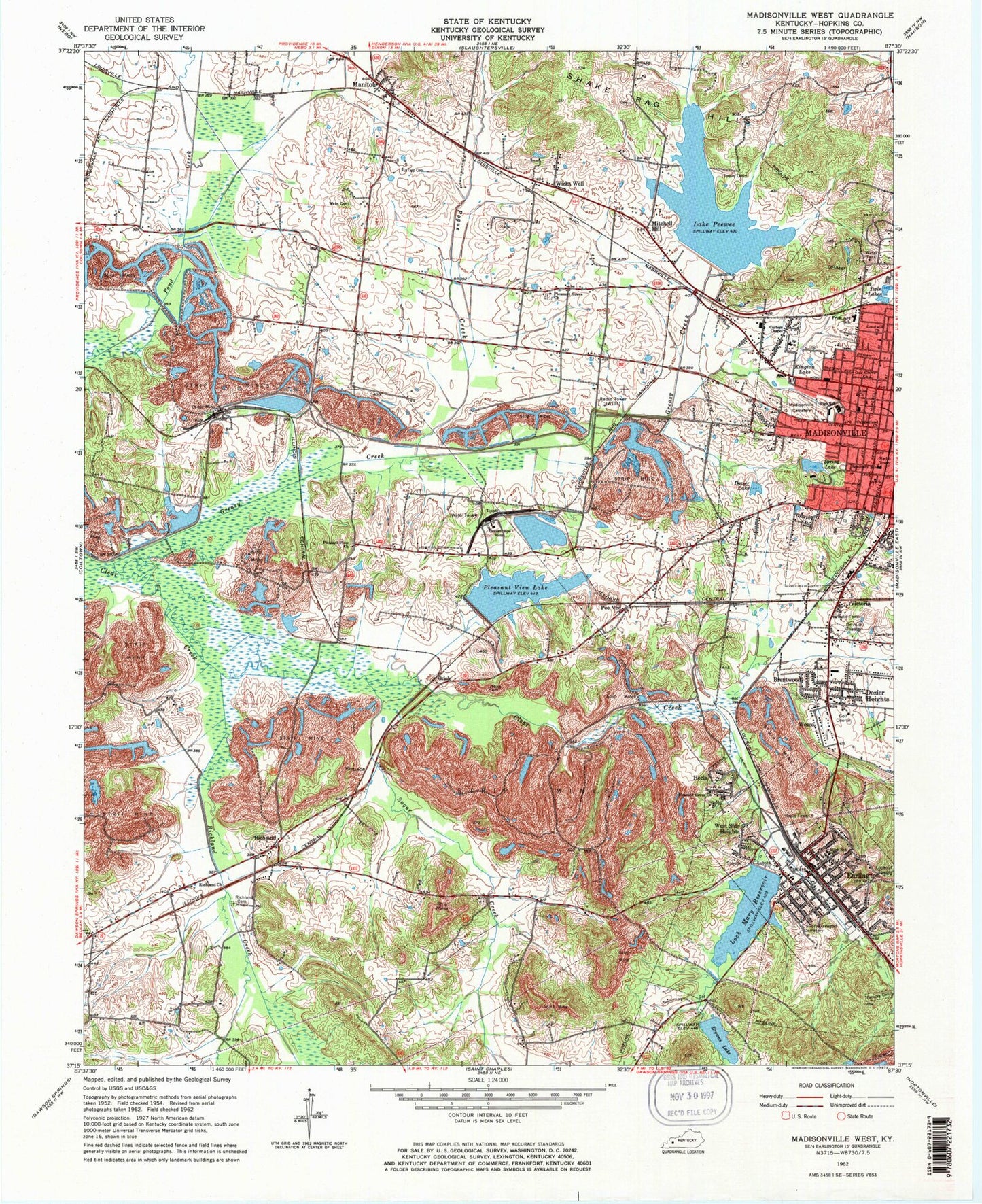
Classic USGS Madisonville West Kentucky 7.5'x7.5' Topo Map
Couldn't load pickup availability
Historical USGS topographic quad map of Madisonville West in the state of Kentucky. Map scale may vary for some years, but is generally around 1:24,000. Print size is approximately 24" x 27"
This quadrangle is in the following counties: Hopkins.
The map contains contour lines, roads, rivers, towns, and lakes. Printed on high-quality waterproof paper with UV fade-resistant inks, and shipped rolled.
Contains the following named places: Army of Six Historical Marker, Barnsley Cemetery, Brentwood, Browns Lake, Calvary Oakwood Cemetery, Carters Chapel, City of Earlington, City of Madisonville, Cumberland Church, Dozier Heights, Dozier Lake, Earlington, Earlington Fire Department, Earlington Historical Marker, Earlington Police Department, Earlington Post Office, Fuquay Cemetery, Greasy Creek, Hecla, Hopkins County, Kington Lake, Lake Peewee, Loch Mary Reservoir, Madisonville Fire Department Station 3, Madisonville Post Office, Manitou, Manitou Post Office, Mitchell Hill, Oak Grove Church, Odd Fellows Cemetery, Oriole, Oriole Mine, Pee Vee, Pleasant Grove Church, Pleasant View, Pleasant View Church, Pleasant View Lake, Pleasant View Mine, Pogue Creek, Richland, Richland Cemetery, Richland Church, Richland Creek, Richland Fire Department, Seminary School, Spring Lake, Steubens Lick Historical Marker, Sugar Creek, Tapp Cemetery Number 1, Twin Lakes, Victoria, Wesco, West Side Heights, Wicks Cemetery, Wicks Well, WLCN-TV (Madisonville), WTTL-AM (Madisonville), Zion Church, ZIP Codes: 42410, 42436