MyTopo
Classic USGS Madisonville Virginia 7.5'x7.5' Topo Map
Couldn't load pickup availability
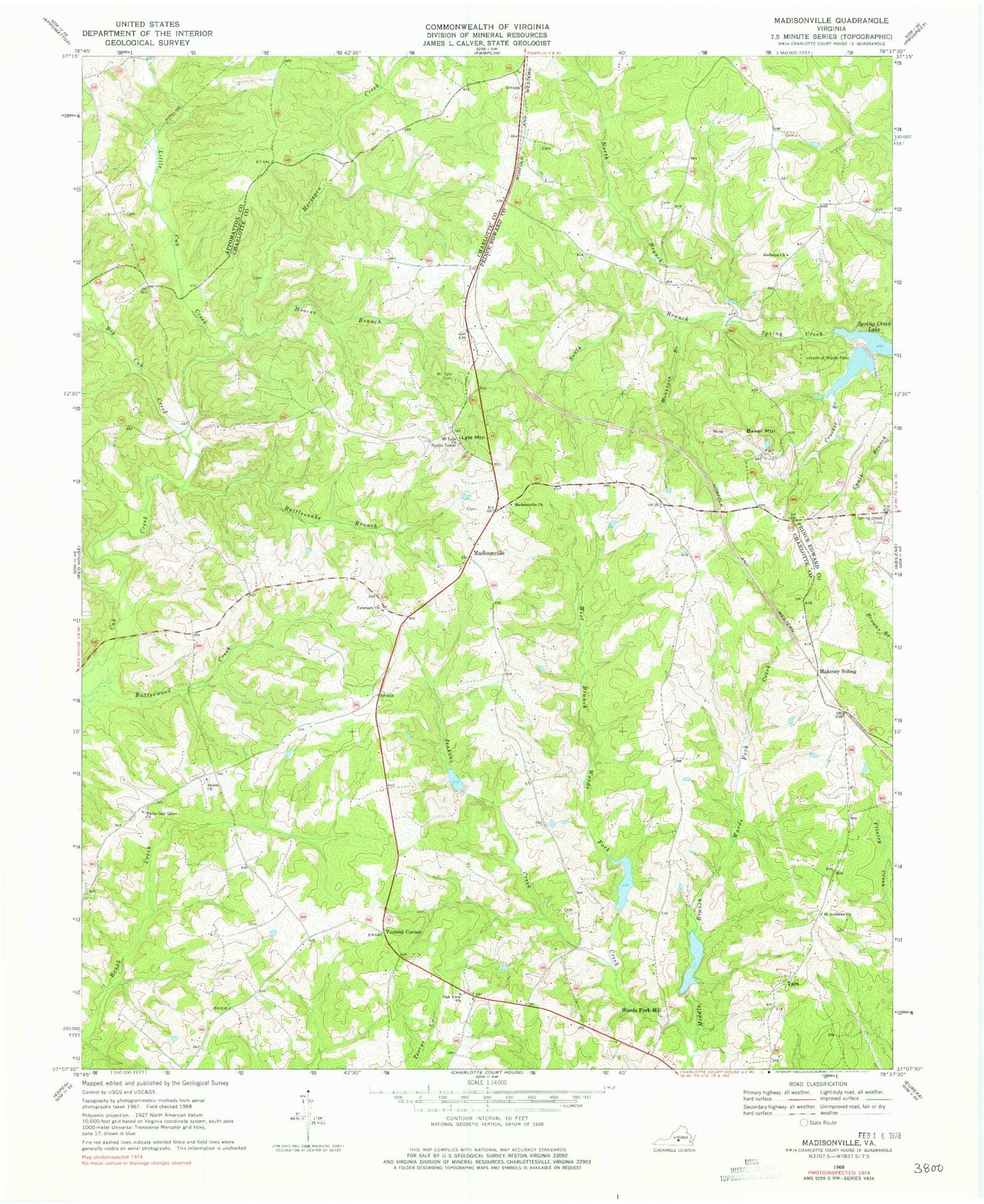
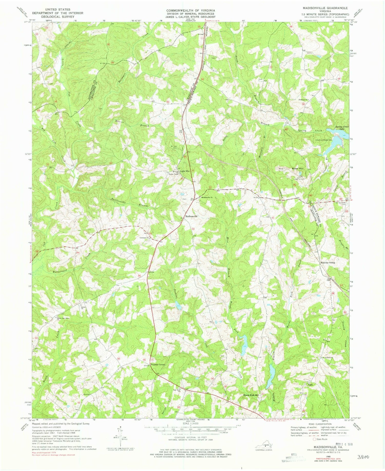
Historical USGS topographic quad map of Madisonville in the state of Virginia. Map scale may vary for some years, but is generally around 1:24,000. Print size is approximately 24" x 27"
This quadrangle is in the following counties: Appomattox, Charlotte, Prince Edward.
The map contains contour lines, roads, rivers, towns, and lakes. Printed on high-quality waterproof paper with UV fade-resistant inks, and shipped rolled.
Contains the following named places: Alabama Church, Baker Mountain, Baker Mountain Mine, Big Cub Creek, Cetenary Church, Crocked Branch, Horsepen Creek, Industrial Waste Dam, Industrial Waste Pond, Jenkins Creek, Little Cub Creek, Lyle Mountain, Madison District, Madisonville, Madisonville Church, Maloney Siding, Moores Branch, Mount Lyle Cemetery, Mount Lyle Church, Mountain Branch, North Branch Spring Creek, Oak View Church, Oaks Cemetery, Rattlesnake Branch, Roanoke Creek Number 4a Dam, Roanoke Creek Number 5b Dam, Roanoke Creek Number 6a Dam, Roanoke Creek Site 4a Lake, Roanoke Creek Site 5b Lake, Roanoke Creek Site 6a Lake, Saint Andrews Church, Salem Cemetery, Salem Church, South Branch Spring Creek, Spring Creek Cemetery, Taro, Vincent Corner, Wards Fork Mill, Wells Dam, West Branch Wards Fork Creek, White Oak Grove Church, ZIP Code: 23934