MyTopo
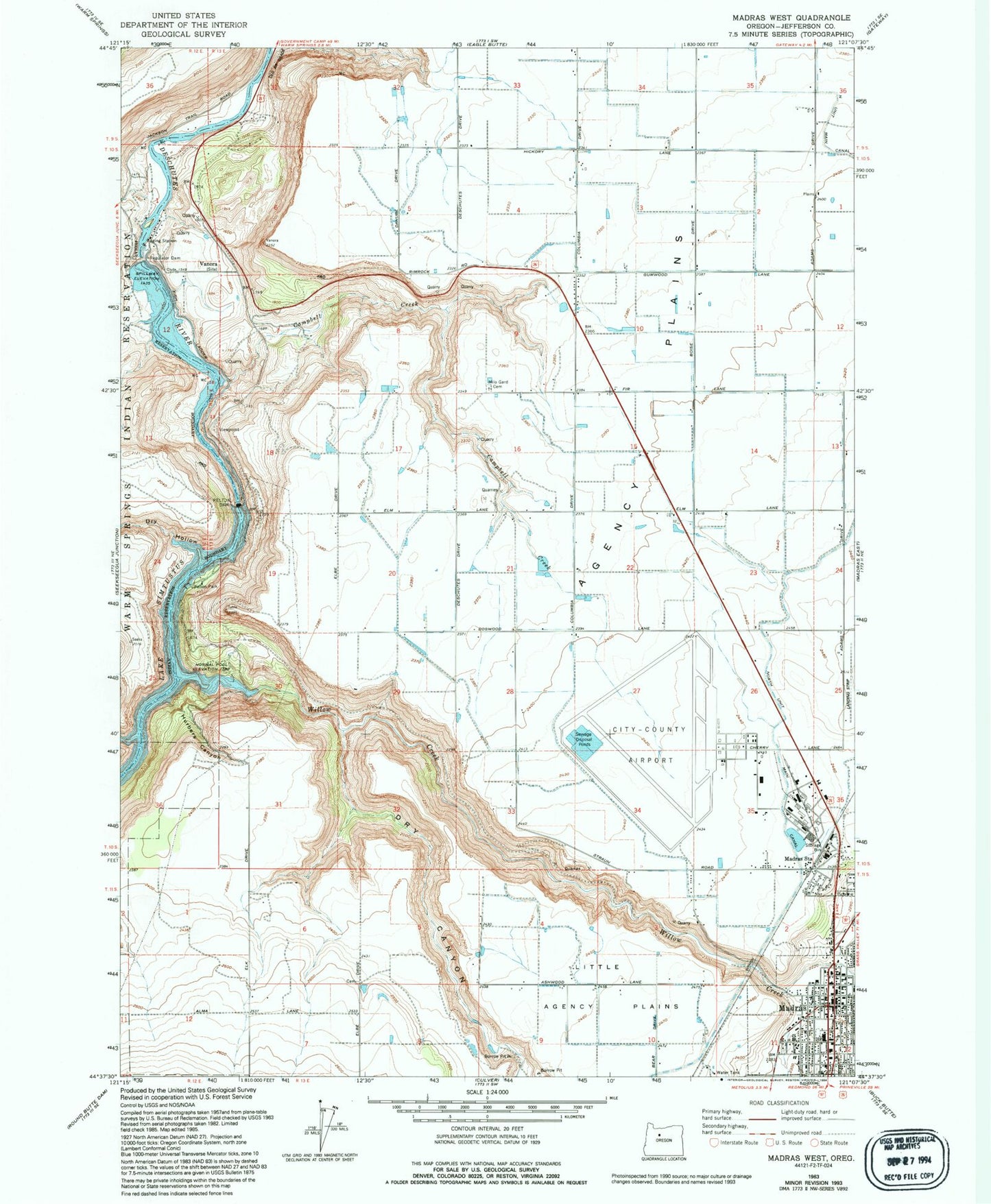
Classic USGS Madras West Oregon 7.5'x7.5' Topo Map
Couldn't load pickup availability
Historical USGS topographic quad map of Madras West in the state of Oregon. Map scale may vary for some years, but is generally around 1:24,000. Print size is approximately 24" x 27"
This quadrangle is in the following counties: Jefferson.
The map contains contour lines, roads, rivers, towns, and lakes. Printed on high-quality waterproof paper with UV fade-resistant inks, and shipped rolled.
Contains the following named places: 7th Street Park, Agency Plains, Air Base Post Office, Bombay Farms Airport, Campbell Creek, Cascades East Transit Madras Worksource Park and Ride, City of Madras, Community Park, Department of Motor Vehicles Madras, Dry Canyon, Dry Hollow, Friendship Park, Hurbers Canyon, Jefferson County, Jefferson County Circuit Court, Jefferson County Library, Jefferson County Museum, Jefferson County Public Health Department Office, Jefferson County Sheriff's Office, Jefferson Plywood Company Dam, Jefferson Plywood Company Mill Pond, John Brown Canyon, Lake Simtustus, Lake Simtustus Resort Boat Launch, Little Agency Plains, Madras, Madras Christian School, Madras City Hall, Madras Control Tower, Madras Division, Madras Municipal Airport, Madras Municipal Court, Madras Police Department, Madras Post Office, Madras Public Works, Madras Speedway Dragstrip and Albany Sand Drags, Madras Station, Milo Gard Cemetery, Pelton, Pelton Dam, Pelton Park, Pelton Park Boat Ramp, Pelton Park Marina, Pelton Regulating Dam, Pelton Regulating Reservoir, Round Butte Cemetery, Seekseequa Creek, Totem Park, U P Water Tank, Vanora, Vanora Post Office, Westside Elementary School, Willow Creek, Willow Creek Canyon