MyTopo
Classic USGS Madrid New Mexico 7.5'x7.5' Topo Map
Couldn't load pickup availability
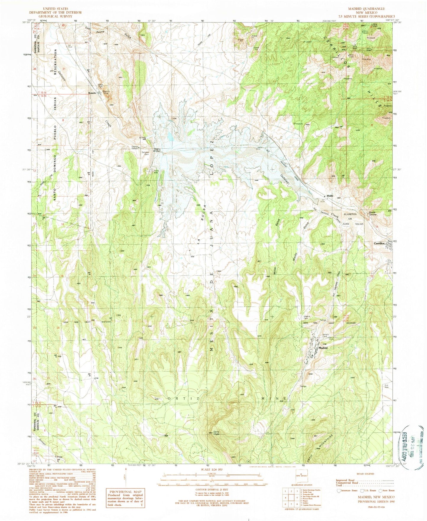
Historical USGS topographic quad map of Madrid in the state of New Mexico. Map scale may vary for some years, but is generally around 1:24,000. Print size is approximately 24" x 27"
This quadrangle is in the following counties: Sandoval, Santa Fe.
The map contains contour lines, roads, rivers, towns, and lakes. Printed on high-quality waterproof paper with UV fade-resistant inks, and shipped rolled.
Contains the following named places: Alamitos or Juan Salas Grant, Anthracite Number Eight Mine, Anthracite Number Thirty Two Mine, Armington Mine, Arroyo Largo, Black Hornet Prospect, Central Hotel, Cerrillos Hills, Cerrillos Historical Marker, Cerrillos Opera House Historic Site, Cerrillos Public School, Cerro Chato, Devils Throne, Evelyn Coal Mine, Galisteo Dam, Galisteo Reservoir, Hotel Mac, Jones Coal Mine, La Bolsa, Los Cerrillos Mining District, Madrid, Madrid Boarding House Historic Site, Madrid Cemetery, Madrid Census Designated Place, Madrid Historic District, Madrid Post Office, Mesita de Juana Lopez Grant, Miller Gulch, Mount Chalchihuitl Turquois Mine, Palace Hotel, RG-24629X9 Water Well, RG-26043 Water Well, RG-27088 Water Well, RG-28309 Water Well, RG-29045 Water Well, RG-29562 Water Well, Rosario, Rosario Cemetery, Saint Joseph Church, Santa Fe County Volunteer Fire Department - Turquoise Trail District Station 1, Santa Fe County Volunteer Fire Madrid District, Tom Payne Gulch, Tom Payne Mine, Union Mine, Waldo, Waldo Coke Ovens Historic Site, Waldo Gulch, Waldo Mesa, Waldo Post Office, White Ash Mine, ZIP Code: 87010