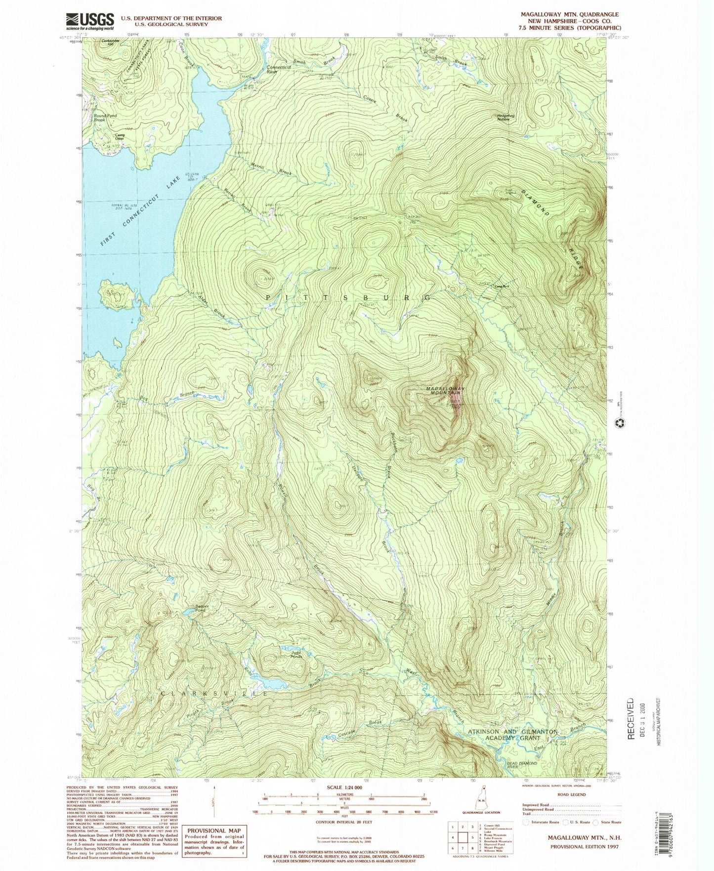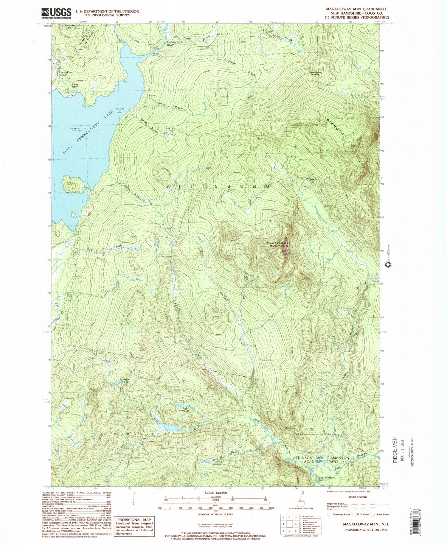
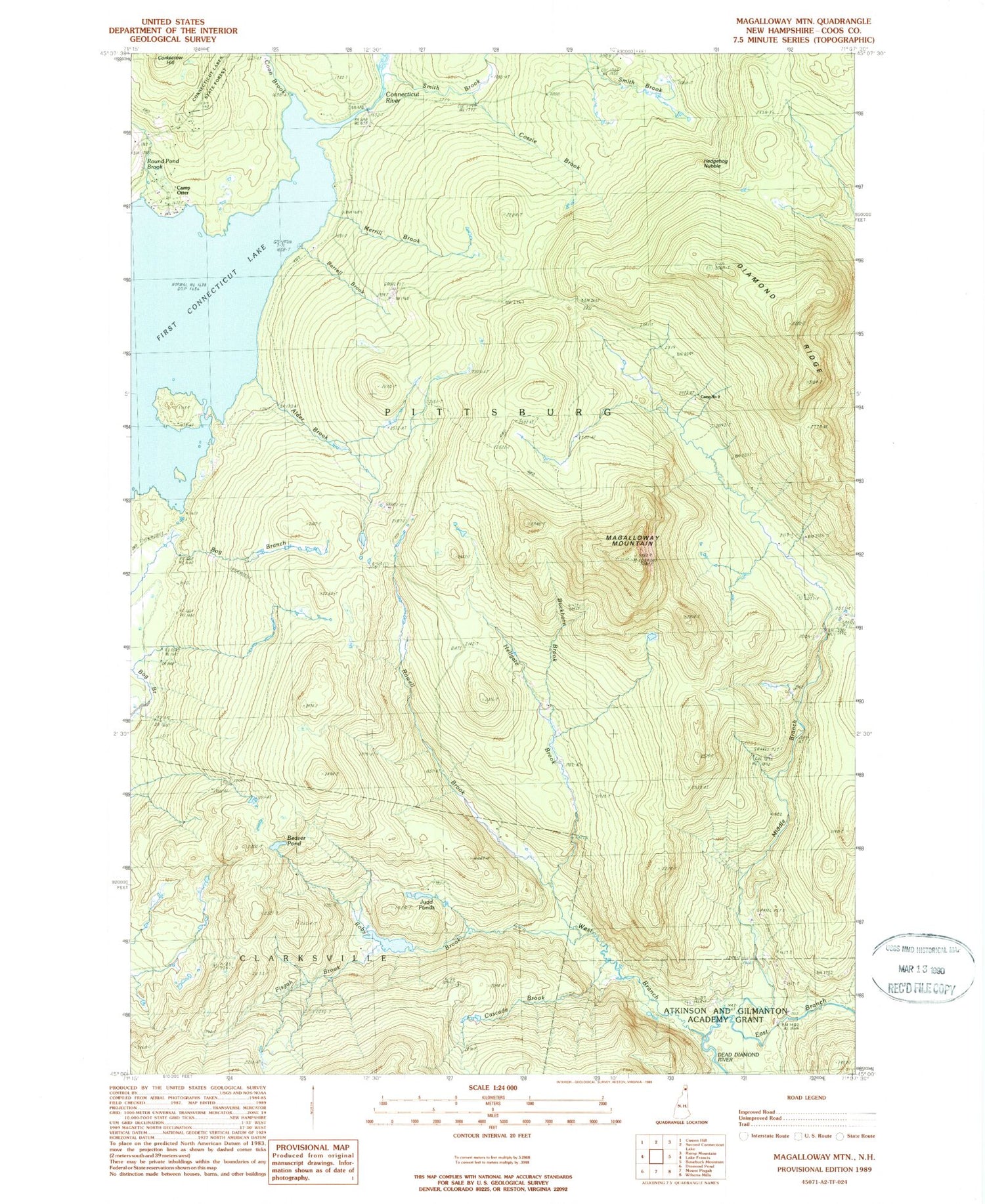
MyTopo
Classic USGS Magalloway Mountain New Hampshire 7.5'x7.5' Topo Map
Couldn't load pickup availability
Historical USGS topographic quad map of Magalloway Mountain in the state of New Hampshire. Typical map scale is 1:24,000, but may vary for certain years, if available. Print size: 24" x 27"
This quadrangle is in the following counties: Coos.
The map contains contour lines, roads, rivers, towns, and lakes. Printed on high-quality waterproof paper with UV fade-resistant inks, and shipped rolled.
Contains the following named places: Beaver Pond, Buckhorn Brook, Camp Number 8, Camp Number 9, Camp Otter, Diamond Ridge, First Connecticut Lake, Hedgehog Nubble, Hellgate Brook, Magalloway Mountain, Middle Branch Dead Diamond River, Pisgah Brook, Roby Brook, Round Pond Brook, Rowell Brook, Smith Brook, West Branch Dead Diamond, Judd Pond, Alder Brook, Cozzie Brook, Merrill Brook, Barrel Brook, Cascade Brook, Judds Ponds, Coon Brook, Shehan Camp (historical), Shehan Pond Dam, Shehan Pond, Connecticut Lakes, Machia Brook