MyTopo
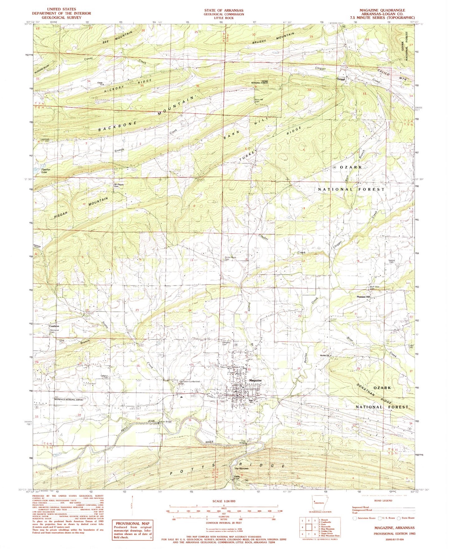
Classic USGS Magazine Arkansas 7.5'x7.5' Topo Map
Couldn't load pickup availability
Historical USGS topographic quad map of Magazine in the state of Arkansas. Map scale may vary for some years, but is generally around 1:24,000. Print size is approximately 24" x 27"
This quadrangle is in the following counties: Logan.
The map contains contour lines, roads, rivers, towns, and lakes. Printed on high-quality waterproof paper with UV fade-resistant inks, and shipped rolled.
Contains the following named places: Backbone Mountain, Barn Hill, Barn Hill Cemetery, Barn Hill Church, Bee Mountain, Bluff View Cemetery, Booneville Municipal Airport, Briar Creek, Callahan Cemetery, Catlett Cemetery, Cauthron, Cauthron Church, Center Point Cemetery, Center Point Church, Chigger Creek, City of Magazine, Clarks Church, Crocker Creek, Driggs, Driggs Rural Fire Department, Ellington Cemetery, Evans Cemetery, First Bridge, Fletcher Branch, Gin Branch, Hickory Ridge, Kilburn Bridge, Landmark Cemetery, Logan County Emergency Medical Service - Booneville, Magazine, Magazine City Volunteer Fire Department, Magazine Elementary School, Magazine Gas Field, Magazine High School, Magazine Police Department, Magazine Post Office, Memorial Cemetery, Middle Bridge, Mount Nebo Church, Mount Pisgah Cemetery, Mount Pisgah School, Old Union-Cumberland Cemetery, Pisgah Mountain, Pleasant Hill, Pleasant Hill School, Prairie Branch, Prospect Church, Revilee, Revilee Church, Revilee Creek, Scotts Creek, Sexton Cemetery, The Narrows, Township of Driggs, Township of Reveilee, Turkey Ridge, Wesley Chapel, Wesson-Davis Field, Whiteoak Valley, ZIP Code: 72943