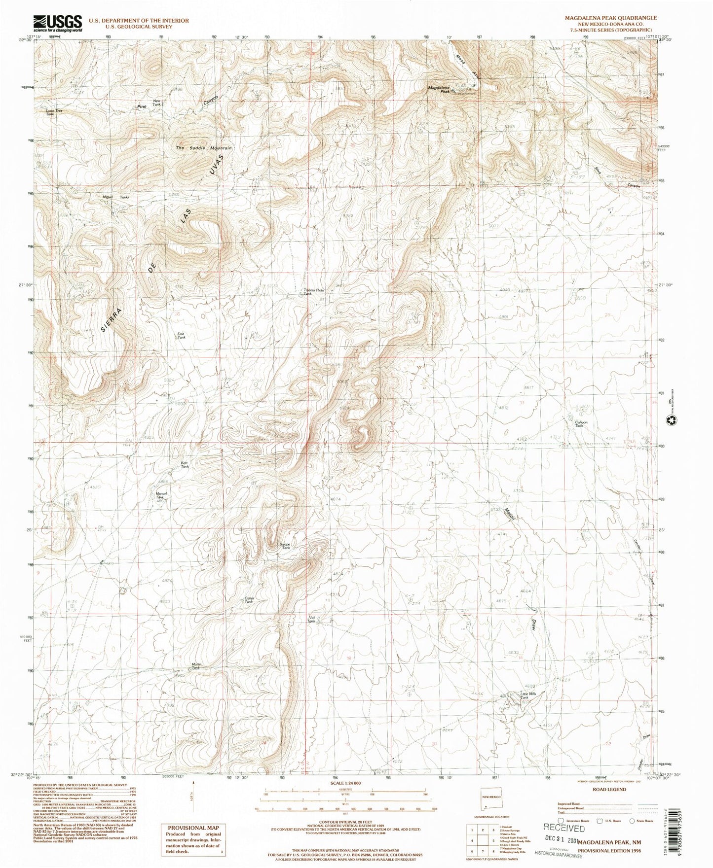
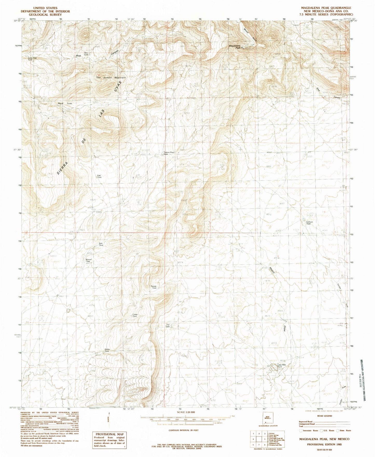
MyTopo
Classic USGS Magdalena Peak New Mexico 7.5'x7.5' Topo Map
Couldn't load pickup availability
Historical USGS topographic quad map of Magdalena Peak in the state of New Mexico. Map scale may vary for some years, but is generally around 1:24,000. Print size is approximately 24" x 27"
This quadrangle is in the following counties: Do��a Ana.
The map contains contour lines, roads, rivers, towns, and lakes. Printed on high-quality waterproof paper with UV fade-resistant inks, and shipped rolled.
Contains the following named places: Cahoon Tank, Carter Tank, East Tank, Kerr Tank, Little Mills Wells, Lone Tree Tank, Magdalena Peak, Manuel Tank, Martin Tank, Mesa Azur, Miguel Tanks, Monterey Well, New Tank, Shorty Swope Tank, Sierra de las Uvas, Swope Tank, Tajanio Pinto Tank, The Saddle Mountain, Twin Hills Tank, Upper Swope Tank, Vail Tank