MyTopo
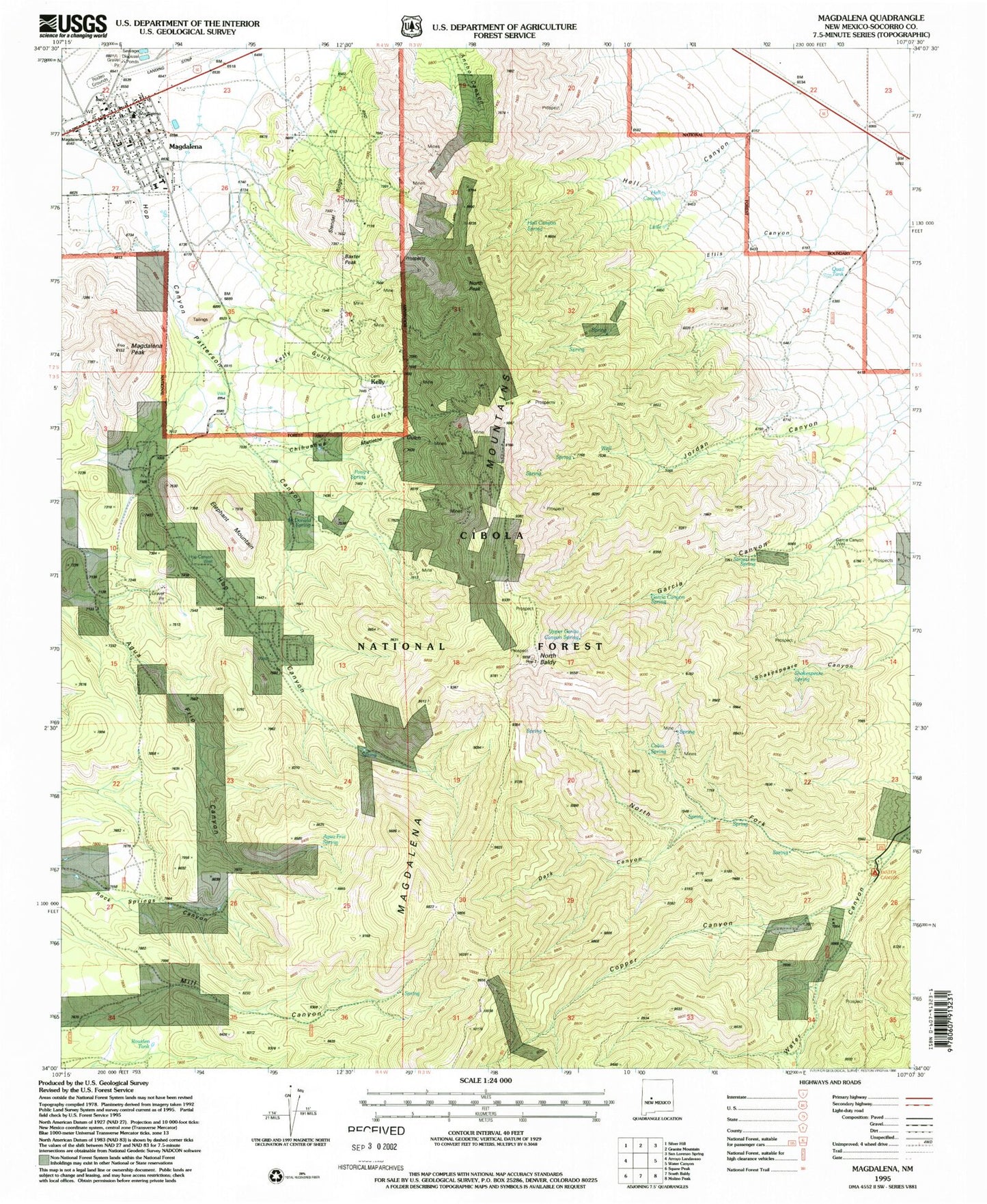
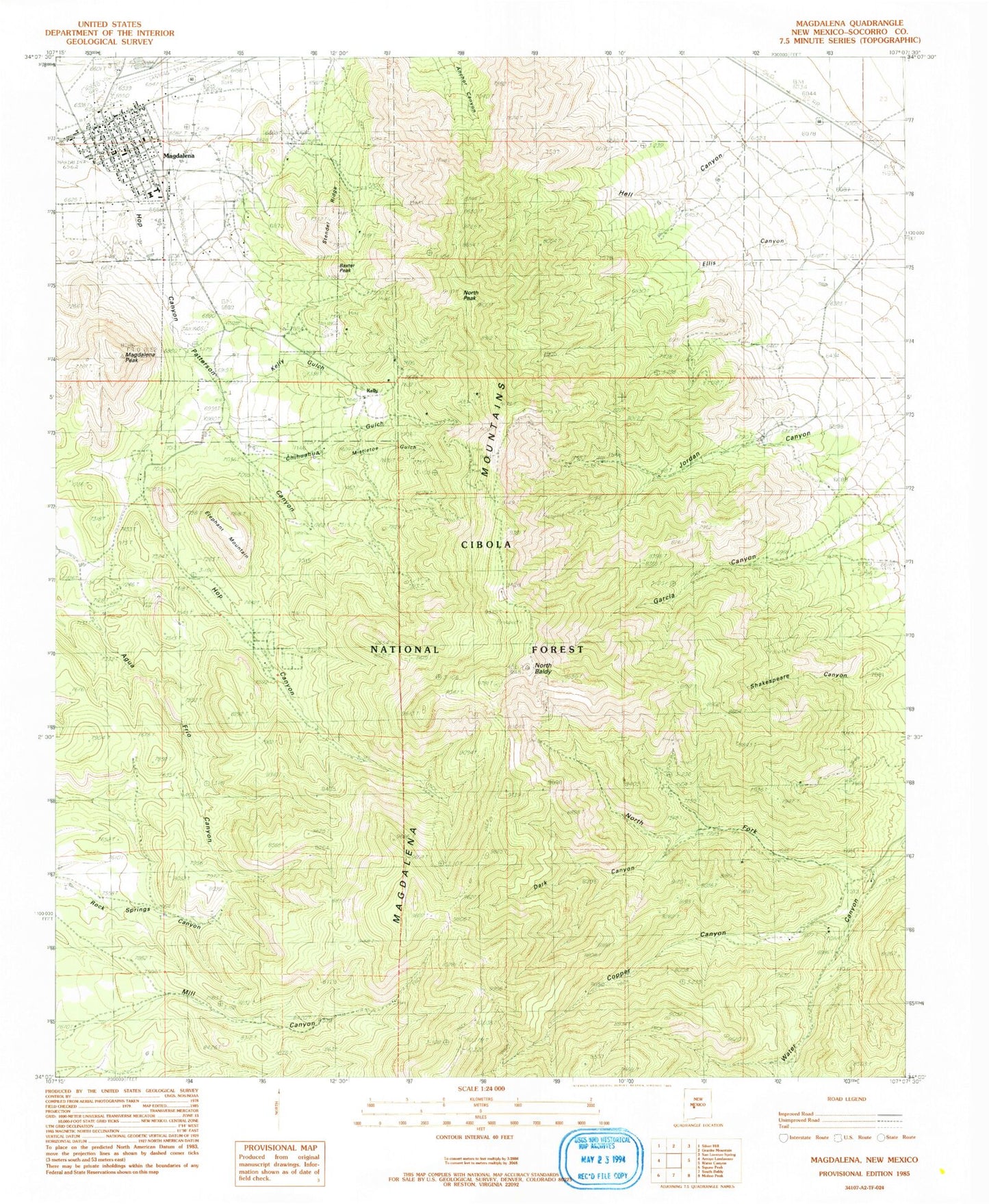
Classic USGS Magdalena New Mexico 7.5'x7.5' Topo Map
Couldn't load pickup availability
Historical USGS topographic quad map of Magdalena in the state of New Mexico. Typical map scale is 1:24,000, but may vary for certain years, if available. Print size: 24" x 27"
This quadrangle is in the following counties: Socorro.
The map contains contour lines, roads, rivers, towns, and lakes. Printed on high-quality waterproof paper with UV fade-resistant inks, and shipped rolled.
Contains the following named places: Stendel Ridge, Water Canyon Campground, Strozzi Su Spring, Shakespeare Spring, Magdalena High School, Magdalena Middle School, Oak Spring, Martin Tunnel, Sleeper Tunnel, Tip Top Mountain, Stonewall Tunnel, Tip Top Tunnel, Cimarron Tunnel, Mitchell Tunnel, Greyhound Tunnel, Ida Hill Tunnel, Grand Tower Shaft, Kelly Tunnel, Taylor Shaft, Tri Bullion Mine, Juanita Tunnel, Mistletoe Tunnel, Linchburg Tunnel, Enterprise Tunnel, Cavern Tunnel, Grand Ledge Tunnel, Connelly Tunnel, Smith Tunnel, Waldo Shaft, Woodland Mine, West Virginia Tunnel, Vindicator Shaft, Nitt Shaft, Anchor Mine, Ambrosia Mine, Key Mine, Germany Mines, Black Cloud Mine, Mistletoe Mine, Iron Mask Shaft, Hardscrabble Camp, South Juanita Shaft, Contact Shaft, Garcia Canyon Spring, Mill Canyon, Buckeye Mine, Chihuahua Gulch, Copper Canyon, Courtney Ranch, Dark Canyon, Elephant Mountain, Ellis Canyon, Frenchies Cabin, Hardscrabble Mine, Hell Canyon, Hop Canyon, Kelly, Kelly Gulch, Linchberg Mine, Magdalena, Magdalena Mountains, Magdalena Peak, Mistletoe Gulch, North Baldy, North Fork Water Canyon, North Peak, Papa Ranch, Paschal Shaft, Patterson Canyon, S Strozzi Ranch, Tri Bullon Shaft, Waldo Tunnel, Rowden Tank, Zamora, TIp Top Spring, Hell Canyon Tank, Little Tank, Magdalena Ranger Station, Earth Tank, Hop Canyon Well, McDonald Spring, Earth Tank, Quail Tank, Garcia Canyon Well, Ellis Cabin, Cabin Spring, Upper Garcia Canyon Spring, Garcia Canyon Spring, Pony Spring, Magdalena Municipal Water Shed, Rock Springs, Connelly, Germany, Grand Tower and Legal Tender, Mockingbird Mine, Stendel, Ambrosia, Anchor, South Juanita, Sampson, Sleeper, Little Loella, Hermit Mine, Iron Mask, Hardscrabble, Young America, Manganese Queen, Traylor Shaft, Unity Tunnel, Enterprise Tunnels, Graphic and Martin Tunnels, Morning Star, Nitt, Stonewall, Woodland, Cavalier, Graphic Waldo, Community Church, First Baptist Church, Magdalena Weather Station, Magdalena Fault Historical Marker, Magdalena Historical Marker, AT and SF RR Depot, Gutierrez House Historic Site, Aragon House Historic Site, Gallinas Spring Historic Site, Hilton House Historic Site, Hall Hotel Historic Site, Clemens Ranch House Historic Site, Magdalena Elementary School, Alamo Navajo School, Alamo School Pueblo Historic Site, Magdalena Stock Driveway Historic Site, Magdalena Historic District, Magdalena House Historic Site, Magdalena Bank Building Historic Site, Charles Ilfield Company Warehouse Historic Site, Dobson House Historic Site, Crown Mill, Kelly Mine, Salome Store Warehouse, Salome Store, Aqua Fria Spring, Elephant Spring, Young America Mine, Magdalena Post Office, Kelly Post Office (historical), Graphic Shaft, Linchburg Mine, Tip Top Mine, Vindicator Mine, West Virginia Mine, Black Cloud and Mistletoe Mine, Cavern and Grand Ledge Mine, Baxter Peak, Hell Canyon Spring, Pony Spring, Agua Fria Spring, Village of Magdalena, Hop Canyon Fire Station, Magdalena Fire and Rescue, Magdalena City Marshal