MyTopo
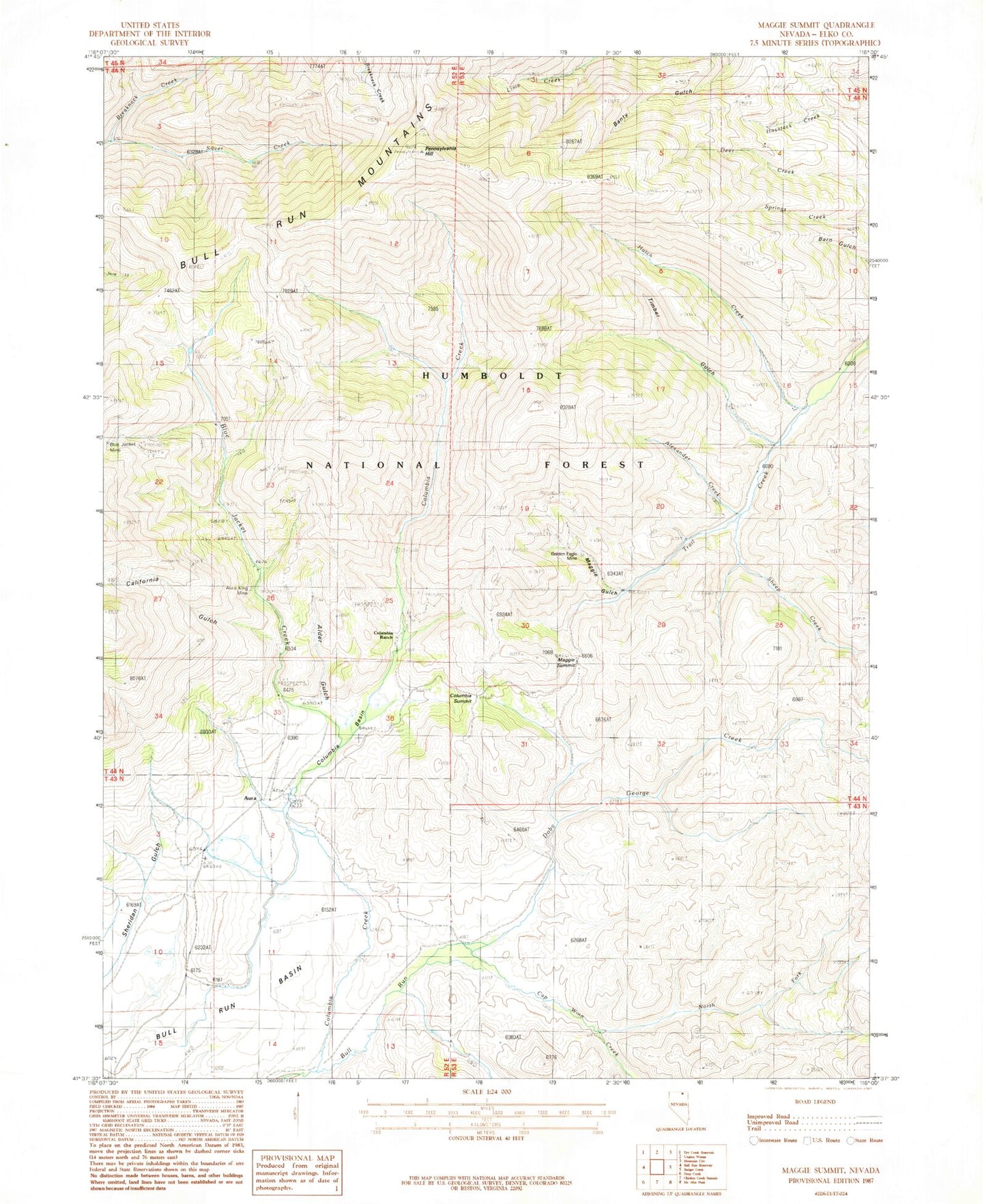
Classic USGS Maggie Summit Nevada 7.5'x7.5' Topo Map
Couldn't load pickup availability
Historical USGS topographic quad map of Maggie Summit in the state of Nevada. Map scale may vary for some years, but is generally around 1:24,000. Print size is approximately 24" x 27"
This quadrangle is in the following counties: Elko.
The map contains contour lines, roads, rivers, towns, and lakes. Printed on high-quality waterproof paper with UV fade-resistant inks, and shipped rolled.
Contains the following named places: Alder Gulch, Alexander Creek, Aura, Aura King Mine, Aura Mining District, Aura Post Office, Big Four Mine, Blue Jacket Creek, Bull Run Basin, California Gulch, Cap Winn Creek, Central Pacific Mine, Columbia, Columbia Basin, Columbia Creek, Columbia Post Office, Columbia Queen Mine, Columbia Ranch, Columbia Summit, Doby George Creek, Golden Eagle Mine, H Ireland Ranch, Humboldt Mine, Hutch Creek, Infidel Mine, Maggie Gulch, Maggie Gulch Creek, Maggie Summit, North Fork Cap Winn Creek, Pennsylvania Hill, Polaris Gulch, Polaris Mine, Porter Mine, Sheep Creek, Spring Creek, Timber Gulch, Timber Gulch Creek, Town Treasure Mine, Twin Creek, ZIP Code: 89831