MyTopo
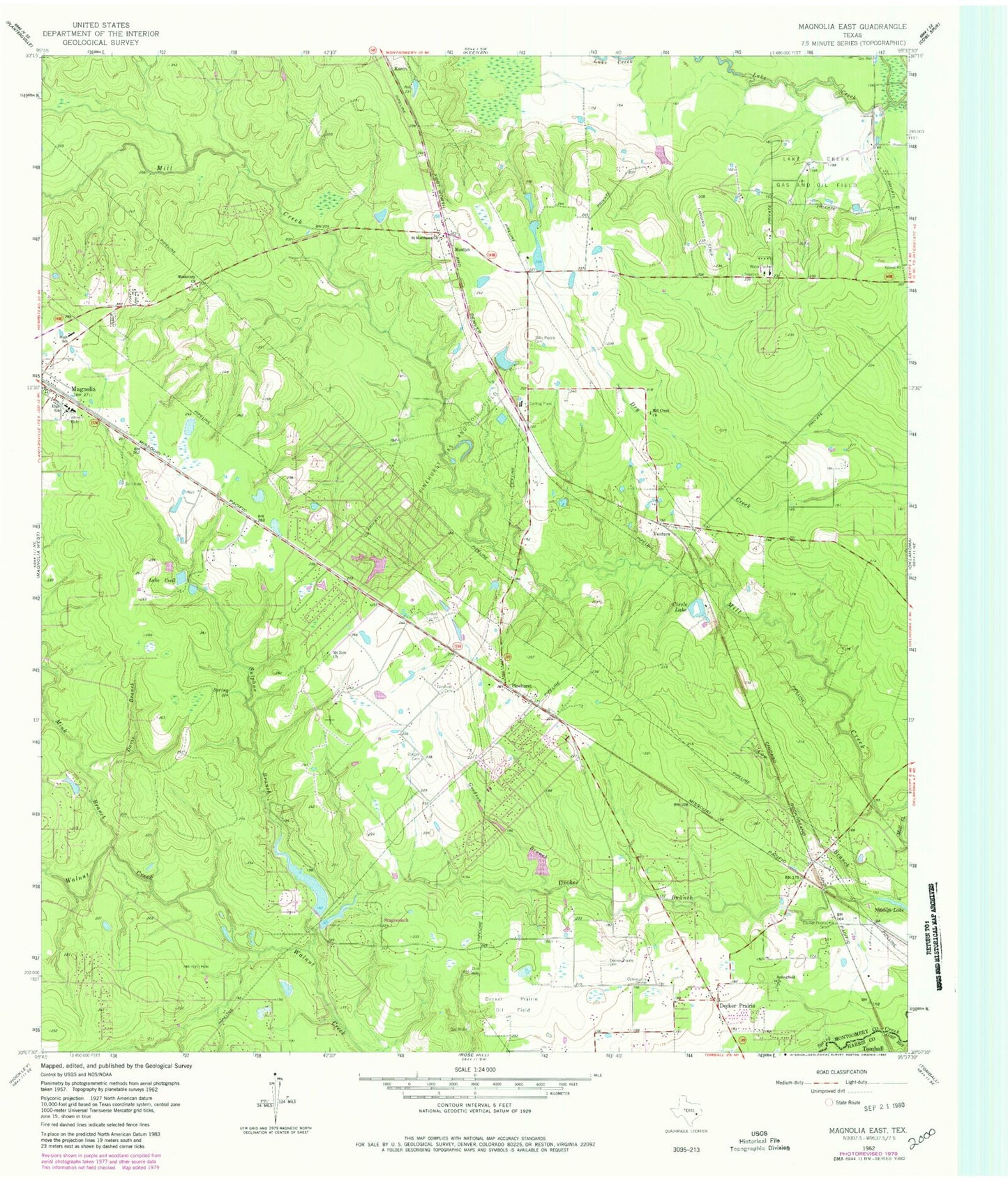
Classic USGS Magnolia East Texas 7.5'x7.5' Topo Map
Couldn't load pickup availability
Historical USGS topographic quad map of Magnolia East in the state of Texas. Map scale may vary for some years, but is generally around 1:24,000. Print size is approximately 24" x 27"
This quadrangle is in the following counties: Harris, Montgomery.
The map contains contour lines, roads, rivers, towns, and lakes. Printed on high-quality waterproof paper with UV fade-resistant inks, and shipped rolled.
Contains the following named places: Abiding Faith Lutheran Church of Pinehurst, Arnold Branch, Central Baptist Church Magnolia Church, Church of Christ in Magnolia, Circle Lake, City of Magnolia, Corgey Cemetery, Cow Branch, Davis Branch, Decker Prairie, Decker Prairie Cemetery, Decker Prairie Elementary School, Delta County Public Library, Goodson Branch, Goodson Cemetery, Hall Lake, Hall Lake Dam, Lake Apache, Lake Apache Dam, Lake Cecil, Lake Hollow, Lake Hollow Dam, Log Gully, Magnolia Baptist Church, Magnolia Church of God in Christ, Magnolia City Hall, Magnolia Division, Magnolia Police Department, Magnolia Stadium, Magnolia Volunteer Fire Department Station 181, Magnolia Volunteer Fire Department Station 184, Magnolia Volunteer Fire Department Station 185, Mill Creek Church, Mink Branch, Missionary Church, Montgomery County Hospital District Emergency Medical Services Station 41, Mostyn, Mount Zion Church, Pinehurst, Pinehurst Census Designated Place, Pinehurst Gas and Oil Field, Pinehurst Post Office, Saint Matthews Church, Silver Springs Baptist Church, Springfield Church, Stagecoach, Stagecoach City Hall, Sulphur Branch, Tillis Prairie Cemetery, Town of Stagecoach, United Pentecostal Church, Ventura, Walnut Creek Baptist Church, Willie E Williams Elementary School, ZIP Codes: 77354, 77355, 77362