MyTopo
Classic USGS Magnolia NW Arkansas 7.5'x7.5' Topo Map
Couldn't load pickup availability
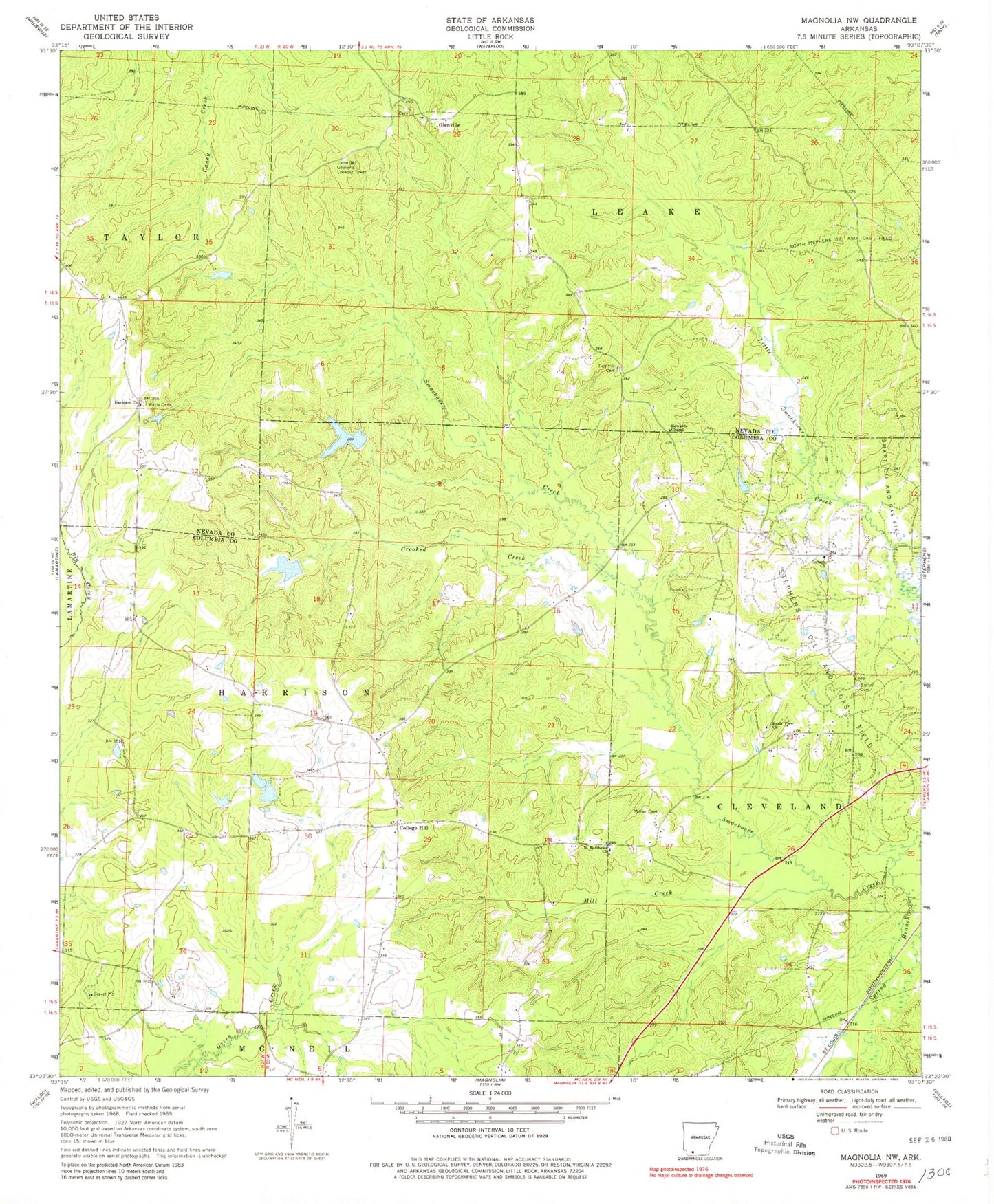
Historical USGS topographic quad map of Magnolia NW in the state of Arkansas. Map scale may vary for some years, but is generally around 1:24,000. Print size is approximately 24" x 27"
This quadrangle is in the following counties: Columbia, Nevada.
The map contains contour lines, roads, rivers, towns, and lakes. Printed on high-quality waterproof paper with UV fade-resistant inks, and shipped rolled.
Contains the following named places: Arkansas Noname 62 Dam, Blake Creek, Bolden - Yarbourgh Cemetery, College Hill, College Hill Oil and Gas Field, Corinth Church, Crooked Creek, Davidson, Davidson Church, Dupriest Lake, Early View Church, Edwards Chapel, Fincher Lake, Fincher Lake Dam, Gatlin Cemetery, Glenville, Glenville Cemetery, Glenville Lookout Tower, Harpers School, Lake Bradshaw, Lake Bradshaw Dam, Mill Creek, Milner, Miner Cemetery, Mount Vernon Baptist Church Cemetery, Mount Zion School, North Stephens Oil and Gas Field, Pine Grove School, Pretty Branch, Saint Matthews, Saint Matthews Church, Spring Branch, Tick Hill Cemetery, Township of Harrison, Township of McNeil, Union Grove School, Watts Cemetery, ZIP Code: 71752