MyTopo
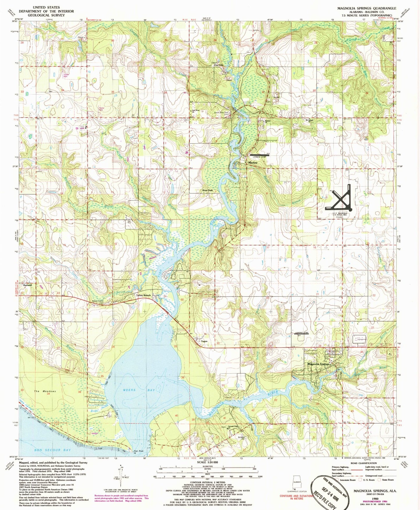
Classic USGS Magnolia Springs Alabama 7.5'x7.5' Topo Map
Couldn't load pickup availability
Historical USGS topographic quad map of Magnolia Springs in the state of Alabama. Map scale may vary for some years, but is generally around 1:24,000. Print size is approximately 24" x 27"
This quadrangle is in the following counties: Baldwin.
The map contains contour lines, roads, rivers, towns, and lakes. Printed on high-quality waterproof paper with UV fade-resistant inks, and shipped rolled.
Contains the following named places: Baker Branch, Bakers Bridge, Barner Branch, Bayside, Beckwith Camp, Bible Way Holiness Church, Branchland Farms Lake, Branchland Lake Dam, Brook Cedron Cemetery, Chestnut Landing, Chestnut Lodge, Clay City, Collier Airpark, Coopers Fishing Camp, Country Living Mobile Home Park, Country Place Mobile Home Park, Cowpen Creek, Danbys Mill, Dove Run Mobile Home Park, Eslava Branch, Fish River, Fish River Church, Fish River Point, Fobbs Ferry, Fulton Heights United Methodist Church, Green Branch, Green Branch Gas Field, Grove School, Jubilee Shores United Methodist Church, Key Allegro Villas Mobile Home Park, Live Oak Mobile Home Park, Louis Branch, Magnolia River, Magnolia Springs, Magnolia Springs Church, Magnolia Springs Elementary School, Magnolia Springs Golf Course, Magnolia Springs Post Office, Magnolia Springs Volunteer Fire Department, Magnolia Springs Wesleyan Church, Marlow, Marlow Church, Marlow Fish River Volunteer Fire Department, Marlow United Methodist Church, McKenzie Ferry, Mount Gilead Church, Muddy Bayou, Noltie Creek, Pine Glory Church, Polecat Creek, Pulliam Village Mobile Home Park, River Park, Saint John Church, Schoolhouse Branch, Smiths Mill, South River Park Church, Springhill School, The Meadows, Timney South River Park Community Cemetery, Town of Magnolia Springs, Triumph Church, Turkey Branch, Vernant Park Baptist Church, View Point Launching and Fishing Camp, Waterhole Branch, Weeks Bay, Weeks Branch, Weeks Creek, Yupon, ZIP Codes: 36532, 36555