MyTopo
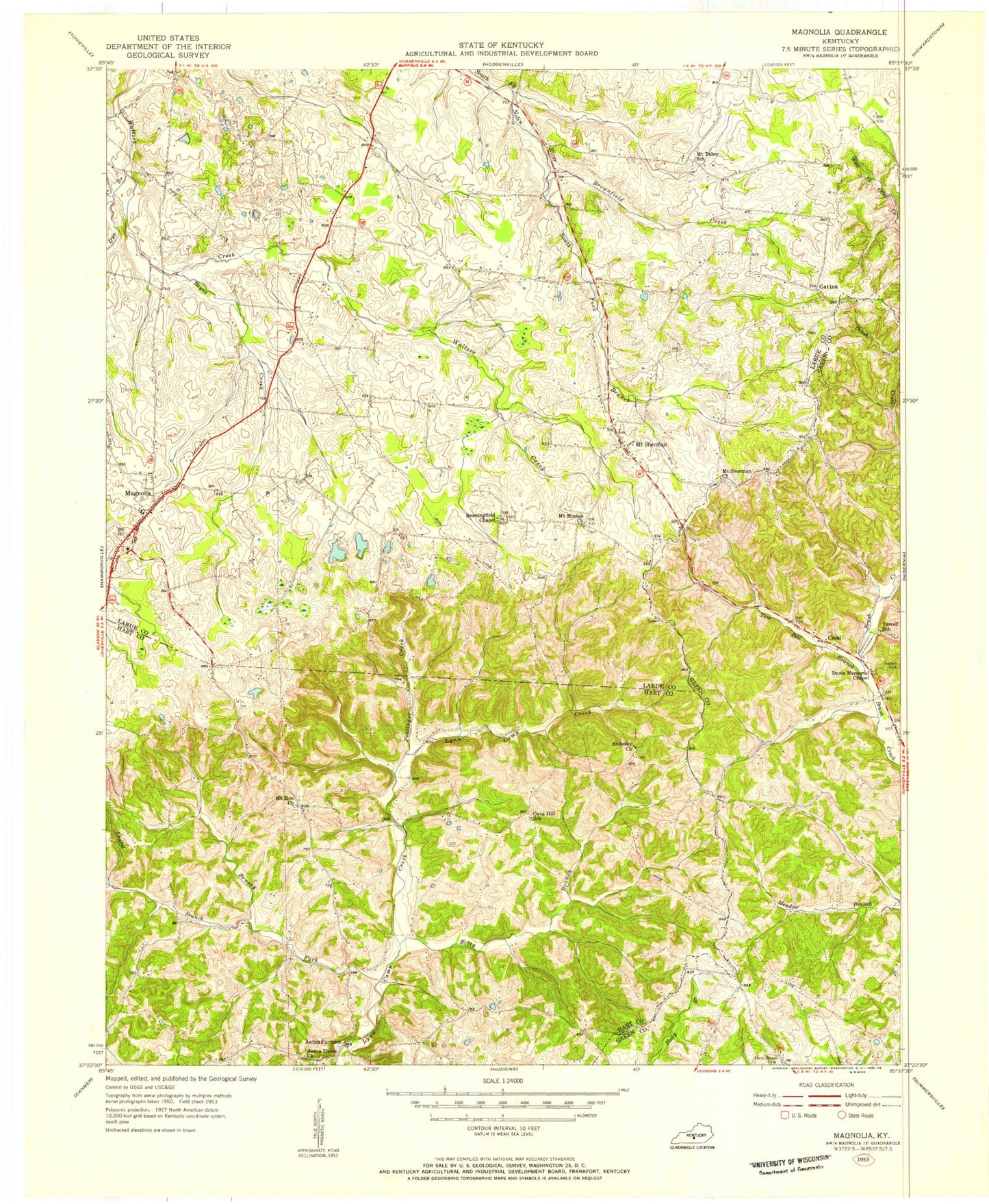
Classic USGS Magnolia Kentucky 7.5'x7.5' Topo Map
Couldn't load pickup availability
Historical USGS topographic quad map of Magnolia in the state of Kentucky. Map scale may vary for some years, but is generally around 1:24,000. Print size is approximately 24" x 27"
This quadrangle is in the following counties: Green, Hart, Larue.
The map contains contour lines, roads, rivers, towns, and lakes. Printed on high-quality waterproof paper with UV fade-resistant inks, and shipped rolled.
Contains the following named places: Aetna Furnace, Bayne Creek, Benningfield Chapel, Brownfield Creek, Brushy Fork, Davis Memorial Chapel, Dezarn Cemetery, Dye Branch, Foote Post Office, Gatton Post Office, Laurel Branch, Lindy Creek, Locust Branch, Magnolia, Magnolia Census Designated Place, Magnolia Fire Department, Magnolia Gas Storage Field, Magnolia High School, Magnolia Post Office, Mount Moriah Baptist Church, Mount Sherman, Mount Sherman Church, Mount Sherman Post Office, Mount Tabor Baptist Cemetery, Mount Tabor Baptist Church, Mount Zion Separate Baptist Church, Pottinger Creek, Rose Hill Church, Russell Cemetery, School Number Twenty-Nine, School Number Twenty-Six, Shiboley Church, Spring Town School, Terrell School, Tom Bill Branch, Union Church, Walters School, Wathen Creek, ZIP Code: 42757