MyTopo
Classic USGS Mahogany Butte Wyoming 7.5'x7.5' Topo Map
Regular price
$16.95
Regular price
Sale price
$16.95
Unit price
per
Couldn't load pickup availability
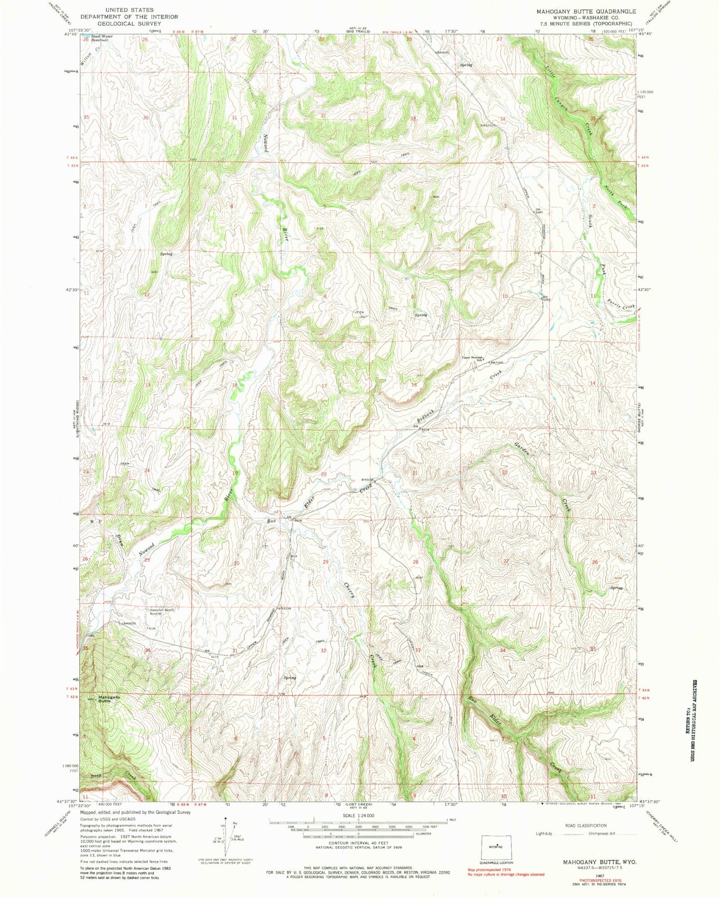
Historical USGS topographic quad map of Mahogany Butte in the state of Wyoming. Map scale may vary for some years, but is generally around 1:24,000. Print size is approximately 24" x 27"
This quadrangle is in the following counties: Washakie.
The map contains contour lines, roads, rivers, towns, and lakes. Printed on high-quality waterproof paper with UV fade-resistant inks, and shipped rolled.
Contains the following named places: Box Elder Creek, Cherry Creek, Ferris Creek, Garden Creek, Mahogany Butte, North Fork Little Canyon Creek, Nowood River Number Two Mine, Red Bank Reservoir, Redbank Creek, S V Draw, South Fork Little Canyon Creek, Upper Nowood School