MyTopo
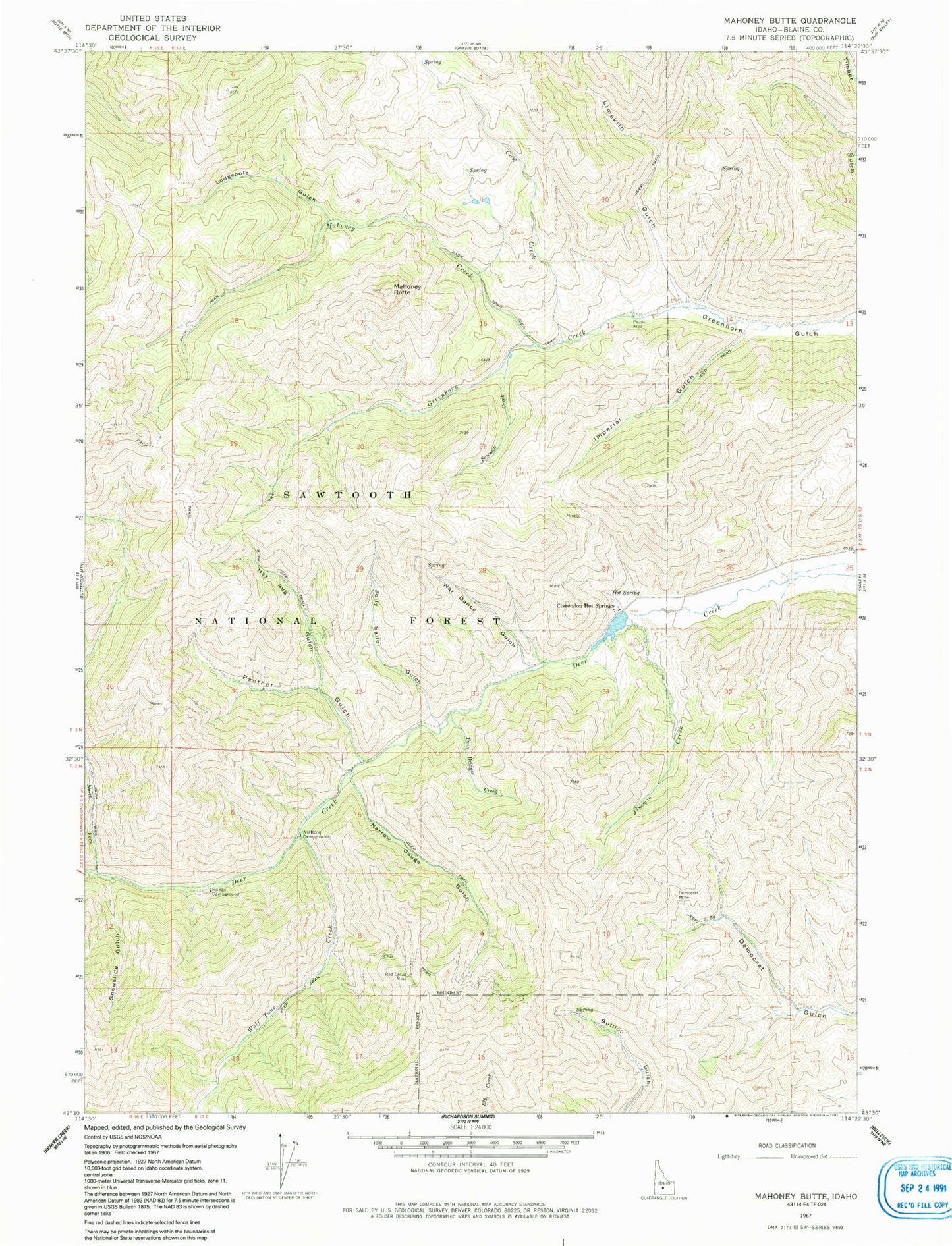
Classic USGS Mahoney Butte Idaho 7.5'x7.5' Topo Map
Couldn't load pickup availability
Historical USGS topographic quad map of Mahoney Butte in the state of Idaho. Map scale may vary for some years, but is generally around 1:24,000. Print size is approximately 24" x 27"
This quadrangle is in the following counties: Blaine.
The map contains contour lines, roads, rivers, towns, and lakes. Printed on high-quality waterproof paper with UV fade-resistant inks, and shipped rolled.
Contains the following named places: Bridge Campground, Clarendon Hot Springs, Clarendon Hot Springs Dam, Cow Creek, Democrat Mine, Greenhorn Guard Station, Imperial Gulch, Jimmie Creek, Jolly Sailor Gulch, Limekiln Gulch, Lodgepole Gulch, Mahoney Butte, Mahoney Creek, Narrow Gauge Gulch, Nay Aug Gulch, North Fork Deer Creek, Panther Gulch, Red Cloud Mine, Sawmill Creek, Snowslide Gulch, Twin Bridges Creek, War Dance Gulch, Wolftone Campground, Wolftone Creek