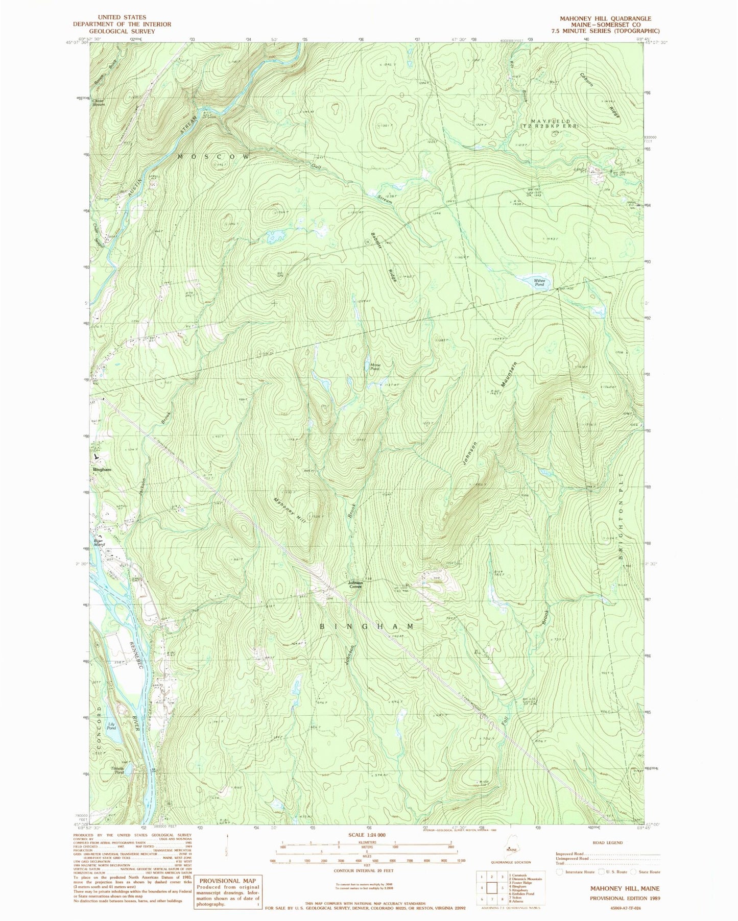
MyTopo
Classic USGS Mahoney Hill Maine 7.5'x7.5' Topo Map
Couldn't load pickup availability
Historical USGS topographic quad map of Mahoney Hill in the state of Maine. Typical map scale is 1:24,000, but may vary for certain years, if available. Print size: 24" x 27"
This quadrangle is in the following counties: Somerset.
The map contains contour lines, roads, rivers, towns, and lakes. Printed on high-quality waterproof paper with UV fade-resistant inks, and shipped rolled.
Contains the following named places: Babbitt Ridge, Bassett Brook, Chase Stream, Coburn Ridge, Gulf Stream, Jackson Brook, Johnson Brook, Johnson Mountain, Mahoney Hill, Morse Pond, Tibbetts Pond, Withee Pond, Johnson Corner, Lily Pond, Gadabout Gaddis Airport, Town of Bingham, Town of Moscow, Upper Kennebec Valley Junior Senior High School, Bingham Census Designated Place, Baker Cemetery, Fall Brook Cemetery