MyTopo
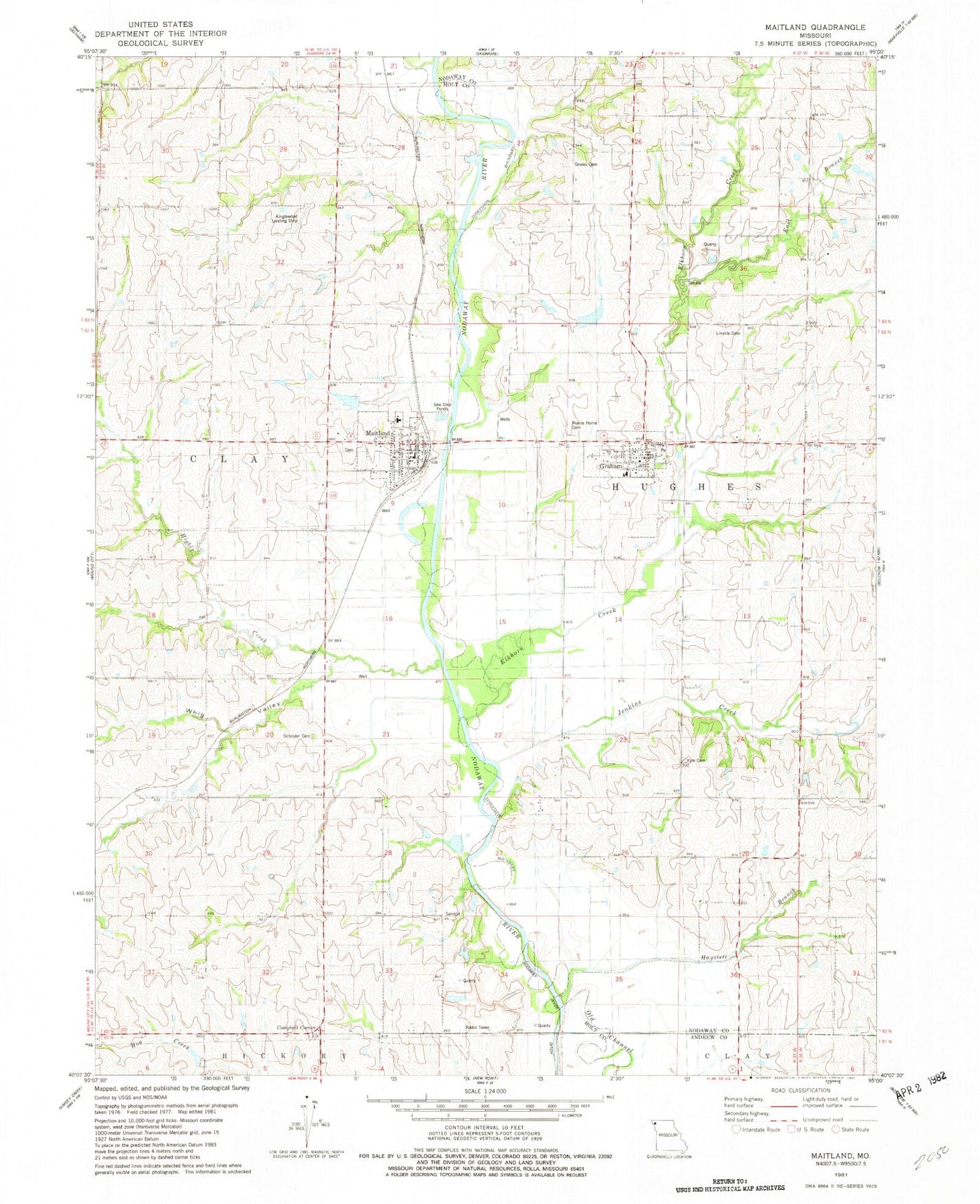
Classic USGS Maitland Missouri 7.5'x7.5' Topo Map
Couldn't load pickup availability
Historical USGS topographic quad map of Maitland in the state of Missouri. Map scale may vary for some years, but is generally around 1:24,000. Print size is approximately 24" x 27"
This quadrangle is in the following counties: Andrew, Holt, Nodaway.
The map contains contour lines, roads, rivers, towns, and lakes. Printed on high-quality waterproof paper with UV fade-resistant inks, and shipped rolled.
Contains the following named places: A-B-C-D Planning Region, Campbell Corner, City of Maitland, Elkhorn Creek, Elkhorn School, Eureka School, Graham, Graham Fire Protection District, Graham Post Office, Graham Quarry, Groves Cemetery, Hayzlett School, Hickory Grove School, Highly Creek, Jenkins Creek, Kinglewood Airport, Kings Grove, Kings Grove School, Kyle Cemetery, Linville Cemetery, Maitland, Maitland Post Office, Maitland Volunteer Fire Protection District, Nodaway - Holt Elementary School, Nodaway - Holt Junior Senior High School, Nodaway - Holt Middle School, Prairie Home Cemetery, Richland School, Rising Sun School, Schooler Cemetery, Town of Graham, Township of Clay, Wakley Lake, Wakley Lake Dam, Whig Valley, Wiley Lake, Wiley Lake Dam, ZIP Codes: 64455, 64466