MyTopo
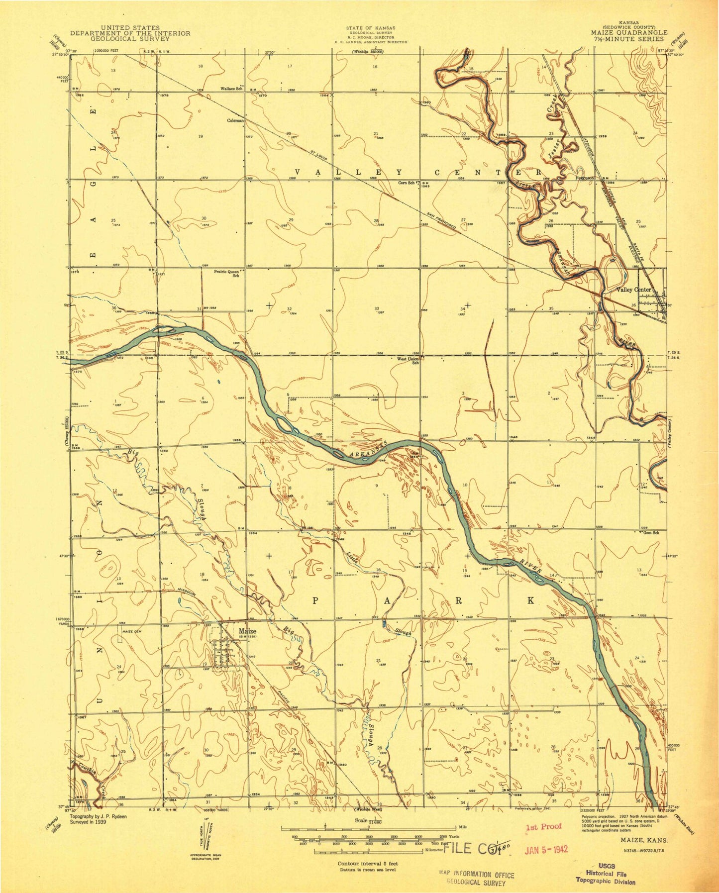
Classic USGS Maize Kansas 7.5'x7.5' Topo Map
Couldn't load pickup availability
Historical USGS topographic quad map of Maize in the state of Kansas. Map scale may vary for some years, but is generally around 1:24,000. Print size is approximately 24" x 27"
This quadrangle is in the following counties: Sedgwick.
The map contains contour lines, roads, rivers, towns, and lakes. Printed on high-quality waterproof paper with UV fade-resistant inks, and shipped rolled.
Contains the following named places: Berwet, Brooks Tract Park, Childs Acres, City of Maize, Coleman, Complete High School Maize, Corn School, Cuba High School, Edna Buschow Memorial Library Valley Center, Ferguson, Gem School, Harrison Landing Field, Jester Creek, Kansas International Dragway, Little Slough, Luther Airport, Maize, Maize Airport, Maize Cemetery, Maize Central Elementary School, Maize City Hall, Maize Elementary School, Maize High School, Maize Middle School, Maize Municipal Court, Maize Police Department, Maize Post Office, Maize Unified School District Number 266 Police Department, Maize Wastewater Plant, New Hope Nursing Home, Oak Court Mobile Home Court, Prairie Queen School, Pray - Woodman Elementary School, Rolling Meadows Mobile Home Park, Sedgwick County Emergency Medical Service Post 14, Sedgwick County Fire District 1 Station 33, Township of Park, Township of Valley Center, Valley Center Wastewater Treatment Plant, Vermillion Elementary School, Wallace School, West Elementary School, West Union School, Wheatland Elementary School, Wichita Number 3 Wastewater Treatment Plant, Wilson Lake, ZIP Code: 67101