MyTopo
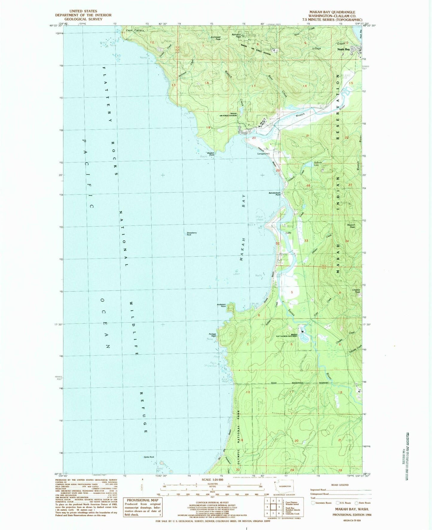
Classic USGS Makah Bay Washington 7.5'x7.5' Topo Map
Couldn't load pickup availability
Historical USGS topographic quad map of Makah Bay in the state of Washington. Typical map scale is 1:24,000, but may vary for certain years, if available. Print size: 24" x 27"
This quadrangle is in the following counties: Clallam.
The map contains contour lines, roads, rivers, towns, and lakes. Printed on high-quality waterproof paper with UV fade-resistant inks, and shipped rolled.
Contains the following named places: Anderson Point, Archawat, Archawat Creek, Bahobohosh Point, Cheeka Creek, Colby Creek, Grimes Creek, Hobuck Beach, Hobuck Lake, Holden Creek, Kabusie Creek, Petroleum Creek, Portage Head, Shi-Shi Beach, Spike Rock, Strawberry Rock, Tyler Creek, Village Creek, Waatch Creek, Waatch Point, Makah Bay, Makah Indian Reservation, Archawat Peak, Bahokus Peak, Cheeka Peak, Waatch Peak, Tsoo-Yess, Waatch, Tsoo-Yess River, Waatch River, Tsoo-Yess Beach, Bear Creek, Ocean Creek, Makah National Salmon Hatchery, Neah Bay Assembly of God Church, Neah Bay Ambulance Service, Makah Tribal Ambulance, Makah Air Force Station (historical), Makah Tribal Fire Department, Makah National Fish Hatchery