MyTopo
Classic USGS Makahalau Hawaii 7.5'x7.5' Topo Map
Couldn't load pickup availability
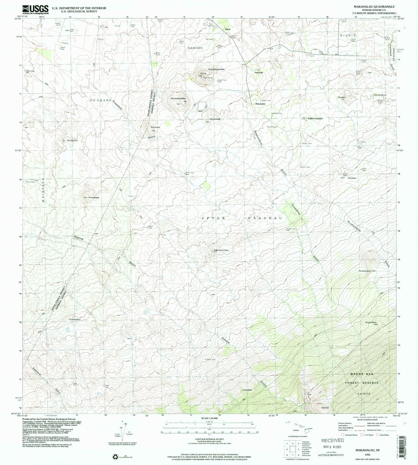
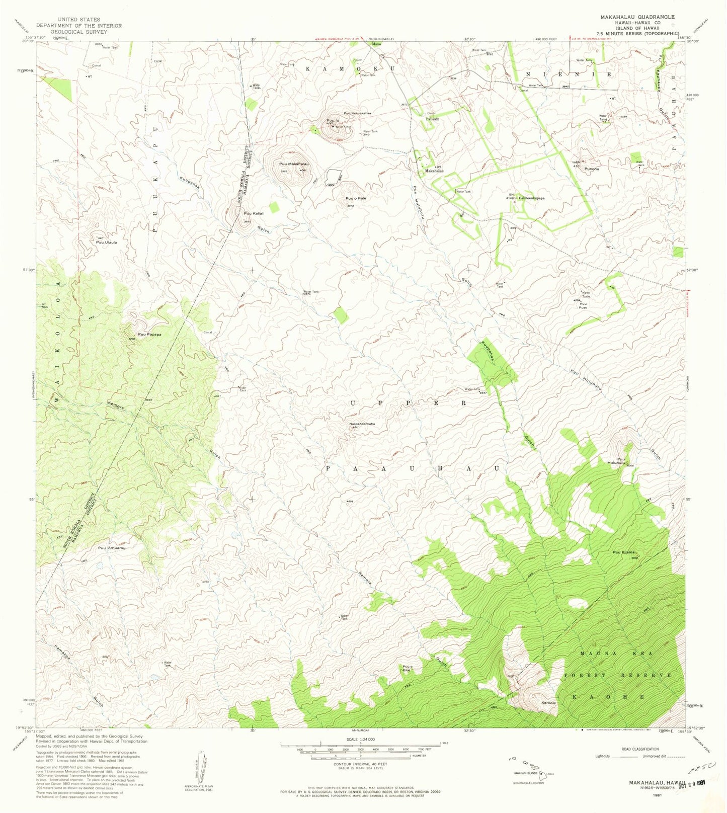
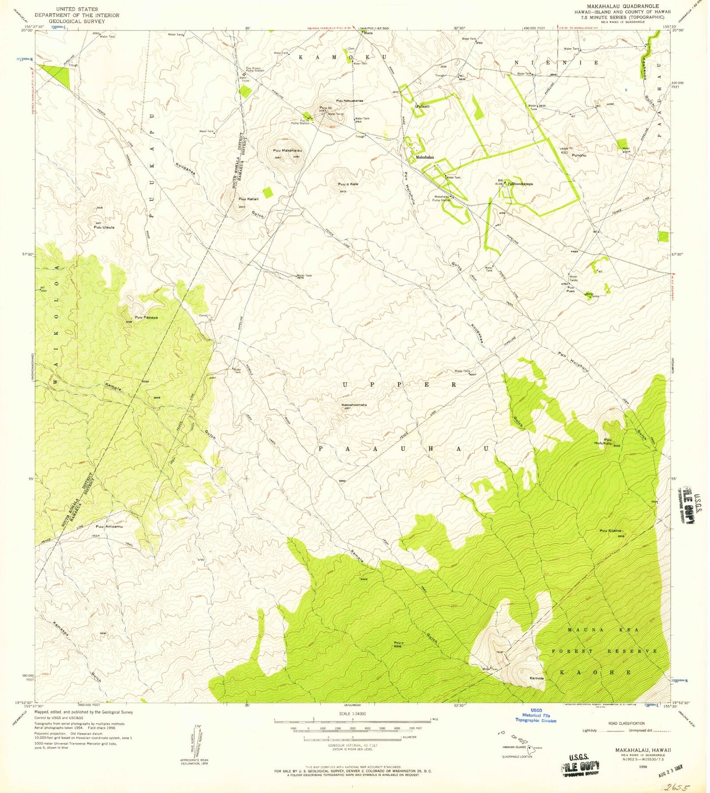
Historical USGS topographic quad map of Makahalau in the state of Hawaii. Map scale may vary for some years, but is generally around 1:24,000. Print size is approximately 24" x 27"
This quadrangle is in the following counties: Hawaii.
The map contains contour lines, roads, rivers, towns, and lakes. Printed on high-quality waterproof paper with UV fade-resistant inks, and shipped rolled.
Contains the following named places: Kemole, Kuupahaa Gulch, Makahalau, Makahalau Pump Station, Mana, Nakoaho'omaha, Pali'a'alii, Paliho'oukapapa, Punohu, Puu Kikoni, Puu Kikoni Pump Station, Pu'uamuamu, Pu'uhuluhulu, Pu'uhuluhulu Gulch, Pu'u'io, Pu'u'io Pump Station, Pu'ukaliali, Pu'ukapu Hawaiian Home Land, Pu'ukekuakahea, Pu'uki'i'aina, Pu'umakahalau, Pu'u'okale, Pu'u'okihe, Pu'upapapa, Pu'upueo, Pu'u'ula'ula, Upper Pa'auhau