MyTopo
Classic USGS Maklaks Crater Oregon 7.5'x7.5' Topo Map
Couldn't load pickup availability
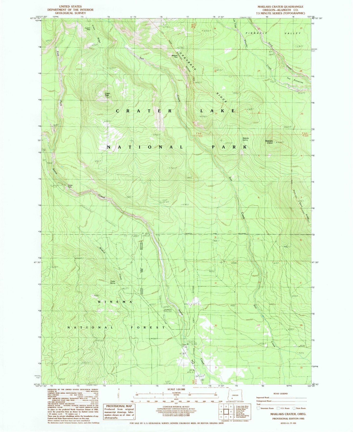
Historical USGS topographic quad map of Maklaks Crater in the state of Oregon. Map scale may vary for some years, but is generally around 1:24,000. Print size is approximately 24" x 27"
This quadrangle is in the following counties: Klamath.
The map contains contour lines, roads, rivers, towns, and lakes. Printed on high-quality waterproof paper with UV fade-resistant inks, and shipped rolled.
Contains the following named places: Annie Creek Pit, Annie Creek Sno-Park, Annie Falls, Cedar Spring, Crater Peak, Crater Peak Trail, East Fork Annie Creek, Grayback Ridge, Lost Creek, Maklaks Crater, Maklaks Pass, Maklaks Spring, Picnic Area Number Two, Ponderosa Picnic Area, Sand Ridge, South Entrance Crater Lake National Park, The Pinnacles, Tututni Pass, Vidae Creek, Wildcat Camp