MyTopo
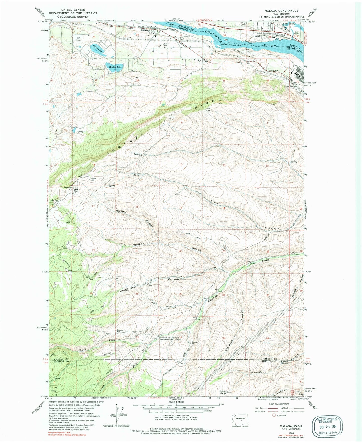
Classic USGS Malaga Washington 7.5'x7.5' Topo Map
Couldn't load pickup availability
Historical USGS topographic quad map of Malaga in the state of Washington. Map scale may vary for some years, but is generally around 1:24,000. Print size is approximately 24" x 27"
This quadrangle is in the following counties: Chelan, Douglas, Kittitas.
The map contains contour lines, roads, rivers, towns, and lakes. Printed on high-quality waterproof paper with UV fade-resistant inks, and shipped rolled.
Contains the following named places: Chelan County Fire District 1 Station 17 Malaga Complex, City of Rock Island, Colockum Research Unit Washington State University, Ivy Walker Canyon, Judkins Spring, Jumpoff Ridge, KCWT-TV (Wenatchee), Keokuk, Keokuk Substation, Kingsbury Canyon, Lake Cortez, Laurel Hill, Malaga, Malaga Post Office, McLaughlin Dam, Meadow Lake, Meadow Lake Dam, Nickles Canyon, North Fork Colockum Creek, Robinson Canyon, Rock Island Post Office, South Fork Colockum Creek, Three Lakes Golf Club, Three Lakes Reservoir Dam, Valhala Substation, Whitson Spring, ZIP Code: 98828