MyTopo
Classic USGS Malapai Hill California 7.5'x7.5' Topo Map
Couldn't load pickup availability
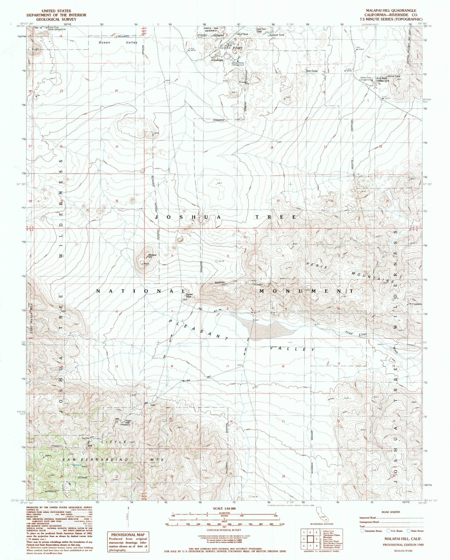
Historical USGS topographic quad map of Malapai Hill in the state of California. Typical map scale is 1:24,000, but may vary for certain years, if available. Print size: 24" x 27"
This quadrangle is in the following counties: Riverside.
The map contains contour lines, roads, rivers, towns, and lakes. Printed on high-quality waterproof paper with UV fade-resistant inks, and shipped rolled.
Contains the following named places: Hidden Tank, Ivanpah Tank, Jumbo Rocks Campground, Live Oak Tank, Pinyon Well, Sheep Pass Group Campground, Squaw Tank, Stirrup Tank, Twin Tanks, White Tank Campground, Grand Tank, White Tank, Arch Rock, Skull Rock, Jumbo Rocks, Queen Valley, Malapai Hill, Gold Coin Mine, Hexahedron Mine