MyTopo
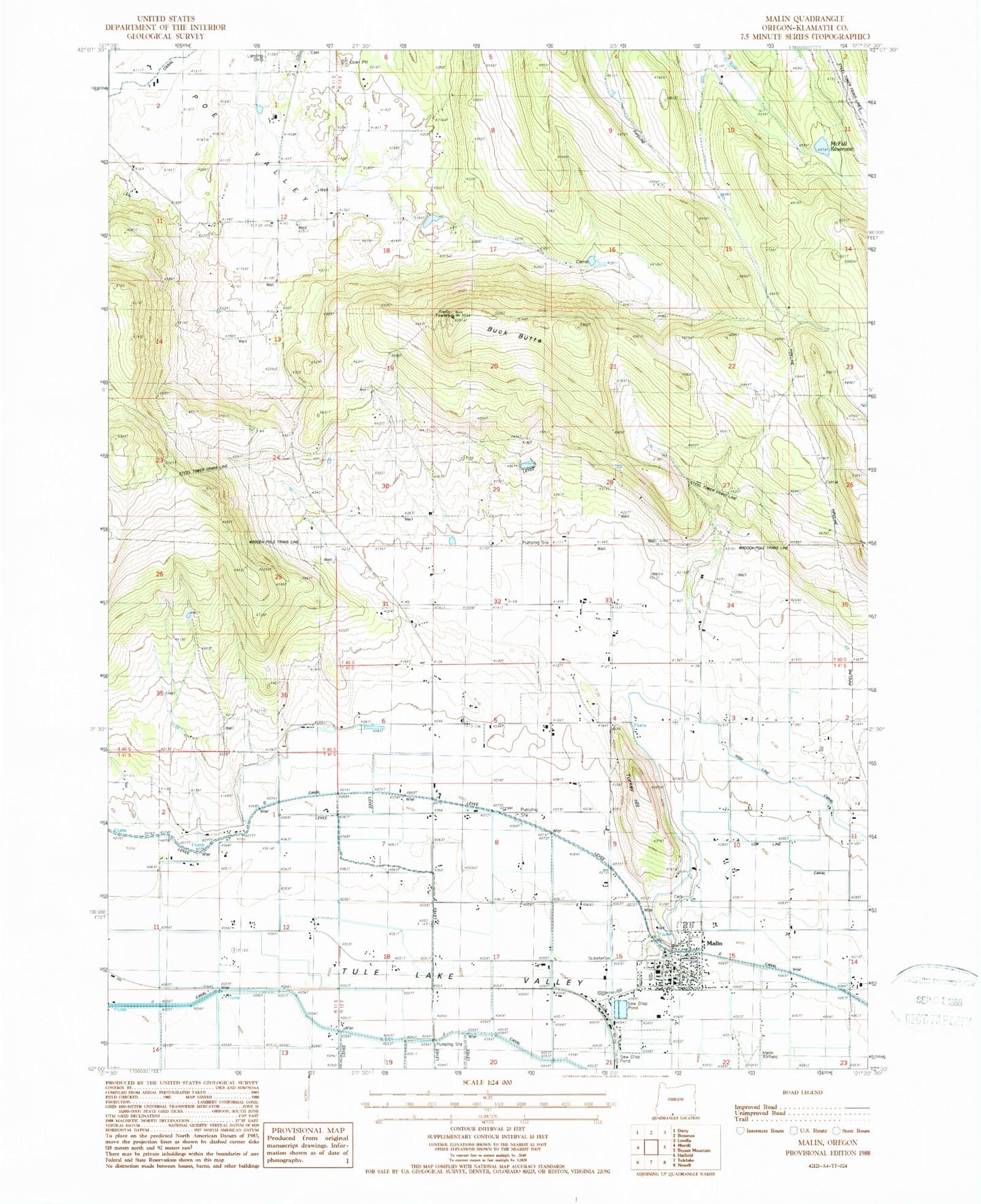
Classic USGS Malin Oregon 7.5'x7.5' Topo Map
Couldn't load pickup availability
Historical USGS topographic quad map of Malin in the state of Oregon. Map scale may vary for some years, but is generally around 1:24,000. Print size is approximately 24" x 27"
This quadrangle is in the following counties: Klamath.
The map contains contour lines, roads, rivers, towns, and lakes. Printed on high-quality waterproof paper with UV fade-resistant inks, and shipped rolled.
Contains the following named places: Adams Point, Bedfield Cemetery, Buck Butte, Buck Butte Dam, Buck Butte Reservoir, City of Malin, D Canal, Easy Creek, High Line Canal, J Canal, John McFall Dam, John McFall Reservoir, Klamath County Library Malin Branch, Low Line Canal, Malin, Malin Cemetery, Malin City Hall, Malin Division, Malin Elementary School, Malin Irrigation District Pumps, Malin Municipal Court, Malin Police Department, Malin Post Office, Malin Public Works Department Office, Malin Sewage Treatment Lagoons, Malin Station, Morton Post Office, Sand Hollow, Simms Dam, Smith Reservoir, T Canal, Turkey Hill, V Canal, ZIP Code: 97632