MyTopo
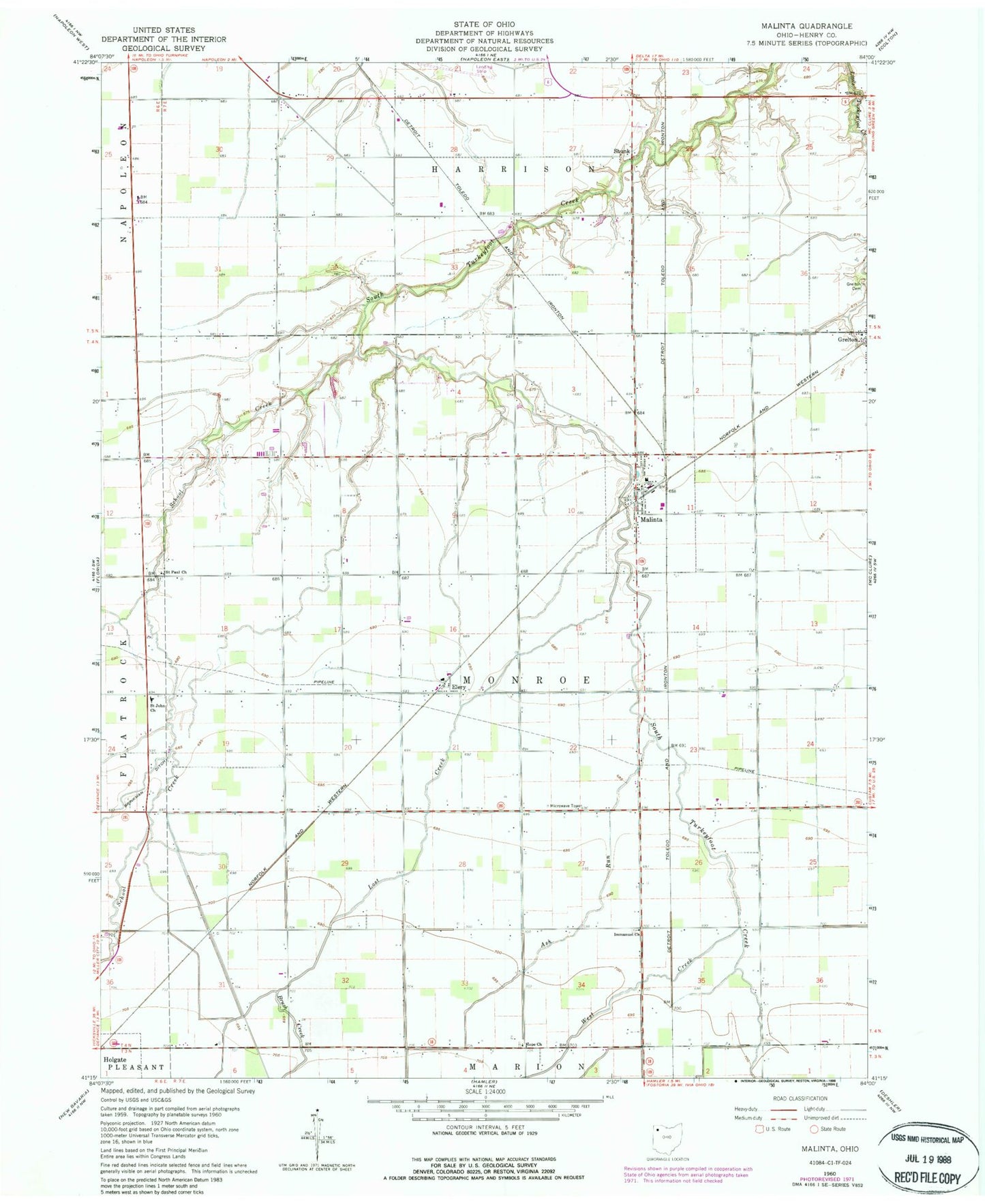
Classic USGS Malinta Ohio 7.5'x7.5' Topo Map
Couldn't load pickup availability
Historical USGS topographic quad map of Malinta in the state of Ohio. Map scale may vary for some years, but is generally around 1:24,000. Print size is approximately 24" x 27"
This quadrangle is in the following counties: Henry.
The map contains contour lines, roads, rivers, towns, and lakes. Printed on high-quality waterproof paper with UV fade-resistant inks, and shipped rolled.
Contains the following named places: Arps School, Ash Run, Bickford School, Brush College, Brush Creek, Deigle School, Dunbar School, Elery, Elery Post Office, Elery School, Emanuel Lutheran Cemetery, Grelton Cemetery, Grelton Methodist Church, Henry County, Henry County Airport, Henry County South Joint Ambulance District Malinta Emergency Medical Services, Hope Lutheran Cemetery, Hope Lutheran Church, Huber School, Immanuel Church, Knipp Cemetery, Kratz School, Lost Creek, Malinta, Malinta - Monroe Township Fire Department, Malinta Post Office, Malinta-Grelton Elementary School, Saint John Church, Saint Paul Church, School Creek, Shunk, Shunk Post Office, Struble School, Township of Harrison, Township of Monroe, Village of Malinta, West Creek, ZIP Code: 43535